
Arai
新居町 | |
|---|---|
Former municipality | |
 Flag  Emblem | |
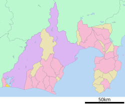 Location of Arai in Shizuoka Prefecture | |
 Arai Location in Japan | |
| Coordinates: 34°41′N 137°34′E / 34.683°N 137.567°E | |
| Country | Japan |
| Region | Chūbu (Tōkai) |
| Prefecture | Shizuoka Prefecture |
| District | Hamana |
| Merged | March 23, 2010 (now part of Kosai) |
| Area | |
| • Total | 18.65 km2 (7.20 sq mi) |
| Population (March 31, 2010) | |
| • Total | 16,975 |
| • Density | 910/km2 (2,400/sq mi) |
| Time zone | UTC+09:00 (JST) |
| Symbols | |
| Bird | Barn swallow |
| Flower | Azalea |
| Tree | Japanese black pine |
Arai (新居町, Arai-chō) was a town located in Hamana District, Shizuoka Prefecture, Japan.
As of March 31, 2010, the town had an estimated population of 16,975 and a population density of 910 persons per km2. The total area was 18.65 km2.
On March 23, 2010, Arai was merged into the expanded city of Kosai and thus no longer exists as an independent municipality. Hamana District was dissolved as a result of this merger.[1]
YouTube Encyclopedic
-
1/2Views:544431
-
Shizuoka-ken shimoda-shi
-
Praia de Bentenjima
Transcription
Geography
Arai was located at the southwest end of Shizuoka Prefecture, with part of Lake Hamana located within the town boundaries. The town was on the Enshu Sea of the Pacific Ocean, with a temperate maritime climate with hot, humid summers and mild, cool winters.[citation needed]
History
Arai was located in former Tōtōmi Province, and was largely tenryō territory under direct control of the Tokugawa shogunate in the Edo period, when it was called Arai-juku, and prospered as a post town on the Tōkaidō highway connecting Edo with Kyoto. During the cadastral reform of the early Meiji period in 1889, the area was reorganized into Arai Town within Fuchi District, Shizuoka Prefecture. Fuchi District was merged into Hamana District in 1896.[citation needed]
Economy
The economy of Arai was largely based on commercial fishing, edible seaweed cultivation, and fireworks production.[citation needed]
Transportation
Highway
Rail
References
- ^ "市町村合併情報 静岡県 <国土地理協会>". Archived from the original on 2007-07-28. Retrieved 2008-09-08.
External links
![]() Media related to Arai, Shizuoka at Wikimedia Commons
Media related to Arai, Shizuoka at Wikimedia Commons
| Shizuoka |
| |||
|---|---|---|---|---|
| Hamamatsu |
| |||
| Special cities | ||||
| Cities | ||||
| Districts | ||||
| International | |
|---|---|
| National | |