
| Apsarasas Kangri | |
|---|---|
| Highest point | |
| Elevation | 7,245 m (23,770 ft)[1] Ranked 96th |
| Prominence | 625 m (2,051 ft)[1][2] |
| Parent peak | Teram Kangri |
| Coordinates | 35°32′18″N 77°08′54″E / 35.53833°N 77.14833°E[1] |
| Geography | |
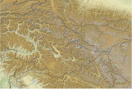
| Location | Ladakh, India, Xinjiang, China |
| Parent range | Siachen Muztagh, Karakoram |
| Climbing | |
| First ascent | 1976 |
| Easiest route | snow/ice climb |


Apsarasas Kangri is a mountain in the Siachen subrange of the Karakoram mountain range. With an elevation of 7,245 m (23,770 ft) it is the 96th highest mountain in the world. Apsarasas Kangri is located within the broader Kashmir region disputed between India, Pakistan and China. It is situated on the border between the areas controlled by China as part of the Xinjiang autonomous region, and the Siachen Glacier controlled by India as part of Ladakh.
Apsarasas was named by Grant Peterkin of the 1908 Workman expedition, from apsara ("fairies") and sas ("place"), thus "place of the fairies".[3] There are at least three main summits of near-equal height, usually labeled I to III from west to east over a distance of 5 km. The eastern summit (35°31′14″N 77°11′56″E / 35.52056°N 77.19889°E) is separated from the other two by a saddle just over 6800 m high.
Only the western peak (Apsarasas I) appears to have been climbed. The first ascent was made over the west ridge by Yoshio Inagaki, Katsuhisa Yabuta and Takamasa Miyomoto of the Osaka University Mountaineering Club on August 7, 1976.[4] The second ascent was by an Indian Army expedition on September 18, 1980,[5] and another Indian army team achieved the third ascent in 1988.[6] Apsarasas II and Apsarasas III are listed as "virgin peaks" by the Indian Mountaineering Foundation,[7] and the eastern summit counts amongst the highest unclimbed peaks.
References
- ^ a b c "Apsarasas, India/China". Peakbagger.com. Retrieved 17 February 2015.
- ^ Note: Sources vary on the prominence of this peak. 8000ers.com states 607m and Global.mongabay Archived July 2, 2013, at the Wayback Machine states 635m. Both agree with the Peakbagger summit elevation of 7245m, but 8000ers.com purports that the unclimbed eastern peak is the highest summit.
- ^ Kapadia, Harish (1 March 2002). High Himalaya Unknown Valleys. Indus Publishing. p. 314. ISBN 978-81-7387-117-7.
- ^ Hideo Misawa, Apsaras, American Alpine Journal 21, 1977 p. 271
- ^ Brig K. N. Thadani, The Ascent of Apsarasas I in the Karakoram, Himalayan Journal 38, 1982.
- ^ Kapadia, 2002, p. 302.
- ^ "Virgin Peaks in East Karakoram". The Indian Mountaineering Foundation (IMF). Archived from the original on 24 September 2015. Retrieved 17 February 2015.
This Indian location article is a stub. You can help Wikipedia by expanding it. |
This article related to a mountain or hill in China is a stub. You can help Wikipedia by expanding it. |