To install click the Add extension button. That's it.

The source code for the WIKI 2 extension is being checked by specialists of the Mozilla Foundation, Google, and Apple. You could also do it yourself at any point in time.

4,5
Kelly Slayton
Congratulations on this excellent venture… what a great idea!
Alexander Grigorievskiy
I use WIKI 2 every day and almost forgot how the original Wikipedia looks like.
Live Statistics
English Articles
Improved in 24 Hours
Added in 24 Hours
Languages
Recent
Show all languages
What we do. Every page goes through several hundred of perfecting techniques; in live mode. Quite the same Wikipedia. Just better.
.
Leo
Newton
Brights
Milds

From Wikipedia, the free encyclopedia

Ankily
Ankily is located in Madagascar
Ankily
Ankily
Location in Madagascar
Coordinates: 22°23′S 46°5′E / 22.383°S 46.083°E / -22.383; 46.083
Country Madagascar
RegionIhorombe
DistrictIhosy
Elevation750 m (2,460 ft)
Population
 (2007)[2]
 • Total10,121
Time zoneUTC3 (EAT)
Postal code
313

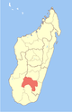
Ankily is a rural municipality in Madagascar. It belongs to the district of Ihosy, which is a part of Ihorombe Region.

Only primary schooling is available. The majority 74% of the population of the commune are farmers, while an additional 10% receives their livelihood from raising livestock. The most important crop is rice, while other important products are peanuts, beans, maize and cassava. Services provide employment for 1% of the population. Additionally fishing employs 15% of the population.[3]

YouTube Encyclopedic

  • 1/3
    Views:
    3 323
    9 943
    7 912
  • Enamel 1
  • Enamel Revision 2014
  • Practical Oral Biology II Data show slides part 1 of 4 ankily.m4v

Transcription

Geography

Ankily is situated at 4 km from Ihosy.[4]

References

  1. ^ Estimated based on DEM data from Shuttle Radar Topography Mission
  2. ^ com.pers. maire d’Ankily 2007
  3. ^ "ILO census data". Cornell University. 2002. Retrieved 2008-04-24.
  4. ^ CADRE DU PROGRAMME ACORDS, MOYEN POUR LA MISE EN PLACE DE LA DECENTRALISATIONCAS DES CINQ COMMUNES RURALES : Analaliry, Analavoka, Iakora

22°23′S 46°5′E / 22.383°S 46.083°E / -22.383; 46.083


This page was last edited on 3 January 2024, at 13:34
Basis of this page is in Wikipedia. Text is available under the CC BY-SA 3.0 Unported License. Non-text media are available under their specified licenses. Wikipedia® is a registered trademark of the Wikimedia Foundation, Inc. WIKI 2 is an independent company and has no affiliation with Wikimedia Foundation.