
Andijan Region
Андижон вилояти / Andijon viloyati | |
|---|---|
Region | |
 Jami Mosque in Andijan | |
 Andijan in Uzbekistan | |
| Coordinates: 40°45′N 72°10′E / 40.750°N 72.167°E | |
| Country | |
| Capital | Andijan |
| Government | |
| • Hokim | Shuhratbek Abdurahmonov |
| Area | |
| • Total | 4,303 km2 (1,661 sq mi) |
| Population (2022) | |
| • Total | 3,253,528 |
| • Density | 760/km2 (2,000/sq mi) |
| Time zone | UTC+5 (East) |
| • Summer (DST) | UTC+5 (not observed) |
| ISO 3166 code | UZ-AN |
| Districts | 14 |
| Cities | 11 |
| Townships | 0 |
| Villages | 95 |
| Website | www |
Andijan Region (Uzbek: Andijon viloyati/Андижон вилояти, اندیجان ولايتى, Russian: Андижанская область) is a region of Uzbekistan, located in the eastern part of the Fergana Valley in far eastern Uzbekistan. It borders with Kyrgyzstan (Jalal-Abad and Osh Regions), Fergana Region and Namangan Region. It covers an area of 4,300 km2. The population is estimated to be around 3,253,528 (2022)[1] thus making Andijan Region the most densely populated region of Uzbekistan.
The name Andijan has originated from the Persian word of اندکان Andakan.[2] The traditional etymology connects the name with the Turk, ethnonym Gandhi (Gandhi Turks), known from pre-Islamic period.[3]
Andijan Region is divided into 14 administrative districts. The capital is the city of Andijan. The climate is a typically continental climate with extreme differences between winter and summer temperatures.
Natural resources include deposits of petroleum, natural gas, ozokerite and limestone. As with other regions of Uzbekistan, it is famous for its very sweet melons and watermelons, but cultivation of crops can be accomplished exclusively on irrigated lands. Main agriculture includes cotton, cereal, viticulture, cattle raising and vegetable gardening.
Industry includes metal processing, chemical industry, light industry, food processing. The first automobile assembly plant in Central Asia was opened in Asaka in Andijan Region by the Uzbek-Korean joint venture, UzDaewoo, which produces Nexia and Tico cars and the Damas minibus.
YouTube Encyclopedic
-
1/5Views:2 3021 71126 7913 095447
-
Pakistani boy weds with Uzbekistan girl || Uzbekistan || Andijan region. Traditional uzbek wedding.
-
Andijan City _ Uzbekistan
-
Uzbekistan: Trip to Andijan / Путешествие в Андижан
-
Cities of Uzbekistan - Andijan
-
Andijan State medical institute || 4th year students || party time 🥳 || Turkish food in Andijan
Transcription
Administrative divisions

The Andijan Region consists of 14 districts (listed below) and two district-level cities: Andijan and Xonobod.[4][5]
| District name | District capital | |
|---|---|---|
| 1 | Andijan District | Kuyganyor |
| 2 | Asaka District | Asaka |
| 3 | Baliqchi District | Baliqchi |
| 4 | Boʻston District | Boʻz |
| 5 | Buloqboshi District | Buloqboshi |
| 6 | Izboskan District | Poytugʻ |
| 7 | Jalaquduq District | Jalaquduq |
| 8 | Xoʻjaobod District | Xoʻjaobod |
| 9 | Qoʻrgʻontepa District | Qoʻrgʻontepa |
| 10 | Marhamat District | Marhamat |
| 11 | Oltinkoʻl District | Oltinkol |
| 12 | Paxtaobod District | Paxtaobod |
| 13 | Shahrixon District | Shahrixon |
| 14 | Ulugʻnor District | Oqoltin |
There are 11 cities (Andijan, Xonobod, Jalaquduq, Poytugʻ, Qoʻrgʻontepa, Qorasuv, Asaka, Marhamat, Shahrixon, Paxtaobod, Xoʻjaobod) and 79 urban-type settlements in the Andijan Region.[4][5]
References
- ^ "Ўзбекистонда энг кўп аҳоли қайси вилоятда яшайди?". Qalampir.uz (in Uzbek). Retrieved 2022-02-10.
- ^ Dehkhoda Dictionary Archived October 3, 2011, at the Wayback Machine
- ^ Географические названия мира: Топонимический словарь. — М: АСТ. Поспелов Е.М. 2001.
- ^ a b "Oʻzbekiston Respublikasining maʼmuriy-hududiy boʻlinishi" [Administrative-territorial division of the Republic of Uzbekistan] (in Uzbek). The State Committee of the Republic of Uzbekistan on statistics. July 2021. Archived from the original on 4 February 2022.
- ^ a b "Classification system of territorial units of the Republic of Uzbekistan" (in Uzbek and Russian). The State Committee of the Republic of Uzbekistan on statistics. July 2020.
Places adjacent to Andijan Region | ||||||||||||||||
|---|---|---|---|---|---|---|---|---|---|---|---|---|---|---|---|---|
| ||||||||||||||||
Capital: Andijan | ||
| Districts | 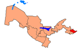 | |
| Cities | ||
| Towns | ||
| Villages | ||
| Authority control databases: Geographic |
|---|