
Amfilochia
Αμφιλοχία | |
|---|---|
 | |
 Amfilochia Location within the region  | |
| Coordinates: 38°51′N 21°10′E / 38.850°N 21.167°E | |
| Country | Greece |
| Administrative region | West Greece |
| Regional unit | Aetolia-Acarnania |
| Area | |
| • Municipality | 1,091.0 km2 (421.2 sq mi) |
| • Municipal unit | 397.9 km2 (153.6 sq mi) |
| Population (2021)[1] | |
| • Municipality | 14,979 |
| • Density | 14/km2 (36/sq mi) |
| • Municipal unit | 9,154 |
| • Municipal unit density | 23/km2 (60/sq mi) |
| • Community | 4,241 |
| Time zone | UTC+2 (EET) |
| • Summer (DST) | UTC+3 (EEST) |
| Postal code | 305 00 |
| Area code(s) | 26420 |
Amfilochia (Greek: Αμφιλοχία) is a town and a municipality in the northwestern part of Aetolia-Acarnania in Greece, on the site of ancient Amfilochia. Under the Ottoman Empire, it was known as Karvasaras (Καρβασαράς; from caravanserai).
Amfilochia is situated by the Ambracian Gulf and features an amphitheatre. Amfilochia dates back to the ancient times and also features the ancient cities of Amphilochian Argos and Limnaia (or Limnaea).
YouTube Encyclopedic
-
1/3Views:1 6211 5932 146
-
Amfilochia, Greece - Sterea / Central Greece - AtlasVisual
-
Driving in Greece from Meteora to Amfilochia 720p
-
Driving in Greece from Amfilochia to Killini 720p
Transcription
History
According to Pausanias, the settlement is named after king Amphilochos, son of Amphiaraus. After the fall of Troy, Amphilochos settled in the area, which consequently was called Amphilochoi until the time of Pausanias.[2]
Under the Ottoman Empire, Ali Pasha of Ioannina, forcibly relocated residents of another village to the current location of the town and established a motel (serai in Turkish) to serve passing caravans. This was how the name Karvasaras came up.[3]
In July 1944 a battle took place in the town between ELAS of the Greek Resistance against the occupation forces and their local collaborators, that resulted in victory for the Resistance.[4]
Municipality
The municipality Amfilochia was formed at the 2011 local government reform by the merger of the following 3 former municipalities, that became municipal units:[5]
The municipality has an area of 1090.991 km2, the municipal unit 397.879 km2.[6]
Subdivisions
The municipal unit of Amfilochia is divided into the following communities:[5]
- Amfilochia (Amfilochia, Boukka, Limnaia and Platos)
- Ampelaki (Ampelaki, Amfilochiko Argos, Ariada, Kampos and Keramidi)
- Anoixiatiko (Anoixiatiko, Agia Triada, Katafourko, Mavrorachi, Moni Retha, Xirolivado, Petralona, Profitis Ilia, Ptelea, Skreiko, Triantafylloula, Tsoukka, Psila Alonia)
- Kechrinia (Kechrinia, Agioi Theodoroi, Kanalos, Kompothekla, Makrychoria, Falangias)
- Loutro (Loutro, Krikellos, Xirakia)
- Megas Kampos
- Sardinia (Sardinia, Kalyvia)
- Sparto (Sparto, Pigadaki, Tria Alonia)
- Stanos
- Varetada
Population
| Year | Town | Community | Municipal unit | Municipality |
|---|---|---|---|---|
| 1981 | - | 6,637 | - | - |
| 1991 | 4,392 | - | 13,711 | - |
| 2001 | 4,119 | 4,681 | 12,834 | - |
| 2011 | 3,827 | 4,325 | 10,264 | 17,056 |
| 2021 | 3,791 | 4,241 | 9,154 | 14,979 |
Transportation

Amfilochia has a port which is sometimes used for the import of grain. It is linked with the GR-5 (E55 and E951, Antirrio - Messolonghi - Ioannina) and is also traversed by the GR-42 that serves Vonitsa, Preveza and the island of Lefkada. Amfilochia is linked with the Ionia Odos, a toll road that bypasses the town itself. Amfilochia is not linked with a railway.
Notable people
- Kyriakos Sfetsas (born 1945), composer
- Nikolaos Stratos (1872–1922), politician and Prime Minister of Greece
- Andreas Stratos (1905–1981), politician and historian
- Vlasios Tsirogiannis, military officer
See also
A part of this article is translated from the German Wikipedia
References
- ^ "Αποτελέσματα Απογραφής Πληθυσμού - Κατοικιών 2021, Μόνιμος Πληθυσμός κατά οικισμό" [Results of the 2021 Population - Housing Census, Permanent population by settlement] (in Greek). Hellenic Statistical Authority. 29 March 2024.
- ^ Παυσανιασ. Κορινθιακα. Ι. Ζαχαρόπουλος. pp. 114–115.
- ^ "Ηλεκτρονική Πλοήγηση Μνημείων Αιτωλοακαρνανίας και Αχαϊας - Χώροι". 2019-11-19. Archived from the original on 2019-11-19. Retrieved 2022-10-20.
- ^ ""Φυσέκι στους φασίστες". H μάχη της Αμφιλοχίας όπου οι αντάρτες εξολόθρευσαν τους Γερμανούς. Διέφυγαν στήνοντας οδοφράγματα από πτώματα γερμανών στρατιωτών". ΜΗΧΑΝΗ ΤΟΥ ΧΡΟΝΟΥ (in Greek). 2022-07-11. Retrieved 2022-10-20.
- ^ a b "ΦΕΚ B 1292/2010, Kallikratis reform municipalities" (in Greek). Government Gazette.
- ^ "Population & housing census 2001 (incl. area and average elevation)" (PDF) (in Greek). National Statistical Service of Greece. Archived from the original (PDF) on 2015-09-21.
External links
- Municipality of Amfilochia (in Greek)
| Regional unit of Achaea | 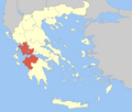 | |
|---|---|---|
| Regional unit of Aetolia-Acarnania | ||
| Regional unit of Elis | ||
| ||
This Western Greece location article is a stub. You can help Wikipedia by expanding it. |