
Phak Hai
ผักไห่ | |
|---|---|
 Lad Chado Market, a local floating market | |
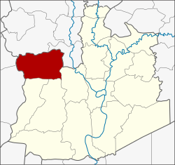 District location in Ayutthaya province | |
| Coordinates: 14°27′30″N 100°22′12″E / 14.45833°N 100.37000°E | |
| Country | Thailand |
| Province | Ayutthaya |
| Seat | Phak Hai |
| Tambon | 16 |
| Area | |
| • Total | 189.0 km2 (73.0 sq mi) |
| Population (2000) | |
| • Total | 44,436 |
| • Density | 235.1/km2 (609/sq mi) |
| Time zone | UTC+7 (ICT) |
| Postal code | 13120 |
| Geocode | 1408 |
Phak Hai (Thai: ผักไห่, pronounced [pʰàk hàj]) is a district (amphoe) in the northwestern part of Ayutthaya province, central Thailand.
History
Historically, the district was named Khwaeng Sena Yai, which became converted to an amphoe at the end of the 19th century. In 1917, the name of district was changed to be Phak Hai after the central tambon.
The name Phak Hai comes from the Nirat Suphan by Sunthorn Phu, which refers to a village named Ban Pak Hai. The spelling has changed however now, so it can also mean a kind of plant (Momordica charantia) that grows in swamps.[1] [2]
Geography
Neighboring districts are (from the north clockwise) Wiset Chai Chan and Pa Mok of Ang Thong province; Bang Ban, Sena, and Bang Sai of Ayutthaya Province; and Bang Pla Ma, and Mueang Suphanburi of Suphanburi province.
Administration
The district is divided into 16 sub-districts (tambon), which are further subdivided into 128 villages (muban).
| 1. | Phak Hai | ผักไห่ | |
| 2. | Ammarit | อมฤต | |
| 3. | Ban Khae | บ้านแค | |
| 4. | Lat Nam Khem | ลาดน้ำเค็ม | |
| 5. | Talan | ตาลาน | |
| 6. | Tha Din Daeng | ท่าดินแดง | |
| 7. | Don Lan | ดอนลาน | |
| 8. | Na Khu | นาคู | |
| 9. | Kudi | กุฎี | |
| 10. | Lam Takhian | ลำตะเคียน | |
| 11. | Khok Chang | โคกช้าง | |
| 12. | Chakkarat | จักราช | |
| 13. | Nong Nam Yai | หนองน้ำใหญ่ | |
| 14. | Lat Chit | ลาดชิด | |
| 15. | Na Khok | หน้าโคก | |
| 16. | Ban Yai | บ้านใหญ่ |
In media
Phak Hai is the setting of a Thai country song, (luk thung), titled (Thai: สาวผักไห่; RTGS: sao phak hai) 'Phak Hai Girl'). It has been popular since around 1970s.[1]
References
- ^ a b somsak (1995-02-01). "ผักไห่ : ผักไทยโบราณที่ลูกหลานไม่รู้จัก" [Phak Hai : traditional Thai vegetable that the descendants do not know]. dortor.co.th (in Thai). Retrieved 2019-06-02.
- ^ "ประวัติความเป็นมาของอำเภอผักไห่" [Historical of Phak Hai district]. Pukhai.com (in Thai). Retrieved 2019-06-02.
External links
This Ayutthaya Province location article is a stub. You can help Wikipedia by expanding it. |