
Khon Buri
ครบุรี | |
|---|---|
 Lam Chae Reservoir | |
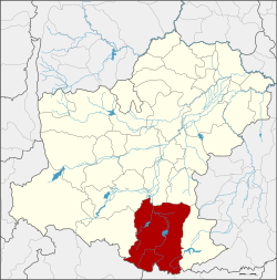 District location in Nakhon Ratchasima province | |
| Coordinates: 14°31′24″N 102°14′54″E / 14.52333°N 102.24833°E | |
| Country | Thailand |
| Province | Nakhon Ratchasima |
| Seat | Chae |
| Area | |
| • Total | 1,816.9 km2 (701.5 sq mi) |
| Population (2010) | |
| • Total | 93,808 |
| • Density | 52.2/km2 (135/sq mi) |
| Time zone | UTC+7 (ICT) |
| Postal code | 30250 |
| Geocode | 3002 |
Khon Buri (Thai: ครบุรี, pronounced [kʰɔ̄ːn bū.rīː]) is a district (amphoe) in the southern part of Nakhon Ratchasima province, northeastern Thailand.
History
Khon Buri in Thai means 'origin of the river', which refers to one of tributaries of the Mun River. In the past it was called Ban Khon Buri. When the town grew, its name was changed to Mueang Khon and then Khon Buri.
In 1907, the area was a minor district (king amphoe) of Chok Chai district. It was called King Amphoe Chae because the city centre was in Tambon Chae.
As Tambon Khon Buri was very far from the center of Pak Thong Chai district, the government administered it together with Chae Sub-district in 1939. At the same time, it was officially upgraded to a full district and renamed Khon Buri.
Geography
Neighbouring districts are (from the north clockwise): Chok Chai and Nong Bun Mak of Nakhon Ratchasima Province; Nong Ki of Buriram province; Soeng Sang of Nakhon Ratchasima; Watthana Nakhon and Mueang Sa Kaeo of Sa Kaeo province; Na Di of Prachinburi province; and Wang Nam Khiao and Pak Thong Chai of Nakhon Ratchasima.
The Sankamphaeng Range mountainous area is in the southern section of this district.
Administration
The district is divided into 12 sub-districts (tambons). There are three townships (thesaban tambons) in the district: Chae and Chorakhe Hin, each covering parts of the same-named tambon, and Sai Yong-Chai Wan covering parts of tambons Khon Buri and Khon Buri Tai.
| 1. | Chae | แชะ | |
| 2. | Chaliang | เฉลียง | |
| 3. | Khon Buri | ครบุรี | |
| 4. | Khok Krachai | โคกกระชาย | |
| 5. | Chorakhe Hin | จระเข้หิน | |
| 6. | Map Tako En | มาบตะโกเอน | |
| 7. | Oraphim | อรพิมพ์ | |
| 8. | Ban Mai | บ้านใหม่ | |
| 9. | Lam Phiak | ลำเพียก | |
| 10. | Khon Buri Tai | ครบุรีใต้ | |
| 11. | Tabaek Ban | ตะแบกบาน | |
| 12. | Sa Wan Phraya | สระว่านพระยา |
This Nakhon Ratchasima Province location article is a stub. You can help Wikipedia by expanding it. |