
Fang
ฝาง | |
|---|---|
 Royal Agricultural Station at Doi Ang Khang | |
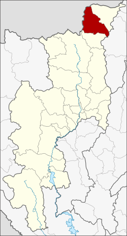 District location in Chiang Mai province | |
| Coordinates: 19°55′8″N 99°12′49″E / 19.91889°N 99.21361°E | |
| Country | Thailand |
| Province | Chiang Mai |
| Seat | Fang (town) |
| Area | |
| • Total | 888.164 km2 (342.922 sq mi) |
| Population (2005) | |
| • Total | 231,544 |
| Time zone | UTC+7 (ICT) |
| Postal code | 50110 |
| Geocode | 5009 |
Fang (Thai: ฝาง, pronounced [fǎːŋ]) is a district (amphoe) in the northern part of Chiang Mai province, northern Thailand.
History
According to the Yonok chronicle, Mueang Fang was built in 641 by King Lawa Changkarat. Later, King Mengrai the Great ruled over Fang before building Wiang Kumkam and Chiang Mai as successive capitals of the Lanna Kingdom, beginning in 1294.[1] Prior to the new capitals, Mengrai had used Mueang Fang as a base to invade Hariphunchai.[2]
In 1910, Mueang Fang was made part of Chiang Rai province, and named Mueang Fang District.[3] In 1925 it was reassigned to Chiang Mai Province.[4] In 1938 the word mueang was dropped from the name, which was then reserved for capital districts of the provinces.[5]
Etymology
The landscape of Mueang Fang looked like the seed of a fang tree (Caesalpinia sappan). The town was named after this tree.
Geography

Neighboring districts are (from the northeast, clockwise) Mae Ai of Chiang Mai Province, Mae Suai of Chiang Rai province, Chai Prakan of Chiang Mai Province, and Shan State of Myanmar. The Fang River, a tributary of the Kok River, gives its name to the district.
Doi Pha Hom Pok National Park is in Fang District. The Daen Lao Range runs through the district's north and west, and the Khun Tan Range begins in the south of the district.
Administration
The district is divided into eight subdistricts (tambons), which are further subdivided into 128 villages (mubans). There are two townships (thesaban tambons): Wiang Fang covers parts of tambon Wiang, and Ban Mae Kha parts of tambon Mae Kha. There are a further eight tambon administrative organizations (TAO).
| No. | Name | Thai name | Villages | Pop. | |
|---|---|---|---|---|---|
| 1. | Wiang | เวียง | 19 | 26,810 | |
| 3. | Mon Pin | ม่อนปิ่น | 22 | 19,123 | |
| 4. | Mae Ngon | แม่งอน | 18 | 17,715 | |
| 5. | Mae Sun | แม่สูน | 17 | 15,019 | |
| 6. | San Sai | สันทราย | 17 | 11,583 | |
| 10. | Mae Kha | แม่คะ | 15 | 14,542 | |
| 11. | Mae Kha | แม่ข่า | 13 | 9,873 | |
| 12. | Pong Nam Ron | โป่งน้ำร้อน | 7 | 6,368 |
Missing numbers are tambons which now form Chai Prakan district.
See also
References
- ^ The Chiang Mai Chronicle 2nd Edition, tr. David K. Wyatt and Aroonrut Wichienkeeo, Chiang Mai: Silkworm Books, 1998, p18 ISBN 978-974-7100-62-4
- ^ Ongsakul, Sarassawadee, History of Lan Na, trans. Chitraporn Tanratanakul, Chiang Mai: Silkworm Books, Thai text 2001, English text 2005, p.55 ISBN 978-974-9575-84-0
- ^ ประกาศกระทรวงมหาดไทย (PDF). Royal Gazette (in Thai). 27 (ง): 426–427. 12 Jun 1910. Archived from the original (PDF) on May 16, 2012.
- ^ ประกาศกระทรวงมหาดไทย เรื่อง โอนอำเภอเมืองฝาง จังหวัดเชียงรายไปขึ้นจังหวัดเชียงใหม่ (PDF). Royal Gazette (in Thai). 42 (ง): 203. 26 Apr 1925. Archived from the original (PDF) on May 16, 2012.
- ^ พระราชกฤษฎีกาเปลี่ยนนามจังหวัด และอำเภอบางแห่ง พุทธศักราช ๒๔๘๑ (PDF). Royal Gazette (in Thai). 55 (ก): 658–666. 14 Nov 1938. Archived from the original (PDF) on November 8, 2011.
External links
 Fang travel guide from Wikivoyage
- amphoe.com (Thai)
- Doi Phahompok National Park