
Amherst, Colorado | |
|---|---|
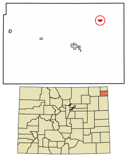 Location of the Amherst CDP in Phillips County, Colorado. | |
 Amherst Location of the Amherst CDP in the United States. | |
| Coordinates: 40°40′59″N 102°10′21″W / 40.6831608°N 102.1725958°W[1] | |
| Country | |
| State | |
| County | Phillips County |
| Established | About 1887[2] |
| Government | |
| • Type | unincorporated town |
| Area | |
| • Total | 0.454 sq mi (1.176 km2) |
| • Land | 0.454 sq mi (1.176 km2) |
| • Water | 0.000 sq mi (0.000 km2) |
| Elevation | 3,697 ft (1,127 m) |
| Population | |
| • Total | 46 |
| • Density | 100/sq mi (39/km2) |
| Time zone | UTC-7 (MST) |
| • Summer (DST) | UTC-6 (MDT) |
| ZIP Code[5] | 80721 |
| Area code | 970 |
| GNIS feature[3] | Amherst CDP |
Amherst is a census-designated place (CDP) and a post office in and governed by Phillips County, Colorado, United States. The Amherst post office has the ZIP Code 80721.[5] At the United States Census 2020, the population of the Amherst CDP was 47.[4]
History
The town of Amherst was established about 1887.[2] The community was named after Amherst, Massachusetts, the native home of a local businessman.[6] The Amherst Post Office opened on February 18, 1888.[7] Phillips County was founded in 1889, and before that, Amherst was in Weld County.[8]
Geography
The Amherst CDP has an area of 291 acres (1.176 km2), all land.[1]
Demographics
| Year | Pop. | ±% |
|---|---|---|
| 2010 | 58 | — |
| 2020 | 47 | −19.0% |
| Source: United States Census Bureau | ||
The United States Census Bureau initially defined the Amherst CDP for the United States Census 2010.
See also
References
- ^ a b c "State of Colorado Census Designated Places - BAS20 - Data as of January 1, 2020". United States Census Bureau. Retrieved December 26, 2020.
- ^ a b Eichler, Geo. R. (1977). Colorado Place Names. Johnson Publishing Company.
- ^ a b c "U.S. Board on Geographic Names: Domestic Names". United States Geological Survey. Retrieved December 26, 2020.
- ^ a b United States Census Bureau. "Amherst CDP, Colorado". Retrieved April 13, 2023.
- ^ a b "Look Up a ZIP Code". United States Postal Service. Retrieved December 26, 2020.
- ^ Dawson, John Frank (1954). Place names in Colorado: why 700 communities were so named, 150 of Spanish or Indian origin. Denver, CO: The J. Frank Dawson Publishing Co. p. 6.
- ^ Bauer, William H.; James L. Ozment; John H. Willard (1990). Colorado Post Offices 1859-1989. The Colorado Railroad Museum. ISBN 0-918654-42-4.
- ^ "Phillips County". Phillips County Website.
External links
![]() Media related to Amherst, Colorado at Wikimedia Commons
Media related to Amherst, Colorado at Wikimedia Commons
Municipalities and communities of Phillips County, Colorado, United States | ||
|---|---|---|
| City | 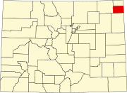 | |
| Towns | ||
| CDP | ||