
Amarda Road Airstrip | |||||||||||||||
|---|---|---|---|---|---|---|---|---|---|---|---|---|---|---|---|
 | |||||||||||||||
| Summary | |||||||||||||||
| Airport type | Defunct | ||||||||||||||
| Owner | Ministry of Defence[1] | ||||||||||||||
| Operator | Indian Air Force[2] | ||||||||||||||
| Location | Rasgovindpur, Odisha, India | ||||||||||||||
| Built | 1940 | ||||||||||||||
| Elevation AMSL | 130 ft / 43 m | ||||||||||||||
| Coordinates | 21°48′18″N 087°02′49″E / 21.80500°N 87.04694°E | ||||||||||||||
| Map | |||||||||||||||
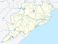 Amarda Road Airstrip Location in Odisha  Amarda Road Airstrip Amarda Road Airstrip (India) | |||||||||||||||
| Runways | |||||||||||||||
| |||||||||||||||
Amarda Road Airstrip, also known as Rasgovindpur Airstrip is a former wartime airfield located near Rasgovindpur village in Mayurbhanj district of Odisha, India. It was used by the Royal Indian Air Force during World War II.
YouTube Encyclopedic
-
1/3Views:63 6365 991427 835
-
Bermuda Triangle of India⚠️ Amarda Road Airstrip | Live Hindi
-
India Bermuda Triangle || Amarda Road Airstrip || T Talks
-
India's Barmuda Triangle | 😳 | Bermuda Triangle | amazing facts | amarda road airfield | #shorts
Transcription
History

The Amarda Road airstrip, as it was called in war terminology, spreads across an area of nearly 900 acres.[3] Built in the 1940s at a cost of Rs 3 crore, it was eventually abandoned after the war.[4] It was probably named as Amarda Road Airfield because of the nearby Amarda Road railway station. The airfield was used by No. 136 Squadron RAF,[5] No. 177 Squadron RAF[6] and No. 607 Squadron RAF. The 'Air Fighting Training Unit', formed in February 1943, was also based here.
As an airfield, Amarda Road fell on the supply route for the Nationalist Armies of China in their fight against the Japanese. Aircraft of the RAF and the United States Army Air Forces (USAAF) would regularly fly from this space to China via Chabua (Dibrugarh), Jorhat and Vijaynagar across the infamous hump route over Arunachal and East Tibet.
Amarda Road and other neighbouring airfields - Dhalbhumgarh, Dudhkundi, Salua, Digri, Salbani and Chakulia - formed a web of airfields created by the Allies to stop the impending Japanese advance in the east. During the war, Amarda Road was, to put it simply, a battle hub. After the war was over, most airfields, including this one, fell into disuse. Today, only the Kalaikunda airstrip, which was declared an Air Force Station in 1954, exists.
Present condition
Eight decades after the base was built, the 11,000 feet (3,400 m) concrete runway is still intact, though the buildings that once cluttered the edges are gone.
There are proposals to renovate the airstrip for future operations under UDAN scheme from 2022.[7][8] As of November 2022, the Government of India and the Ministry of Defence have cleared for the airstrip to be developed as a commercial airport by acquiring a land area of 160 acres, and developing it at a cost of ₹ 25 crores.[3][9]
Gallery
-

Airstrip
-

Airstrip
-

Concrete runway
References
- ^ "List of Airstrip in the State maintained by State Government" (PDF). ct.odisha.gov.in. Commerce and Transport Department, Government of Odisha. Retrieved 14 January 2023.
- ^ "AAI Unserved Airports" (PDF). aai.aero. Airports Authority of India.
- ^ a b Barik, Satyasundar (23 November 2022). "Decks cleared for development of World War II era airstrip into an airport in Odisha". The Hindu. Retrieved 26 November 2022.
- ^ Sahoo, Akshaya Kumar (29 April 2018). "WW-II era Amarda airstrip in Odisha cries for attention". The Asian Age.
- ^ Jacobs, Vivian K. The Woodpecker Story. Durham, UK: The Pentland Press Ltd., 1994. ISBN 1-85821-235-9. 1994, p. 156.
- ^ C.G.Jefford (1988). RAF Squadrons. UK Airlife Publishing. ISBN 1-85310-053-6.
- ^ "Amarda airstrip revamp in 2022: Bishweswar Tudu". The New Indian Express. 9 September 2021.
- ^ "Rasgobindpur now under UDAN scheme". Daily Pioneer. 20 June 2021.
- ^ Bisoyi, Sujit (23 November 2022). "President Droupadi Murmu's home district to have airport, gets MoD nod". The Indian Express. Retrieved 26 November 2022.