
Alubijid | |
|---|---|
| Municipality of Alubijid | |
 Flag  Seal | |
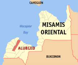 Map of Misamis Oriental with Alubijid highlighted | |
OpenStreetMap  | |
 Alubijid Location within the Philippines | |
| Coordinates: 8°34′17″N 124°28′30″E / 8.571411°N 124.475125°E | |
| Country | Philippines |
| Region | Northern Mindanao |
| Province | Misamis Oriental |
| District | 2nd district |
| Barangays | 16 (see Barangays) |
| Government | |
| • Type | Sangguniang Bayan |
| • Mayor | Emmanuel L. Jamis |
| • Vice Mayor | Alvin Giovanni A. Labis |
| • Representative | Yevgeny Vincente B. Emano |
| • Municipal Council | Members |
| • Electorate | 21,616 voters (2022) |
| Area | |
| • Total | 85.56 km2 (33.03 sq mi) |
| Elevation | 51 m (167 ft) |
| Highest elevation | 182 m (597 ft) |
| Lowest elevation | 0 m (0 ft) |
| Population (2020 census)[3] | |
| • Total | 32,163 |
| • Density | 380/km2 (970/sq mi) |
| • Households | 8,713 |
| Economy | |
| • Income class | 4th municipal income class |
| • Poverty incidence | 14.93 |
| • Revenue | ₱ 135.7 million (2020) |
| • Assets | ₱ 359.3 million (2020) |
| • Expenditure | ₱ 124.6 million (2020) |
| • Liabilities | ₱ 49.6 million (2020) |
| Service provider | |
| • Electricity | Misamis Oriental 1 Rural Electric Cooperative (MORESCO 1) |
| Time zone | UTC+8 (PST) |
| ZIP code | 9018 |
| PSGC | |
| IDD : area code | +63 (0)88 |
| Native languages | Cebuano Binukid Subanon Tagalog |
| Website | www |
Alubijid (locally [ɐlʊˈbihɪd]), officially the Municipality of Alubijid (Cebuano: Lungsod sa Alubijid; Tagalog: Bayan ng Alubijid), is a 4th class municipality in the province of Misamis Oriental, Philippines. According to the 2020 census, it has a population of 32,163 people.[3]
Etymology
According to oral tradition, the town's name is derived from the local term for the hog plum tree (Spondias pinnata)—alubijid or alubihod. The trees grew along the town's coast and were used as landmarks by traders. Historical variations of the spelling include: Alubigid, Alubuhid, Alubijig, and Alubid.[5]
History
Alubijid, along with El Salvador, was part of Cagayan de Misamis (present-day Cagayan de Oro) when the two entities petitioned to become municipalities in 1933. Alubijid became a separate town in 1940, and El Salvador became one 9 years later.
Geography
Barangays
Alubijid is politically subdivided into 16 barangays. Each barangay consists of puroks while some have sitios.
- Baybay
- Benigwayan
- Calatcat
- Lagtang
- Lanao
- Loguilo
- Lourdes
- Lumbo
- Molocboloc
- Poblacion
- Sampatulog
- Sungay
- Talaba
- Taparak
- Tugasnon
- Tula
Climate
| Climate data for Alubijid, Misamis Oriental | |||||||||||||
|---|---|---|---|---|---|---|---|---|---|---|---|---|---|
| Month | Jan | Feb | Mar | Apr | May | Jun | Jul | Aug | Sep | Oct | Nov | Dec | Year |
| Mean daily maximum °C (°F) | 28 (82) |
29 (84) |
30 (86) |
31 (88) |
30 (86) |
30 (86) |
30 (86) |
30 (86) |
30 (86) |
30 (86) |
29 (84) |
29 (84) |
30 (85) |
| Mean daily minimum °C (°F) | 24 (75) |
24 (75) |
24 (75) |
25 (77) |
26 (79) |
26 (79) |
25 (77) |
25 (77) |
25 (77) |
25 (77) |
25 (77) |
25 (77) |
25 (77) |
| Average precipitation mm (inches) | 271 (10.7) |
217 (8.5) |
193 (7.6) |
178 (7.0) |
344 (13.5) |
423 (16.7) |
362 (14.3) |
358 (14.1) |
329 (13.0) |
320 (12.6) |
322 (12.7) |
260 (10.2) |
3,577 (140.9) |
| Average rainy days | 23.2 | 19.5 | 22.0 | 22.8 | 29.6 | 28.9 | 30.3 | 29.8 | 28.1 | 28.8 | 26.1 | 24.1 | 313.2 |
| Source: Meteoblue[6] | |||||||||||||
Demographics
|
| |||||||||||||||||||||||||||||||||||||||||||||
| Source: Philippine Statistics Authority[7][8][9][10] | ||||||||||||||||||||||||||||||||||||||||||||||
In the 2020 census, the population of Alubijid was 32,163 people,[3] with a density of 380 inhabitants per square kilometre or 980 inhabitants per square mile.
Economy
Education
College:
- University of Science and Technology of Southern Philippines (Main Campus)
- Bukidnon State University - Alubijid Campus
High schools:
- Alubijid National Comprehensive High School
- Lourdes National High School
- Living Hope Christian Academy (Private)
Elementary schools:
- Alubijid Central School
- Baybay Elementary School
- Benigwayan Elementary School
- Calatcat Elementary School
- Lagtang Elementary School
- Lanao Elementary School
- Loguilo Elementary School
- Lourdes Elementary School
- Lumbo Elementary School
- Molocboloc Elementary School
- Sampatulog Elementary School
- Sungay Elementary
- Talaba Elementary School
- Taparak Elementary School
- Tugasnon Elementary School
- Tula Elementary School
References
- ^ Municipality of Alubijid | (DILG)
- ^ "2015 Census of Population, Report No. 3 – Population, Land Area, and Population Density" (PDF). Philippine Statistics Authority. Quezon City, Philippines. August 2016. ISSN 0117-1453. Archived (PDF) from the original on May 25, 2021. Retrieved July 16, 2021.
- ^ a b c Census of Population (2020). "Region X (Northern Mindanao)". Total Population by Province, City, Municipality and Barangay. Philippine Statistics Authority. Retrieved July 8, 2021.
- ^ "PSA Releases the 2018 Municipal and City Level Poverty Estimates". Philippine Statistics Authority. December 15, 2021. Retrieved January 22, 2022.
- ^ Neri, Leee Anthony M.; Basilia, Pauline Grace A.; Luga, Ena Angelica C. (February 2020). Escalante, Rene R.; Dulnuan, Christine G. (eds.). "The Alubijid Spanish Kiln: The Archaeology, Colonial History and Cultural Significance". Journal Of Philippine Local History And Heritage. Manila: National Historical Commission of the Philippines. 6 (1): 107–142. ISSN 2449-4372. Retrieved December 13, 2023.
- ^ "Alubijid: Average Temperatures and Rainfall". Meteoblue. Retrieved April 29, 2020.
- ^ Census of Population (2015). "Region X (Northern Mindanao)". Total Population by Province, City, Municipality and Barangay. Philippine Statistics Authority. Retrieved June 20, 2016.
- ^ Census of Population and Housing (2010). "Region X (Northern Mindanao)" (PDF). Total Population by Province, City, Municipality and Barangay. National Statistics Office. Retrieved June 29, 2016.
- ^ Censuses of Population (1903–2007). "Region X (Northern Mindanao)". Table 1. Population Enumerated in Various Censuses by Province/Highly Urbanized City: 1903 to 2007. National Statistics Office.
{{cite encyclopedia}}: CS1 maint: numeric names: authors list (link) - ^ "Province of Misamis Oriental". Municipality Population Data. Local Water Utilities Administration Research Division. Retrieved December 17, 2016.
- ^ "Poverty incidence (PI):". Philippine Statistics Authority. Retrieved December 28, 2020.
- ^ "Estimation of Local Poverty in the Philippines" (PDF). Philippine Statistics Authority. November 29, 2005.
- ^ "2003 City and Municipal Level Poverty Estimates" (PDF). Philippine Statistics Authority. March 23, 2009.
- ^ "City and Municipal Level Poverty Estimates; 2006 and 2009" (PDF). Philippine Statistics Authority. August 3, 2012.
- ^ "2012 Municipal and City Level Poverty Estimates" (PDF). Philippine Statistics Authority. May 31, 2016.
- ^ "Municipal and City Level Small Area Poverty Estimates; 2009, 2012 and 2015". Philippine Statistics Authority. July 10, 2019.
- ^ "PSA Releases the 2018 Municipal and City Level Poverty Estimates". Philippine Statistics Authority. December 15, 2021. Retrieved January 22, 2022.
External links
- Philippine Standard Geographic Code
- Philippine Census Information
- Local Governance Performance Management System
- Official website
Places adjacent to Alubijid | |
|---|---|
Cagayan de Oro (capital and largest city) | |
| Municipalities | |
| Component cities | |
| Highly urbanized city |
|
This article about a location in Northern Mindanao region is a stub. You can help Wikipedia by expanding it. |