
Alto da Boa Vista | |
|---|---|
Neighborhood | |
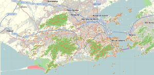 Alto da Boa Vista Location in Rio de Janeiro  Alto da Boa Vista Alto da Boa Vista (Brazil) | |
| Coordinates: 22°57′32″S 43°15′11″W / 22.95889°S 43.25306°W | |
| Country | |
| State | Rio de Janeiro (RJ) |
| Municipality/City | Rio de Janeiro |
| Zone | North Zone |
Alto da Boa Vista is a neighborhood in the North Zone of Rio de Janeiro, Brazil.
Geography
Climate
| Climate data for Rio de Janeiro (station of Alto da Boa Vista, 1981—2010). Elevation: 300 m (984 ft). | |||||||||||||
|---|---|---|---|---|---|---|---|---|---|---|---|---|---|
| Month | Jan | Feb | Mar | Apr | May | Jun | Jul | Aug | Sep | Oct | Nov | Dec | Year |
| Record high °C (°F) | 37.5 (99.5) |
36.5 (97.7) |
36.8 (98.2) |
34.8 (94.6) |
33.0 (91.4) |
32.9 (91.2) |
32.7 (90.9) |
38.5 (101.3) |
37.5 (99.5) |
38.5 (101.3) |
37.1 (98.8) |
38.5 (101.3) |
38.5 (101.3) |
| Mean daily maximum °C (°F) | 30.1 (86.2) |
30.6 (87.1) |
29.1 (84.4) |
27.7 (81.9) |
25.2 (77.4) |
24.3 (75.7) |
24.1 (75.4) |
24.7 (76.5) |
24.7 (76.5) |
25.9 (78.6) |
27.3 (81.1) |
28.7 (83.7) |
26.9 (80.4) |
| Mean daily minimum °C (°F) | 20.7 (69.3) |
20.9 (69.6) |
20.2 (68.4) |
18.8 (65.8) |
16.8 (62.2) |
15.3 (59.5) |
14.8 (58.6) |
15.3 (59.5) |
16.1 (61.0) |
17.3 (63.1) |
18.6 (65.5) |
19.8 (67.6) |
17.9 (64.2) |
| Record low °C (°F) | 12.0 (53.6) |
15.2 (59.4) |
14.5 (58.1) |
11.5 (52.7) |
10.2 (50.4) |
6.7 (44.1) |
7.3 (45.1) |
8.7 (47.7) |
8.1 (46.6) |
10.5 (50.9) |
11.4 (52.5) |
10.2 (50.4) |
6.7 (44.1) |
| Average precipitation mm (inches) | 209.1 (8.23) |
174.8 (6.88) |
215.7 (8.49) |
203.3 (8.00) |
188.5 (7.42) |
132.7 (5.22) |
182.3 (7.18) |
141.9 (5.59) |
223.0 (8.78) |
203.7 (8.02) |
217.0 (8.54) |
273.8 (10.78) |
2,365.8 (93.14) |
| Average precipitation days (≥ 1.0 mm) | 11 | 8 | 11 | 9 | 10 | 7 | 8 | 9 | 12 | 12 | 12 | 13 | 122 |
| Source: (climatic average of 1981-2010;[1] temperature records: 06/01/1966-present)[1][2][3] | |||||||||||||
References
- ^ a b "Normais climatológicas do Brasil". Instituto Nacional de Meteorologia. Retrieved 2018-03-23.
- ^ "BDMEP - série histórica - dados diários - temperatura mínima (°C) - Alto da Boa Vista". Instituto Nacional de Meteorologia. Retrieved 2018-04-01.
- ^ "BDMEP - série histórica - dados diários - temperatura máxima (°C) - Alto da Boa Vista". Instituto Nacional de Meteorologia. Retrieved 2018-04-01.
This Rio de Janeiro state, Brazil location article is a stub. You can help Wikipedia by expanding it. |