
Altai
Алтай | |
|---|---|
 Seal | |
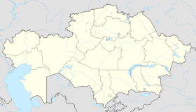 Altai Location in Kazakhstan | |
| Coordinates: 49°44′19″N 84°16′19″E / 49.73861°N 84.27194°E | |
| Country | Kazakhstan |
| Region | East Kazakhstan Region |
| District | Zyryan District |
| Founded | 1791 |
| Incorporated (city) | 1941 |
| Government | |
| • Akim (mayor) | Larisa Grechushnikova |
| Population (2009) | |
| • Total | 39,320 |
| Time zone | UTC+6 (ALMT) |
| Postal code | F42**** |
| Area code | +7 72335 |
Altai (Kazakh: Алтай, romanized: Altai, Russian: Алтай, romanized: Altai), until 2019 known as Zyryan (Kazakh: Зырян, Zyrian) or Zyryanovsk (Russian: Зыряновск) is a town of regional significance in East Kazakhstan Region of Kazakhstan, and the administrative center of the Altai District. It was established in 1791 and was granted town status in 1941. Population: 39,320 (2009 Census results);[1]43,894 (1999 Census results).[1]
Location

Zyryanovsk is located in the Rudnyi Altai, on the banks of the Berezovka River, a left tributary of the Bukhtarma. A 183-km railroad connects Zyrianovsk with Ust-Kamenogorsk. Also through Zyryanovsk there passes a highways Ust-Kamenogorsk – Rakhmanovskie Kluchi and Ust-Kamenogorsk – Bolshenarymskoe.
Industry
Zyrianovsk owed its establishment to the exploitation of a complex-ore deposit, discovered in 1791 by a local inhabitant, G. G. Zyrianov. Zyrianovsk has a lead combinat (division "Kazzinc"). The combine is educated from two mines (Maleevsky and Grekhovsky), concentrating factory, non-productive departments.
Education
In the city the center of the East Kazakhstan state technical university, and also medical college, agrarian and technical college, humanitarian college, construction and transport college, industrial college functions. There are 8 schools, 3 kindergartens, 3 public libraries, Palace of culture, equipment and sports, the Equipments-House.
Notable residents
- Alfred Koch (born 1961) – Russian writer, mathematician-economist, and businessman
- Alexander Rosenbaum (born 1951) – Soviet and Russian bard
References
- ^ a b "Население Республики Казахстан" [Population of the Republic of Kazakhstan] (in Russian). Департамент социальной и демографической статистики. Retrieved 8 December 2013.
49°44′N 84°16′E / 49.733°N 84.267°E
Capital: Oskemen | ||
| Districts |
|  |
| Major cities | ||
| International | |
|---|---|
| National | |
This Kazakhstan location article is a stub. You can help Wikipedia by expanding it. |