
| Allegheny Mountain | |
|---|---|
| Allegheny Ridge[1] | |
 | |
| Highest point | |
| Peak | Grandview Summit, Eastern Continental Divide |
| Elevation | 3,010.3 ft (917.5 m)[2]: a |
| Coordinates | 40°3′29″N 78°45′29″W / 40.05806°N 78.75806°W |
| Geography | |
 Allegheny Mountain Allegheny Mountain is a northern portion of the range of Allegheny Mountains | |
| Country | United States |
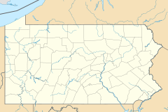
| State | Pennsylvania |
| Counties | Bedford, Cambria and Somerset |
| Parent range | Ridge-and-Valley Appalachians of the Allegheny Mountains |
| Geology | |
| Orogeny | Alleghenian orogeny |
| Type of rock | Carboniferous[3] |
 Eastern Continental Divide points of Allegheny Mountain (Pennsylvania) | |
Allegheny Mountain is a stratigraphic ridge that extends northeast to southwest from south of Blue Knob to a saddle point at the Savage Mountain anticline. It merges with Negro Mountain just north of the Cambria County line where the Berlin-Salisbury basin expires.[4]
The Eastern Continental Divide enters Allegheny Mountain south of Fraziers Pass and follows the Allegheny Backbone[5] southwest where it leaves the escarpment toward the saddle point to the southeast between headwaters of Flaugherty and Wills Creeks, at which the ECD enters the Savage Mountain anticline.[4]: 9
YouTube Encyclopedic
-
1/5Views:65412 3832 24410 2957 321
-
Travel Allegheny Mountain
-
Allegheny Mountain Tunnel near Somerset, Pennsylvania
-
Tunnel Allegheny Mountain PA
-
Allegheny Tunnel - Pennsylvania
-
Allegheny Mountain Tunnel Pennsylvania Turnpike
Transcription
References
- ^ DeFebo, Michael. "Improving the Roadway Turnpike Considers Tunnel Options". PATurnpike.com. Archived from the original on 2011-09-28. Retrieved 2009-11-28.
- ^ "GISDATA Map Studio". United States Geological Survey. Archived from the original on 2010-02-18. Retrieved 2009-12-09.:a. "USGS Elevation Web Service Query". Retrieved 2009-12-03.[permanent dead link]: 1) Y_Value=40.058056&X_Value=-78.758056 ... 3010.25951315412 Archived 2011-07-22 at the Wayback Machine:b. quadrangle maps, 1:24,000, 7.5-Minute Series (Topographic): 1) Berlin, Pennsylvania, 2) Cumberland, Maryland-Pennsylvania-West Virginia
- ^ Stevenson, J. J (1882). "Second Geological Survey of Pennsylvania: Report of Progress Volume 2". The Geology of Bedford and Fulton Counties. Board of Commissioners for the Second Geological Survey. p. 95. Retrieved 2009-12-06.
- ^ a b American Institute of Mining, Metallurgical, and Petroleum Engineers (1882). Transactions of the American Institute of Mining, Metallurgical and Petroleum Engineers. Vol. 12. American Institute of Mining, Metallurgical, and Petroleum Engineers. p. 469.
{{cite book}}: CS1 maint: multiple names: authors list (link) - ^ Atkinson, Edward (1881). Railroads of the United States: a Potent Factor in the Politics of That Country and of Great Britain. A. Williams and Company.
Places adjacent to Allegheny Mountain (Pennsylvania) | |
|---|---|