
Alberni–Clayoquot | |
|---|---|
| Alberni–Clayoquot Regional District | |
|
Logo | |
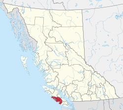 Location in British Columbia | |
| Country | Canada |
| Province | British Columbia |
| Administrative office location | Port Alberni |
| Government | |
| • Body | Board of directors |
| • Chair | John Jack (Huu-ay-aht) |
| • Vice chair | Debbie Haggard (Port Alberni) |
| • Electoral areas |
|
| Area | |
| • Land | 6,577.08 km2 (2,539.42 sq mi) |
| Population (2021)[2] | |
| • Total | 33,521 |
| • Density | 5.1/km2 (13/sq mi) |
| Website | www |
The Alberni–Clayoquot Regional District of British Columbia is located on west central Vancouver Island.[3] Adjacent regional districts it shares borders with are the Strathcona and Comox Valley Regional Districts to the north, and the Nanaimo and Cowichan Valley Regional Districts to the east. The regional district offices are located in Port Alberni.
YouTube Encyclopedic
-
1/1Views:2 590
-
Port Alberni, British Columbia - Evening Walking Tour in 4K (UHD)
Transcription
Communities
Cities
- Port Alberni – pop. 17,678
Regional district electoral areas
- Area A (Bamfield)
- Area B (Beaufort)
- Area C (Long Beach)
- Estevan Point
- Port Alberni
- Area D (Sproat Lake)
- Great Central
- Kleecoot
- Sproat Lake
- Area E (Beaver Creek)
- Area F (Cherry Creek)
District municipalities
Indian Reserves
NB Indian Reserves are not part of municipal or regional district governance and are outside the regional district's jurisdiction, and also counted separately in the census figures. Population figures here are from the 2006 census:
- Ahahswinis IR No. 1 pop. 148[4]
- Alberni IR No. 2 pop. 5[5]
- Anacla IR No. 12 pop. 95[6]
- Clakamucus IR No. 2 pop. 5[7]
- Elhlateese IR No. 2 pop. 27[8]
- Esowista IR No. 3 pop. 160[9]
- Hesquiat IR No. 1 pop. 10[10]
- Ittatsoo IR No. 1 pop. 200[11]
- Keeshan IR No. 9 pop. 0[12]
- Klehkoot IR No. 2 pop. 10[13]
- Macoah IR No. 1 pop. 19[14]
- Marktosis IR No. 15 pop. 661[15]
- Numukamis IR No. 1 pop. 5[16]
- Openit IR No. 27 pop. 0[17]
- Opitsat IR No. 1 pop. 174[18]
- Refuge Cove IR No. 6 pop. 103[19]
- Sachsa IR No. 4 pop. 0[20]
- Stuart Bay IR No. 6 pop. 0[21]
- Tsahaheh IR No. 1 pop. 425[22]
Highways
Highways that run through the Alberni–Clayoquot Regional District:
Demographics
As a census division in the 2021 Census of Population conducted by Statistics Canada, the Alberni-Clayoquot Regional District had a population of 33,521 living in 14,615 of its 16,704 total private dwellings, a change of 8.2% from its 2016 population of 30,981. With a land area of 6,577.08 km2 (2,539.42 sq mi), it had a population density of 5.1/km2 (13.2/sq mi) in 2021.[23]
| Panethnic group |
2021[24] | 2016[25] | 2011[26] | 2006[27] | 2001[28] | 1996[29] | 1991[30][31] | |||||||
|---|---|---|---|---|---|---|---|---|---|---|---|---|---|---|
| Pop. | % | Pop. | % | Pop. | % | Pop. | % | Pop. | % | Pop. | % | Pop. | % | |
| European[a] | 24,675 | 75.5% | 22,740 | 75.14% | 24,145 | 79.46% | 24,235 | 79.63% | 24,140 | 80.11% | 25,870 | 82.3% | 25,140 | 80.89% |
| Indigenous | 6,420 | 19.65% | 6,035 | 19.94% | 5,120 | 16.85% | 4,940 | 16.23% | 4,900 | 16.26% | 3,690 | 11.74% | 4,295 | 13.82% |
| South Asian | 530 | 1.62% | 570 | 1.88% | 415 | 1.37% | 740 | 2.43% | 635 | 2.11% | 1,215 | 3.87% | 1,045 | 3.36% |
| East Asian[b] | 370 | 1.13% | 445 | 1.47% | 410 | 1.35% | 205 | 0.67% | 270 | 0.9% | 395 | 1.26% | 405 | 1.3% |
| Southeast Asian[c] | 245 | 0.75% | 215 | 0.71% | 100 | 0.33% | 100 | 0.33% | 70 | 0.23% | 130 | 0.41% | 70 | 0.23% |
| African | 165 | 0.5% | 90 | 0.3% | 85 | 0.28% | 80 | 0.26% | 65 | 0.22% | 75 | 0.24% | 70 | 0.23% |
| Latin American | 95 | 0.29% | 40 | 0.13% | 40 | 0.13% | 65 | 0.21% | 45 | 0.15% | 30 | 0.1% | 40 | 0.13% |
| Middle Eastern[d] | 50 | 0.15% | 30 | 0.1% | 0 | 0% | 10 | 0.03% | 0 | 0% | 0 | 0% | 15 | 0.05% |
| Other[e] | 130 | 0.4% | 95 | 0.31% | 50 | 0.16% | 60 | 0.2% | 20 | 0.07% | 25 | 0.08% | — | — |
| Total responses | 32,680 | 97.49% | 30,265 | 97.69% | 30,385 | 97.82% | 30,435 | 99.25% | 30,135 | 99.31% | 31,435 | 99.31% | 31,080 | 99.54% |
| Total population | 33,521 | 100% | 30,981 | 100% | 31,061 | 100% | 30,664 | 100% | 30,345 | 100% | 31,652 | 100% | 31,224 | 100% |
- Note: Totals greater than 100% due to multiple origin responses.
See also
Notes
- ^ Statistic includes all persons that did not make up part of a visible minority or an indigenous identity.
- ^ Statistic includes total responses of "Chinese", "Korean", and "Japanese" under visible minority section on census.
- ^ Statistic includes total responses of "Filipino" and "Southeast Asian" under visible minority section on census.
- ^ Statistic includes total responses of "West Asian" and "Arab" under visible minority section on census.
- ^ Statistic includes total responses of "Visible minority, n.i.e." and "Multiple visible minorities" under visible minority section on census.
References
- ^ "District Board Members". Retrieved December 14, 2022.
- ^ a b "Census Profile, 2021 Census of Population: Profile table: Alberni-Clayoquot, Regional district (RD)". Statistics Canada. November 11, 2022. Retrieved December 14, 2022.
- ^ "Alberni–Clayoquot Regional District". BC Geographical Names.
- ^ Community Profiles, 2006, Ahahswinis 1 (Indian Reserve)
- ^ Community Profiles, Alberni 2 (Indian Reserve)
- ^ Community Profiles, Anacla 12 (Indian Reserve)
- ^ Community Profiles, Clackamus 2 (Indian Reserve)
- ^ Community Profiles "Elhlateese 2 (Indian Reserve)
- ^ Esowista 3 (Indian Reserve)
- ^ Community Profiles, Hesquiat 1 (Indian Reserve)
- ^ Community Profiles Ittatsoo 1 (Indian Reserve)
- ^ Community Profiles, Keeshan 9 (Indian Reserve)
- ^ Community Profiles, Klehkoot 2 (Indian Reserve)
- ^ Community Profiles, Machoa 1 (Indian Reserve)
- ^ Community Profiles, Martosis 15 (Indian Reserve)
- ^ Community Profiles, Numukamis 1 (Indian Reserve)
- ^ Community Profiles, Openit 27 (Indian Reserve)
- ^ Community Profiles
- ^ Community Profiles, Refuge Cove 6 (Indian Reserve)
- ^ Community Profiles, Sachsa 4 (Indian Reserve)
- ^ Community Profiles, Stuart Bay 1 (Indian Reserve)
- ^ Community Profiles, Tsahaheh 1 (Indian Reserve)
- ^ "Population and dwelling counts: Canada and census divisions". Statistics Canada. February 9, 2022. Retrieved April 3, 2022.
- ^ Government of Canada, Statistics Canada (October 26, 2022). "Census Profile, 2021 Census of Population". www12.statcan.gc.ca. Retrieved February 23, 2023.
- ^ Government of Canada, Statistics Canada (October 27, 2021). "Census Profile, 2016 Census". www12.statcan.gc.ca. Retrieved February 23, 2023.
- ^ Government of Canada, Statistics Canada (November 27, 2015). "NHS Profile". www12.statcan.gc.ca. Retrieved February 23, 2023.
- ^ Government of Canada, Statistics Canada (August 20, 2019). "2006 Community Profiles". www12.statcan.gc.ca. Retrieved February 23, 2023.
- ^ Government of Canada, Statistics Canada (July 2, 2019). "2001 Community Profiles". www12.statcan.gc.ca. Retrieved February 23, 2023.
- ^ Government of Canada, Statistics Canada (June 4, 2019). "Electronic Area Profiles Profile of Census Divisions and Subdivisions, 1996 Census". www12.statcan.gc.ca. Retrieved February 23, 2023.
- ^ Government of Canada, Statistics Canada (March 29, 2019). "1991 Census Area Profiles Profile of Census Divisions and Subdivisions - Part B". www12.statcan.gc.ca. Retrieved February 23, 2023.
- ^ Government of Canada, Statistics Canada (March 29, 2019). "Data tables, 1991 Census Population by Ethnic Origin (24), Showing Single and Multiple Origins (2) - Canada, provinces and territories, census divisions and census subdivisions". www12.statcan.gc.ca. Retrieved February 23, 2023.
External links
Places adjacent to Alberni-Clayoquot Regional District | ||||||||||||||||
|---|---|---|---|---|---|---|---|---|---|---|---|---|---|---|---|---|
| ||||||||||||||||
49°15′00″N 125°20′00″W / 49.25000°N 125.33333°W