
Albany, Illinois | |
|---|---|
 Albany from the Mississippi River | |
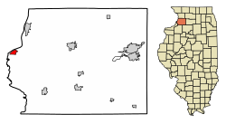 Location of Albany in Whiteside County, Illinois. | |
 Location of Illinois in the United States | |
 Albany, Illinois Location in Illinois  Albany, Illinois Albany, Illinois (the United States)  Albany, Illinois Albany, Illinois (North America) | |
| Coordinates: 41°47′18″N 90°13′9″W / 41.78833°N 90.21917°W | |
| Country | United States |
| State | Illinois |
| County | Whiteside |
| Area | |
| • Total | 1.07 sq mi (2.77 km2) |
| • Land | 1.07 sq mi (2.77 km2) |
| • Water | 0.00 sq mi (0.00 km2) |
| Population (2020) | |
| • Total | 864 |
| • Density | 806.72/sq mi (311.45/km2) |
| Time zone | UTC-6 (CST) |
| • Summer (DST) | UTC-5 (CDT) |
| ZIP Code(s) | 61230 |
| Area code | 309 |
| FIPS code | 17-00516 |
Albany is a village in Whiteside County, Illinois, United States. The population was 891 at the 2010 census, down from 895 in 2000.
YouTube Encyclopedic
-
1/1Views:642
-
Fulton, Illinois to Clinton, Iowa on the Lincoln Highway.wmv
Transcription
History
Albany was laid out in 1837, and named after Albany, New York, the native home of a large share of the first settlers.[2] A post office called Albany has been in operation since 1838.[3]
Geography
Albany is located at 41°47′18″N 90°13′9″W / 41.78833°N 90.21917°W (41.788411, -90.219128).[4]
According to the 2010 census, Albany has a total area of 1.07 square miles (2.77 km2), all land.[5]
Demographics
| Census | Pop. | Note | %± |
|---|---|---|---|
| 1860 | 628 | — | |
| 1870 | 606 | −3.5% | |
| 1880 | 623 | 2.8% | |
| 1890 | 611 | −1.9% | |
| 1900 | 629 | 2.9% | |
| 1910 | 618 | −1.7% | |
| 1920 | 491 | −20.6% | |
| 1930 | 450 | −8.4% | |
| 1940 | 492 | 9.3% | |
| 1950 | 544 | 10.6% | |
| 1960 | 637 | 17.1% | |
| 1970 | 942 | 47.9% | |
| 1980 | 1,014 | 7.6% | |
| 1990 | 835 | −17.7% | |
| 2000 | 895 | 7.2% | |
| 2010 | 891 | −0.4% | |
| 2020 | 864 | −3.0% | |
| U.S. Decennial Census[6] | |||
As of the census[7] of 2000, there were 895 people, 349 households, and 262 families residing in the village. The population density was 894.8 inhabitants per square mile (345.5/km2). There were 383 housing units at an average density of 382.9 per square mile (147.8/km2). The racial makeup of the village was 98.66% White, 0.67% African American, 0.22% from other races, and 0.45% from two or more races. Hispanic or Latino of any race were 0.56% of the population.
There were 349 households, out of which 33.5% had children under the age of 18 living with them, 63.0% were married couples living together, 8.3% had a female householder with no husband present, and 24.9% were non-families. 21.8% of all households were made up of individuals, and 9.2% had someone living alone who was 65 years of age or older. The average household size was 2.56 and the average family size was 2.98.
In the village, the population was spread out, with 26.8% under the age of 18, 5.8% from 18 to 24, 28.3% from 25 to 44, 26.1% from 45 to 64, and 13.0% who were 65 years of age or older. The median age was 38 years. For every 100 females, there were 94.6 males. For every 100 females age 18 and over, there were 90.4 males.
The median income for a household in the village was $46,719, and the median income for a family was $51,333. Males had a median income of $40,521 versus $20,938 for females. The per capita income for the village was $18,780. About 3.7% of families and 5.3% of the population were below the poverty line, including 7.7% of those under age 18 and 0.9% of those age 65 or over.
Notable people
- Nan Sheets, painter and museum director[8]
References
- ^ "2020 U.S. Gazetteer Files". United States Census Bureau. Retrieved March 15, 2022.
- ^ Callary, Edward (September 29, 2008). Place Names of Illinois. University of Illinois Press. p. 3. ISBN 978-0-252-09070-7.
- ^ "Whiteside County". Jim Forte Postal History. Retrieved November 7, 2015.
- ^ "US Gazetteer files: 2010, 2000, and 1990". United States Census Bureau. February 12, 2011. Retrieved April 23, 2011.
- ^ "G001 - Geographic Identifiers - 2010 Census Summary File 1". United States Census Bureau. Archived from the original on February 13, 2020. Retrieved August 1, 2015.
- ^ "Census of Population and Housing". Census.gov. Retrieved June 4, 2015.
- ^ "U.S. Census website". United States Census Bureau. Retrieved January 31, 2008.
- ^ Jules Heller; Nancy G. Heller (December 19, 2013). North American Women Artists of the Twentieth Century: A Biographical Dictionary. Routledge. ISBN 978-1-135-63882-5.
Municipalities and communities of Whiteside County, Illinois, United States | ||
|---|---|---|
| Cities |  | |
| Villages | ||
| Townships | ||
| CDPs | ||
| Other communities | ||
| International | |
|---|---|
| National | |