
Aladağ | |
|---|---|
District and municipality | |
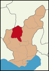 Map showing Aladağ District in Adana Province | |
 Aladağ Location in Turkey | |
| Coordinates: 37°32′47″N 35°23′55″E / 37.54639°N 35.39861°E | |
| Country | Turkey |
| Province | Adana |
| Government | |
| • Mayor | Mustafa Akgedik (AKP) |
| Area | 1,340 km2 (520 sq mi) |
| Elevation | 921 m (3,022 ft) |
| Population (2022)[1] | 15,897 |
| • Density | 12/km2 (31/sq mi) |
| Time zone | TRT (UTC+3) |
| Postal code | 01720 |
| Area code | 0322 |
| Website | www |
Aladağ, formerly Karsantı, is a municipality and district of Adana Province, Turkey.[2] Its area is 1,340 km2,[3] and its population is 15,897 (2022).[1] It is about 100 km north of the city of Adana, up in the mountains. This is an undeveloped area, the people live from agriculture and forestry. People from the Çukurova retreat up here in the summer to escape the heat on the plain, although it's too high up for a day trip.
The Aladağlar mountains are an eastern extension of the Taurus Mountains. These high mountains are a popular area for climbing, usually accessed from the north through the town of Niğde. The town of Aladağ sits on their southern side, accessed by road up from Adana. Approximately 9 kilometers from the settlement of Karsantı / Aladağ is Meydan Kalesi, an impressive castle and chapel constructed during the period of the Armenian Kingdom of Cilicia. This fortresses has three baileys, an array of rounded towers, and a ceremonial hall whose decorations included carved capitals.[4] The fortification was surveyed in 1974 and 1979.[5]
YouTube Encyclopedic
-
1/3Views:2 5674 5986 248
-
ADANA-ALADAĞ TV PROGRAMI-NİSAN 2015
-
Kapuzbaşı Şelaleleri Waterfalls - Aladag Adana
-
Eğner Köyü - Aladağ- ADANA - TÜRKİYE
Transcription
Composition
There are 31 neighbourhoods in Aladağ District:[6]
References
- ^ a b "Address-based population registration system (ADNKS) results dated 31 December 2022, Favorite Reports" (XLS). TÜİK. Retrieved 12 July 2023.
- ^ Büyükşehir İlçe Belediyesi, Turkey Civil Administration Departments Inventory. Retrieved 12 July 2023.
- ^ "İl ve İlçe Yüz ölçümleri". General Directorate of Mapping. Retrieved 12 July 2023.
- ^ Edwards, Robert W. (1987). The Fortifications of Armenian Cilicia: Dumbarton Oaks Studies XXIII. Washington, D.C.: Dumbarton Oaks, Trustees for Harvard University. pp. 189–194. ISBN 0-88402-163-7.
- ^ Photographs and a plan of Meydan / Aladağ Kalesi
- ^ Mahalle, Turkey Civil Administration Departments Inventory. Retrieved 12 July 2023.
External links
- (in Turkish) District governor's official website
- (in Turkish) District municipality's official website
- Miscellaneous images of Aladağ
Aladağ, Adana in Adana Province of Turkey | |||||||||||||||||||||||||||
|---|---|---|---|---|---|---|---|---|---|---|---|---|---|---|---|---|---|---|---|---|---|---|---|---|---|---|---|
| Districts |   | ||||||||||||||||||||||||||
|
Metropolitan municipalities are bolded. | |||||||||||||||||||||||||||
This geographical article about a location in Adana Province, Turkey is a stub. You can help Wikipedia by expanding it. |