
al-Mughayyir | |
|---|---|
| Arabic transcription(s) | |
| • Arabic | المغيّر |
 al-Mughayyir | |
 al-Mughayyir Location of al-Mughayyir within Palestine | |
| Coordinates: 32°01′10″N 35°20′46″E / 32.01944°N 35.34611°E | |
| Palestine grid | 183/158 |
| State | State of Palestine |
| Governorate | Ramallah and al-Bireh |
| Government | |
| • Type | Village council |
| Population (2017)[1] | |
| • Total | 2,872 |
| Name meaning | The caves[2] |
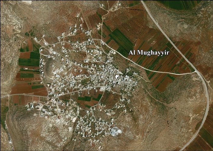
al-Mughayyir (Arabic: المغيّر) is a Palestinian village in the Ramallah and al-Bireh Governorate, located 27 kilometers Northeast of Ramallah and 34 kilometers Southeast of Nablus, in the northern West Bank. According to the Palestinian Central Bureau of Statistics (PCBS), the village had a population of 2,872 inhabitants in 2017.[1]
Location
Al Mughayyir is located 18.6 kilometres (12 mi) north-east of Ramallah. It is bordered by Fasayil to the east, Turmus'ayya and Khirbet Abu Falah to the west, Duma and Jalud to the north, and Kafr Malik and al-Auja to the south.[3]
History
The PEF's Survey of Western Palestine (SWP) found here "ancient cisterns, and a rock-cut winepress near the village, which is well built of hewn stone."[4]
Potsherds from the Byzantine/Umayyad and Mamluk eras have been found here.[5]
Ottoman period
In 1517, the village was included in the Ottoman empire with the rest of Palestine, appearing in the 1596 tax-records as Mugayyir, located in the Nahiya of Jabal Qubal, part of Nablus Sanjak. The population was 7 households and 9 bachelors, all Muslim. They paid taxes on wheat, barley, summer crops, olive trees, occasional revenues, goats and beehives; a total of 4500 akçe.[6] Potsherds from the early Ottoman era have also been found here.[5]
In 1838 Edward Robinson noted al-Mughayyir was located in the Beitawy district, east of Nablus,[7] while in 1852, he described the village as being of "considerable size", and built of hewn stones. He further noted that the villagers were "quite civil, and readily answered all our inquiries."[8]
In 1870 Victor Guérin found it largely deserted by its inhabitants, for lack of drinking water. He especially noticed a small mosque, which had a number of regularly cut stones that seem ancient. There were also several caves, dug in rock, that also seemed old.[9] In 1882, the PEF's Survey of Western Palestine described it as "a small village of stone houses, on a ridge, with olives to the west, and beautiful corn-land in the Merj Sia. There is also corn-land on the north."[10]
British Mandate period
In the 1922 census of Palestine conducted in 1922 by the British Mandate authorities, al-Mughayyir had a population of 179, all Muslims,[11] increasing in the 1931 census when the village had a population of 204, still all Muslims, in a total of 41 houses.[12]
In the 1945 statistics, al-Mughayyir (including Khirbat Jib'it) had a population of 290 Muslims,[13] with total of 33,903 dunams of land, according to an official land and population survey.[14] Of this, 361 dunams were plantations and irrigable land, 6,908 used for cereals,[15] while 34 dunams were built-up (urban) land.[16]
Jordanian period
In the wake of the 1948 Arab–Israeli War, and after the 1949 Armistice Agreements, al-Mughayyir came under Jordanian rule.
The Jordanian census of 1961 found 365 inhabitants.[17]
1967-present
Since the Six-Day War in 1967, al-Mughayyir has been under Israeli occupation.
Impact of the Israeli occupation
According to the Oslo II Interim Agreement signed between the Palestinian Liberation Organization (PLO) and Israel in September 1995, al-Mughayyir village was divided into politically classified area 'B' and area 'C'. Approximately 1,934 dunums (5.9% of the village's total area) is classified as area B, where the Palestinian National Authority has control over civil matters and Israel continues to have overriding responsibility for security. Area B constitutes most of all inhabited Palestinian areas, including municipalities, villages and some refugee camps. The majority of the village's population resides in Area B which forms a small part compared to the village's total area. The rest of the village's area, constituting 31,121 dunums (94.1% of the total area) is classified as Area C, where Israel retains full control over security and administration related to the territory. In Area C, Palestinian building and land management is prohibited except through consent or authorization by the Israeli Civil Administration. Most of the lands lying within Area C are agricultural areas and open spaces, in addition to Israeli military camps.[18] According to villagers 75% of its land has been confiscated for Israeli settlements, military bases and natural reserves.[19]
On 12 November 2014, the al-Mughayyir mosque was damaged extensively when it was torched, reportedly by settlers in what was believed to be a price-tag attack.[20] According to Haaretz journalist Chaim Levinson, it was the tenth such mosque subject to arson in Israel and the West Bank since June 2011, and no investigation has ever led to an indictment.[21]
On the November 25, 2018, another price tag attack left eight cars damaged, and graffiti stating "Death to the Arabs", "Revenge", and "Price Tag".[22]
2019 death
On January 26, 2019, 38-year-old local resident Hamdy Taleb Na'asan was shot in the back and killed, and 10 other Palestinians were wounded. The Israeli army believed that Israeli settlers from Adei Ad had fired the shots. The head of the al-Mughayyir village council told Haaretz: "We're not entirely sure who was hit by military fire and who was hit by settler (shooting), but there undoubtedly are some hit by the settlers, who had attacked the houses unprovoked."[23] The Israeli settlers gave conflicting stories about how the disturbances started, but ended by telling that according to an Israeli hiker, claiming to stabbed, the altercation began some 200 meters from Adei Ad when three Arabs ambushed him and attempted to drag him to the village. The Israeli army expressed "doubts" that the teen was stabbed, while the Aa-Mughayyir villagers flatly denied it, and Yesh Din also said the settlers initiated the disturbances.[24][25][26]
2020 death
In December 2020, Ali Ayman Abu Aliya, 13 years old, was killed during protests at the village against "the construction of a Jewish settlement in the occupied West Bank". Abu Aliya was hit in the abdomen during clashes with the Israeli army, where the army had used 0.22-inch calibre Ruger ammunition. The UN Middle East envoy, Nickolay Mladenov, described the killing as "shocking and unacceptable".[27] According to the DCIP; "Ali did not present any threat to Israeli forces at the time he was killed".[28][29]
Tree wars
According to The Economist in October 2009, 200 olive trees belonging to villagers from al-Mughayyir were felled by settlers from the illegal settler outpost at Adei Ad, near Shvut Rachel.[30] October is harvest time for olives and is often a time of "tension between Palestinian farmers and Jewish settlers", and The Economist tied the destruction of trees to the settlers' 'price tag policy.[30]
"Many of the settlers pursue a “price-tag policy”, deliberately instigating violence and mayhem so that the Israeli military and political establishment is loth to take action, such as evacuating the 100-plus “illegal” settlements, for fear of further violence. As international criticism has mounted, even in America, several Israeli governments have promised to dismantle the outposts but so far little has been done. The settlers are generally against the peace process, because it could mean their expulsion. So whenever there are signs of negotiation, they increase their attacks—among other things, on olive trees. They want to show who controls the land."
— The Economist
In her 2009 publication entitled Tree Flags, legal scholar and ethnographer Irus Braverman describes how Palestinians identify olive groves as an emblem or symbol of their longtime, steadfast agricultural connection (tsumud) to the land.[31]: 1 [32][33]
"More than 80,000 Palestinian farmers derive a substantial portion of their annual income from olives. Harvesting the fruit, pressing the oil, selling and sharing the produce is a ritual of life."[34]
In January 2019, twenty-five 35-year-old olive trees were cut down by vandals who left vehicle tracks leading to the nearby Israeli outpost of Mevo Shiloh, but no disciplinary action was taken by Israeli authorities.[22]
Families
Principal families in the village include Na'san, Abu Aliya, al-Hajj Muhammad, Abu Na'im, and Abu Assaf.
Footnotes
- ^ a b Preliminary Results of the Population, Housing and Establishments Census, 2017 (PDF). Palestinian Central Bureau of Statistics (PCBS) (Report). State of Palestine. February 2018. pp. 64–82. Retrieved 2023-10-24.
- ^ Palmer, 1881, p. 258
- ^ Al Mughayyir Village Profile, ARIJ, p. 4
- ^ Conder and Kitchener, 1882, SWP II, p. 402
- ^ a b Finkelstein et al, 1997, pp. 750-1
- ^ Hütteroth and Abdulfattah, 1977, p. 132
- ^ Robinson and Smith, 1841, vol 3, Appendix 2, p. 128
- ^ Robinson and Smith, 1856, p. 292
- ^ Guérin, 1875, pp. 17 -18
- ^ Conder and Kitchener, 1882, SWP II, p. 387
- ^ Barron, 1923, Table IX, Sub-district of Nablus. p. 25
- ^ Mills, 1932, p. 63
- ^ Government of Palestine, Department of Statistics, 1945, p. 19
- ^ Government of Palestine, Department of Statistics. Village Statistics, April, 1945. Quoted in Hadawi, 1970, p. 60
- ^ Government of Palestine, Department of Statistics. Village Statistics, April, 1945. Quoted in Hadawi, 1970, p. 107 Archived 2013-10-05 at the Wayback Machine
- ^ Government of Palestine, Department of Statistics. Village Statistics, April, 1945. Quoted in Hadawi, 1970, p. 157 Archived 2013-10-05 at the Wayback Machine
- ^ Government of Jordan, Department of Statistics, 1964, p. 26
- ^ "ARIJ town profile" (PDF). Vprofile.arij.org. Retrieved 2013-11-14.
- ^ 'Israeli settlers torch mosque in Ramallah-area village,' Archived 2015-01-25 at the Wayback Machine Ma'an News Agency 12 November 2014
- ^ 'Protection of Civilians: 11– 17 NOVEMBER 2014,' Archived 2014-12-04 at the Wayback Machine OCHA November
- ^ Chaim Levinson, 'Ten torched mosques, zero indictments,' Haaretz 13 November 2014
- ^ a b The sadists who destroyed a decades-old Palestinian olive grove can rest easy, by Gideon Levy and Alex Levac. January 24, 2019, Haaretz
- ^ Palestinian shot dead by settler in West Bank clashes, IDF officials believe, Jack Khoury, Yotam Berger, Yaniv Kubovich, Jan. 26 2019, Haaretz
- ^ Palestinians, IDF clash in second day of violence near al-Mughayer, Tovah Lazaroff January 27, 2019, The Jerusalem Post
- ^ Palestinian killed in violent altercation with settlers over Shabbat JPost, 26 January 2018
- ^ No settlers questioned after Palestinian shot dead in the West Bank, Yotam Berger, Jack Khoury, January 28, 2019, Haaretz
- ^ Israel to investigate shooting of Palestinian child, Oliver Holmes Mon 7 Dec 2020, The Guardian
- ^ Israeli forces shoot, kill 16-year-old Palestinian boy, May, 5, 2021, dci-palestine.org
- ^ Israeli forces shoot and kill 15-year-old Palestinian boy, Dec 04, 2020, dci-palestine.org
- ^ a b "Not much of an olive branch", The Economist, 15 October 2009, retrieved 22 January 2014
- ^ Planted Flags: Trees, Land, and Law in Israel/Palestine (PDF). Yale Agrarian Studies Colloquium. Buffalo, New York. 28 September 2010. p. 54. Archived from the original (PDF) on 2013-01-31. Retrieved 23 January 2015.
- ^ Staton, Bethan (21 January 2015). "The deep roots of the Palestine-Israel conflict: Palestinians have tended olive groves for decades, but Israelis are staking a claim by planting their own trees". Israel/Palestine. Retrieved 23 January 2015.
- ^ Braverman, Irus (2009). Planted Flags: Trees, Land, and Law in Israel/Palestine. Cambridge University Press. ISBN 978-0521760027.
- ^ Booth, William (22 October 2014). "In West Bank, Palestinians gird for settler attacks on olive trees". Kfar Yassug, West Bank. Retrieved 23 January 2015.
Bibliography
- Barron, J.B., ed. (1923). Palestine: Report and General Abstracts of the Census of 1922. Government of Palestine.
- Conder, C.R.; Kitchener, H.H. (1882). The Survey of Western Palestine: Memoirs of the Topography, Orography, Hydrography, and Archaeology. Vol. 2. London: Committee of the Palestine Exploration Fund.
- Finkelstein, I.; Lederman, Zvi, eds. (1997). Highlands of many cultures. Tel Aviv: Institute of Archaeology of Tel Aviv University Publications Section. ISBN 965-440-007-3.
- Government of Jordan, Department of Statistics (1964). First Census of Population and Housing. Volume I: Final Tables; General Characteristics of the Population (PDF).
- Government of Palestine, Department of Statistics (1945). Village Statistics, April, 1945.
- Guérin, V. (1875). Description Géographique Historique et Archéologique de la Palestine (in French). Vol. 2: Samarie, pt. 2. Paris: L'Imprimerie Nationale.
- Hadawi, S. (1970). Village Statistics of 1945: A Classification of Land and Area ownership in Palestine. Palestine Liberation Organization Research Center. Archived from the original on 2018-12-08. Retrieved 2013-12-08.
- Hütteroth, Wolf-Dieter; Abdulfattah, Kamal (1977). Historical Geography of Palestine, Transjordan and Southern Syria in the Late 16th Century. Erlanger Geographische Arbeiten, Sonderband 5. Erlangen, Germany: Vorstand der Fränkischen Geographischen Gesellschaft. ISBN 3-920405-41-2.
- Mills, E., ed. (1932). Census of Palestine 1931. Population of Villages, Towns and Administrative Areas. Jerusalem: Government of Palestine.
- Palmer, E.H. (1881). The Survey of Western Palestine: Arabic and English Name Lists Collected During the Survey by Lieutenants Conder and Kitchener, R. E. Transliterated and Explained by E.H. Palmer. Committee of the Palestine Exploration Fund.
- Robinson, E.; Smith, E. (1841). Biblical Researches in Palestine, Mount Sinai and Arabia Petraea: A Journal of Travels in the year 1838. Vol. 3. Boston: Crocker & Brewster.
- Robinson, E.; Smith, E. (1856). Later Biblical Researches in Palestine and adjacent regions: A Journal of Travels in the year 1852. London: John Murray.
External links
- Welcome To al-Mughaiyir
- PIWP database profile
- Survey of Western Palestine, Map 15: IAA, Wikimedia commons
- Al-Mughayyir Fact Sheet, Applied Research Institute–Jerusalem, ARIJ
- Al Mughayyir Village Profile, ARIJ,
- Al-Mughayyir aerial photo, ARIJ
- Locality Development Priorities and Needs in Al Mughayyir Village, ARIJ

| International | |
|---|---|
| National | |