
Agotime-Ziope District | |
|---|---|
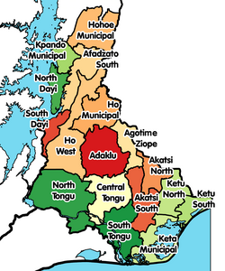 Districts of Volta Region | |
 Agotime-Ziope District Location of Agotime-Ziope District within Volta | |
| Coordinates: 6°32′59.28″N 0°41′42.36″E / 6.5498000°N 0.6951000°E | |
| Country | |
| Region | |
| Capital | Agortime-Kpetoe |
| Government | |
| • District Executive | Hon. Michael Kobla Adzaho |
| Area | |
| • Total | 3,200 km2 (1,200 sq mi) |
| Population (2021[1]) | |
| • Total | 39,553 |
| • Density | 12/km2 (32/sq mi) |
| Time zone | UTC+0 (GMT) |
| ISO 3166 code | GH-TV-AZ |
Agotime-Ziope District is one of the eighteen districts in Volta Region, Ghana.[2] Originally it was formerly part of the then-larger Adaklu-Anyigbe District on 13 August 2004, until the western part of the district was split off to create Adaklu District on 28 June 2012; thus the remaining part has been renamed as Agotime-Ziope District (under the then-president John Atta Mills government).[3] The district assembly is located in the central part of Volta Region and has Agortime-Kpetoe as its capital town.
References
- ^ Ghana: Administrative Division
- ^ "Srekpe and surrounding communities share water sources with animals - MyJoyOnline.com". www.myjoyonline.com. Retrieved 2021-05-20.
- ^ "Volta » Adaklu (New)". GhanaDistricts.com. Archived from the original on 6 March 2013. Retrieved 12 May 2013.
| Municipal (6) |
|  |
|---|---|---|
| Ordinary (12) |
| |
6°32′59.28″N 0°41′42.36″E / 6.5498000°N 0.6951000°E