
Adamsburg, Pennsylvania | |
|---|---|
 Main Street | |
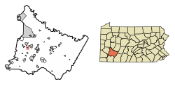 Location of Adamsburg in Westmoreland County, Pennsylvania. | |
 Adamsburg, Pennsylvania | |
| Coordinates: 40°18′38″N 79°39′16″W / 40.31056°N 79.65444°W | |
| Country | United States |
| State | Pennsylvania |
| County | Westmoreland |
| Incorporated | March 5, 1841 |
| Government | |
| • Type | Borough Council |
| Area | |
| • Total | 0.28 sq mi (0.73 km2) |
| • Land | 0.28 sq mi (0.73 km2) |
| • Water | 0.00 sq mi (0.00 km2) |
| Elevation | 1,155 ft (352 m) |
| Population | |
| • Total | 142 |
| • Density | 507.14/sq mi (195.52/km2) |
| Time zone | UTC-5 (Eastern (EST)) |
| • Summer (DST) | UTC-4 (EDT) |
| Zip code | 15611 |
| FIPS code | 42-00332 |
| Website | www |
Adamsburg is a borough that is located in Westmoreland County, Pennsylvania, United States. The population was 144 at the time of the 2020 federal census.[3]
History
This Pennsylvania borough was named for John Quincy Adams, sixth President of the United States.[4]
Geography
Adamsburg is located at 40°18′38″N 79°39′16″W / 40.31056°N 79.65444°W (40.310501, -79.654423).[5]
According to the United States Census Bureau, the borough has a total area of 0.3 square miles (0.8 km2), all land.
Demographics
| Census | Pop. | Note | %± |
|---|---|---|---|
| 1850 | 253 | — | |
| 1860 | 236 | −6.7% | |
| 1870 | 229 | −3.0% | |
| 1880 | 199 | −13.1% | |
| 1890 | 223 | 12.1% | |
| 1900 | 184 | −17.5% | |
| 1910 | 300 | 63.0% | |
| 1920 | 246 | −18.0% | |
| 1930 | 227 | −7.7% | |
| 1940 | 210 | −7.5% | |
| 1950 | 238 | 13.3% | |
| 1960 | 191 | −19.7% | |
| 1970 | 251 | 31.4% | |
| 1980 | 236 | −6.0% | |
| 1990 | 257 | 8.9% | |
| 2000 | 221 | −14.0% | |
| 2010 | 172 | −22.2% | |
| 2020 | 144 | −16.3% | |
| 2021 (est.) | 143 | [3] | −0.7% |
| Sources:[6][7][8][2] | |||
At the time of the 2000 census, there were 221 people, eighty-four households, and sixty-three families living in the borough.
The population density was 838.3 inhabitants per square mile (323.7/km2). There were 92 housing units at an average density of 349.0 per square mile (134.7/km2).
The racial makeup of the borough was 100.00% White. Hispanic or Latino of any race were 0.90%.[9]
Of the eighty-four households documented in the borough, 33.3% had children who were under the age of eighteen living with them, 54.8% were married couples living together, 15.5% had a female householder with no husband present, and 25.0% were non-families. 21.4% of households were one-person households and 7.1% were one-person households with residents who were sixty-five years of age or older.
The average household size was 2.40 and the average family size was 2.75.
The age distribution was 18.6% of residents who were under the age of eighteen, 11.3% who were aged eighteen to twenty-four, 25.3% who were aged twenty-five to forty-four, 24.0% who were aged forty-five to sixty-four, and 20.8% who were aged sixty-five or older. The median age was forty-two years.
For every one hundred females, there were 90.5 males. For every one hundred females who were aged eighteen or older, there were 81.8 males.
The median household income was $38,750 and the median family income was $45,000. Males had a median income of $29,000 versus $18,958 for females.
The per capita income for the borough was $17,172.
Approximately 9.4% of families and 10.4% of the population were living below the poverty line, including 9.1% of those who were under the age of eighteen; however, none of those who were documented as being sixty-five or older were living in poverty.
Surrounding communities
Notable person
- Bill Bishop, baseball player
References
- ^ "ArcGIS REST Services Directory". United States Census Bureau. Retrieved October 12, 2022.
- ^ a b "Census Population API". United States Census Bureau. Retrieved Oct 12, 2022.
- ^ a b "City and Town Population Totals: 2020—2021". Census.gov. US Census Bureau. Retrieved July 26, 2022.
- ^ Linder, Lee (Jul 9, 1970). "Happenings in Pennsylvania". Observer-Reporter. pp. B3. Retrieved 23 May 2015.
- ^ "US Gazetteer files: 2010, 2000, and 1990". United States Census Bureau. 2011-02-12. Retrieved 2011-04-23.
- ^ "Census of Population and Housing: Decennial Censuses". United States Census Bureau. Retrieved 2012-03-04.
- ^ "Incorporated Places and Minor Civil Divisions Datasets: Subcounty Resident Population Estimates: April 1, 2010 to July 1, 2012". Population Estimates. U.S. Census Bureau. Archived from the original on 11 June 2013. Retrieved 11 December 2013.
- ^ "Census of Population and Housing". Census.gov. Retrieved June 4, 2016.
- ^ "U.S. Census website". United States Census Bureau. Retrieved 2008-01-31.
External links

| Counties |
|  | ||||||||
|---|---|---|---|---|---|---|---|---|---|---|
| Major cities | ||||||||||
| Cities and towns 15k–50k (in 2010) | ||||||||||
| Airports | ||||||||||
| Topics | ||||||||||