
Acht | |
|---|---|
Location of Acht (Eifel) within Mayen-Koblenz district 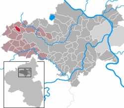 | |
 Acht  Acht | |
| Coordinates: 50°22′13″N 7°4′21″E / 50.37028°N 7.07250°E | |
| Country | Germany |
| State | Rhineland-Palatinate |
| District | Mayen-Koblenz |
| Municipal assoc. | Vordereifel |
| Government | |
| • Mayor (2019–24) | Helmut Thelen[1] |
| Area | |
| • Total | 3.79 km2 (1.46 sq mi) |
| Elevation | 430 m (1,410 ft) |
| Population (2021-12-31)[2] | |
| • Total | 84 |
| • Density | 22/km2 (57/sq mi) |
| Time zone | UTC+01:00 (CET) |
| • Summer (DST) | UTC+02:00 (CEST) |
| Postal codes | 56729 |
| Dialling codes | 02656 |
| Vehicle registration | MYK |
| Website | www.acht-eifel.de |
Acht (German pronunciation: [axt] ⓘ) is a municipality in the district of Mayen-Koblenz in Rhineland-Palatinate, western Germany. It is situated on the eastern edge of the Eifel.
Acht is part of Verbandsgemeinde of Vordereifel, whose head office is located in Mayen.
YouTube Encyclopedic
-
1/3Views:7188351 218
-
deutschland - die hohe acht in der eifel
-
Eifel Hohe Acht und Miri KO
-
10.01.2015 - Winterspaß an der Hohen Acht
Transcription
Geography
Acht is located in the Achterbach valley the Eifel mountain range and is part of the landscape protection area "Rhei-Ahr-Eifel".
History
The earliest known written records of the municipality are from 1110 CE.
On 10 June 2003 a category F3 tornado[3][4] swept through the area, leading to the injuries of two individuals. Multiple buildings were also so badly damaged during the incident that they had to be completely demolished.[5]
Religion
88% of the inhabitants identify as catholic, 4% Protestant.[6] Catholics belong to the parish of St. Quirinus with its residence being located in the neighbouring community of Langenfeld (Eifel), Diocese of Trier.
The few Protestants are part of the Protestant congregation of Adenau and attend the Erlöserkirche situated there.
Politics
Municipal Council
The Gemeinderat consists of six councillors voted in following the local elections on 26 May 2019 via a majority voting system. The honorary local mayor was also chosen to be chairman.[7]
Mayor
Helmut Thelen was elected as the local mayor of Acht on 25 July 2019. In the direct elections on the 26 May 2019 he achieved 70.49% of the vote and was elected for a five-year term. His predecessors were Werner Hilger and Nanny Vellguth.[1][8]
Coat of arms
Original Blazon: „Unter goldenem Schildhaupt, darin ein blauer Wellenbalken, in Rot zwei goldene Hirschstangen, ein goldenes Kreuz einschließend.“

English Translation: "Beneath a golden shield-head, in it a blue waved bar, in red two golden stag antlers, enclosing a golden cross."
The stag antlers are a reference to the former patron of the local chapel, St. Hubertus.
The authority has used the crest since 1996.
Attractions
Located centrally is the Catholic Chapel of St. Hubertus, a hall-type construction built in 1826. The wayside cross has earlier origins, in 1631.
There are two other wayside crosses: one from 1724 located in Hasenbaum, on the corner of Kirchenweg, and another from 1597 located to the north-east by the K 11 road.
Literature
- Heimatbuch der Gemeinde Acht. Acht 2002
- Nachrichtliches Verzeichnis der Kulturdenkmäler Kreis Mayen-Koblen (PDF; 5.8 MB). Mainz 2017
References
- ^ a b "Direktwahlen 2019, Landkreis Mayen-Koblenz". Landeswahlleiter Rheinland-Pfalz. Retrieved 5 August 2021.
- ^ "Bevölkerungsstand 2021, Kreise, Gemeinden, Verbandsgemeinden" (in German). Statistisches Landesamt Rheinland-Pfalz. 2022.
- ^ Sävert, Thomas. "Tornadoliste Deutschland - 2003". Tornadoliste Deutschland. Archived from the original on 2014-07-02. Retrieved 12 April 2020.
- ^ "Tornadolage 10.06.03 : Met.Strukturen (2,5 mB)". wetterzentrale. 21 June 2003. Retrieved 12 April 2020.
- ^ von der Hagen, Hans (12 April 2020). "Die Furcht vor dem T-Wort". Süddeutsche Zeitung. Retrieved 12 April 2020.
- ^ "Bevölkerung nach Geschlecht und Religion". zensus2011. Archived from the original on 5 June 2013. Retrieved 12 April 2020.
- ^ "Acht". Landeswahlleiter Rheinland-Pfalz. Retrieved 12 April 2020.
- ^ Hilger, Werner (15 July 2019). "Mitteilungsblatt Vordereifel - Heimat- u. Bürgerzeitung der VG Vordereifel". Linus Wittich. Retrieved 12 April 2020.
External links
- Homepage of the Ortsgemeinde Acht
- Ortsgemeinde Acht on the page of the Verbandsgemeinde Vordereifel
- The St.Hubertus Chapel in Acht
- Literature on Acht in the Rheinland-Pfälzischen Landesbibliographie

| Authority control databases: National |
|---|