
Abadeh Airport فرودگاه آباده Farūdegāh-e Ābāde | |||||||||||
|---|---|---|---|---|---|---|---|---|---|---|---|
| Summary | |||||||||||
| Airport type | Public | ||||||||||
| Serves | Abadeh, Fars Province, Iran | ||||||||||
| Elevation AMSL | 6,394 ft / 1,949 m | ||||||||||
| Coordinates | 31°1′54″N 52°47′23″E / 31.03167°N 52.78972°E | ||||||||||
| Map | |||||||||||
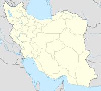 OISA Location of airport in Iran | |||||||||||
| Runways | |||||||||||
| |||||||||||
Abadeh Airport (Persian: فرودگاه آباده – Farūdegāh-e Ābāde) (ICAO: OISA) is an airport near Abadeh, Fars Province, Iran. The airport is intended to serve the greater Northern Fars Region, including the counties of Abadeh, Eghlid, and Abarkuh.
The Airport is located in Bidak Rural District, Abadeh County, Fars, accessible via a gravel road branching off at Amirabad, from Abadeh-Shiraz Expressway.
References
- ^ "ICAO code OISA Flughäfen Abadeh Airport Iran". Archived from the original on 2016-02-16. Retrieved 2016-02-10.
| Capital | |||||||||||||||||||||
|---|---|---|---|---|---|---|---|---|---|---|---|---|---|---|---|---|---|---|---|---|---|
| Districts |
| ||||||||||||||||||||
This article about an Iranian airport is a stub. You can help Wikipedia by expanding it. |
This Jahrom County location article is a stub. You can help Wikipedia by expanding it. |
This Abadeh County location article is a stub. You can help Wikipedia by expanding it. |