
A Lưới district
Huyện A Lưới | |
|---|---|
| Country | |
| Region | North Central Coast |
| Province | Thừa Thiên Huế |
| Capital | A Lưới |
| Area | |
| • Total | 475 sq mi (1,229 km2) |
| Population (2003) | |
| • Total | 38,616 |
| • Density | 81/sq mi (31/km2) |
| Time zone | UTC+7 (UTC + 7) |
A Lưới is a rural district of Thừa Thiên Huế province in the North Central Coast region of Vietnam. It is located west in the highly mountainous area of A Shau Valley bordering Laos. The population includes many Bru, Hoa and Tà Ôi people. As of 2003 the district had a population of 38,616.[1] The district covers an area of 1,229 km² and its capital lies at A Lưới, a former French airfield, later used by the Americans in Operation Delaware and then by the North Vietnamese for courier flights.[1]
Many areas and mountains in the A Luoi region became historically significant in the mid-late 1960s during the Vietnam War, such the Battle of A Shau, the 5th Special Forces' A Lưới Camp that was overrun in 1966, as well as the 4,878-foot Dong Re Lao Mountain best known as the "Signal Hill" that was seized by 1st Cavalry Division LRRP / Rangers in 1968 during Operation Delaware.[2] Also, A Bia Mountain, known as the Hamburger Hill that was seized by members of the 101st Airborne Division.[3]
A Lưới is connected to the former French colonial capital and coastal city, Huế, one of the main historical cities in central Vietnam by National Road 49, a road notorious for poor safety because of the mountainous terrain and poor road surface. The A Lưới district has one town and 21 communes. The central town has gas stations, and a few guest-houses for travelers.
Communes
- Hồng Thủy
- Hồng Vân
- Hồng Trung
- Hồng Kim
- Hồng Nam
- Hồng Hạ
- Hồng Bắc
- Bắc Sơn
- Hồng Quảng
- A Ngo
- Sơn Thủy
- Phú Vinh
- Nhâm
- Hồng Thái
- Hồng Thượng
- Hương Phong
- Hương Lâm
- Đông Sơn
- A Đớt
- A Roàng
- Hương Nguyên
Climate
| Climate data for A Lưới | |||||||||||||
|---|---|---|---|---|---|---|---|---|---|---|---|---|---|
| Month | Jan | Feb | Mar | Apr | May | Jun | Jul | Aug | Sep | Oct | Nov | Dec | Year |
| Record high °C (°F) | 31.5 (88.7) |
34.6 (94.3) |
36.2 (97.2) |
38.1 (100.6) |
36.6 (97.9) |
35.9 (96.6) |
34.9 (94.8) |
35.2 (95.4) |
33.9 (93.0) |
32.4 (90.3) |
31.2 (88.2) |
30.7 (87.3) |
38.1 (100.6) |
| Mean daily maximum °C (°F) | 21.4 (70.5) |
23.4 (74.1) |
26.6 (79.9) |
29.4 (84.9) |
30.4 (86.7) |
30.7 (87.3) |
30.5 (86.9) |
29.8 (85.6) |
28.3 (82.9) |
25.6 (78.1) |
22.9 (73.2) |
20.7 (69.3) |
26.6 (79.9) |
| Daily mean °C (°F) | 17.3 (63.1) |
18.5 (65.3) |
20.7 (69.3) |
22.9 (73.2) |
24.2 (75.6) |
25.4 (77.7) |
25.0 (77.0) |
24.7 (76.5) |
23.3 (73.9) |
21.7 (71.1) |
19.9 (67.8) |
17.7 (63.9) |
21.8 (71.2) |
| Mean daily minimum °C (°F) | 14.8 (58.6) |
15.5 (59.9) |
17.2 (63.0) |
19.3 (66.7) |
20.8 (69.4) |
22.1 (71.8) |
21.7 (71.1) |
21.6 (70.9) |
20.5 (68.9) |
19.4 (66.9) |
18.0 (64.4) |
15.7 (60.3) |
18.9 (66.0) |
| Record low °C (°F) | 5.9 (42.6) |
8.2 (46.8) |
8.1 (46.6) |
12.5 (54.5) |
12.6 (54.7) |
16.6 (61.9) |
17.4 (63.3) |
17.4 (63.3) |
14.7 (58.5) |
10.8 (51.4) |
9.2 (48.6) |
5.4 (41.7) |
5.4 (41.7) |
| Average precipitation mm (inches) | 80.1 (3.15) |
48.9 (1.93) |
70.4 (2.77) |
160.3 (6.31) |
253.7 (9.99) |
188.0 (7.40) |
167.0 (6.57) |
228.4 (8.99) |
438.6 (17.27) |
856.7 (33.73) |
757.4 (29.82) |
317.7 (12.51) |
3,606 (141.97) |
| Average rainy days | 16.6 | 13.4 | 14.5 | 16.5 | 20.1 | 14.4 | 14.9 | 17.4 | 20.5 | 23.2 | 22.5 | 21.9 | 216.3 |
| Average relative humidity (%) | 91.6 | 91.0 | 89.3 | 87.8 | 86.1 | 80.6 | 80.3 | 82.2 | 89.1 | 91.6 | 92.9 | 92.9 | 88.0 |
| Mean monthly sunshine hours | 112.6 | 127.8 | 160.2 | 170.1 | 185.4 | 179.9 | 185.0 | 165.9 | 130.7 | 111.5 | 82.8 | 72.4 | 1,679.9 |
| Source: Vietnam Institute for Building Science and Technology[4] | |||||||||||||
Get to A Luoi
There are many ways to get to A Luoi such as local bus at South Bus Station but it's a really local bus and not good one. Beside you can also rent a private car to explore A Luoi for one or two days. You can connect to Hue city or Hoian Town as well. It could be the best chance to take photos of the minority people on a Vietnam Photo tour.
See also
References
- ^ a b "Districts of Vietnam". Statoids. Archived from the original on 31 March 2009. Retrieved 20 March 2009.
- ^ Robert C.Ankony, Lurps: A Ranger's Diary of Tet, Khe Sanh, A Shau, and Quang Tri, revised ed., Rowman & Littlefield Publishing Group, Landham, MD, (2009).
- ^ Robert C. Ankony, "No Peace in the Valley," Vietnam magazine, Oct. 2008, 26-31.
- ^ "Vietnam Institute for Building Science and Technology" (PDF). Retrieved 16 August 2023.
16°10′01″N 107°19′59″E / 16.167°N 107.333°E
| Thanh Hóa province | 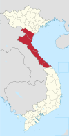 | |
|---|---|---|
| Nghệ An province | ||
| Hà Tĩnh province | ||
| Quảng Bình province |
| |
| Quảng Trị province | ||
| Thừa Thiên Huế province |
| |
※ denotes provincial seat. | ||