
 2019 Davao del Sur earthquake (Mindanao)  2019 Davao del Sur earthquake (Philippines) | |
| UTC time | 2019-12-15 06:11:51 |
|---|---|
| ISC event | 616987910 |
| USGS-ANSS | ComCat |
| Local date | December 15, 2019 |
| Local time | 14:11 PST |
| Magnitude | 6.8 Mww 6.9 Ms |
| Depth | 18.0 km (11.2 mi) |
| Epicenter | 6°41′49″N 125°10′26″E / 6.697°N 125.174°E |
| Fault | Tangbulan Fault |
| Type | Strike-slip |
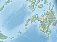
| Areas affected | Mindanao, Philippines |
| Max. intensity | VII (Very strong) PEIS – VII (Destructive) |
| Landslides | Yes |
| Casualties | 13 dead, 1 missing, 210 injured[1] |
At 14:11 PST (06:11 UTC) on December 15, 2019, the province of Davao del Sur on the island of Mindanao in the Philippines was struck by an earthquake measuring 6.8 Mww. It had a maximum perceived intensity of VII (Very strong) on the Modified Mercalli Intensity Scale.[2] At least 13 people were killed and another 210 injured.[1]
YouTube Encyclopedic
-
1/2Views:9 5291 145
-
Philippines Magnitude 6.6 earthquake in Digos City Mindanao 2019
-
Magnitude 6.9 Earthquake in Davao del Sur December 15, 2019
Transcription
Tectonic setting
Mindanao lies across the complex convergent boundary between the Sunda Plate and the Philippine Sea Plate.[3] Part of the oblique convergence between these plates is taken up by subduction along the Cotabato Trench. The strike-slip component of the convergence is accommodated partly by the Philippine Fault System and partly by the Cotabato Fault System, a network of mainly NW-SE trending sinistral (left-lateral) strike-slip faults that form the boundary between the Cotabato Arc and the Central Mindanao Volcanic Belt.[4] In the area of the December 2019 earthquake, the individual faults include the NW-SE trending Makilala–Malungon Fault, Tangbulan Fault and the Central Digos Fault.[5]
Earthquake

The earthquake was recorded as 6.8 Mw by ANSS and 6.9 Ms by PHIVOLCS. The maximum felt intensity was assigned as VII MMI on the ANSS ShakeMap and VII PEIS in the PHIVOLCS summary for this event.[6] The focal mechanism indicates strike-slip faulting with either sinistral movement on a NW-SE trending fault or dextral movement on a SW-NE trending fault, but the distribution of the aftershocks are consistent with the sinistral fault plane.[2] The earthquake may be the result of movement on the Tangbulan Fault, according to PHIVOLCS.[7][8][9]
There were a series of large aftershocks, including nine of M ≥ 5.0 in the first 48 hours after the mainshock,[10] with the largest being an mb 5.7 event about an hour afterwards, which had a maximum felt intensity of VII (MMI).[11]
This event followed on from a series of earthquakes that struck Mindanao during October that year. The sequence of three M>6 events affected that area to the northwest of the December earthquake. The December 15 event is likely to be related to the earlier sequence,[2] possibly by the effects of stress transfer.[12][8][9]
Analysis using InSAR data
The sequence of four earthquakes has examined using Interferometric synthetic aperture radar (InSAR). One study used information only from Sentinel-1,[9] while the other also included information from ALOS-2.[8] InSAR interferograms can be used to detect and quantify ground deformation associated with an earthquake, allowing the location and orientation of fault ruptures, epicenters and slip distributions to be estimated. For the second and third earthquakes in the sequence no information was recorded by either of the satellites between the events, so these events had to be analysed together. Sufficient data were available to allow the other two earthquakes to be analysed separately.[9][8]
The two studies give similar results, confirming that the first and last major earthquakes in the sequence were caused by rupture along NW-SE trending left-lateral strike-slip faults, while the second and third resulted from rupture along SW-NE trending right-lateral strike-slip faults nearly orthogonal to the other two. One of the studies matched the four interpreted ruptures to known faults. The first event is interpreted to have ruptured the M'lang Fault, the second the Makilala Fault, the third the Balabag Fault and the last the Makilala-Malungon Fault. The observed sequence of earthquakes rupturing orthogonal strike-slip fault sets has been compared to the 2019 Ridgecrest earthquake sequence.[9]
Damage and casualties
The greatest damage from the earthquake was in the area around the epicenter, in the towns of Matanao, Magsaysay, Hagonoy and Padada. Significant damage was reported in 207 out of 232 barangays in Davao del Sur, five in Sarangani, three in Sultan Kudarat and North Cotabato, respectively.[13] This earthquake added to the damage that much of the affected area suffered during the Cotabato earthquakes in October. At least one road was declared impassable in the Matanao area, a hospital was destroyed in Hagonoy and there was significant damage to a police station and fire station in Padada.[7] A total of 5,973 houses were destroyed in Davao del Sur, with 31,832 suffering some damage and a further 32 in North Cotabato.[13] Three hundred and ninety-seven schools and 62 health facilities were damaged in Davao del Sur, Sarangani and North Cotabato.[14]
A six-year-old child was crushed by a wall in the barangay of Asinan in Matanao. Three others were killed and several others were trapped in Padada when a supermarket collapsed. As of December 23, at least 13 people had been killed, one remained missing and a total of 210 people were reported injured in the quake.[1]
Aftermath
As of December 29, 40,424 people from 10,505 families were reported to be sheltering in a total of 102 evacuation centers after the earthquake, with a further 100,427 people (23,321 families) being assisted by friends and family.[13]
See also
- List of earthquakes in 2019
- List of earthquakes in the Philippines
- 2019 Cotabato earthquakes
- July 2019 Cotabato earthquake
References
- ^ a b c National Disaster Risk Reduction and Management Council (December 22, 2019). "NDRRMC Update: SitRep No. 12 regarding Magnitude 6.9 Earthquake in Matanao, Davao del Sur (Region XI)" (PDF). Retrieved December 22, 2019.
- ^ a b c ANSS. "Davao del Sur 2019: M 6.8 - 6km S of Magsaysay, Philippines". Comprehensive Catalog. U.S. Geological Survey. Retrieved December 15, 2019.
- ^ "Philippine Sea Plate". Tectonics of Asia. Retrieved 2019-12-15.
- ^ United States Geological Survey (2010). "Porphyry Copper Assessment of East and Southeast Asia— Philippines, Taiwan (Republic of China), Republic of Korea (South Korea), and Japan" (PDF). Global Mineral Resource Assessment. p. 3032.
- ^ Philippine Institute of Volcanology and Seismology (November 8, 2019). "Update on the October 2019 Cotabato Fault System Earthquake Series". Retrieved December 15, 2019.
- ^ a b Philippines Institute of Volcanology and Seismology (December 15, 2019). "Earthquake Information No. 4". Retrieved December 18, 2021.
- ^ a b United Nations Office for the Coordination of Humanitarian Affairs (December 16, 2019). "Philippines: 6.9-magnitude earthquake, Davao del Sur Flash Update No. 1" (PDF). Retrieved December 16, 2019.
- ^ a b c d Zhao, L.; Qu, C.; Shan, X.; Zhao, D.; Gong, W.; Li, Y. (2021). "Coseismic deformation and multi-fault slip model of the 2019 Mindanao earthquake sequence derived from Sentinel-1 and ALOS-2 data". Tectonophysics. 799. doi:10.1016/j.tecto.2020.228707.
- ^ a b c d e Li, B.; Li, Y.; Jiang, W.; Su, Z.; Shen, W. (2020). "Conjugate ruptures and seismotectonic implications of the 2019 Mindanao earthquake sequence inferred from Sentinel-1 InSAR data". International Journal of Applied Earth Observation and Geoinformation. 90. doi:10.1016/j.jag.2020.102127.
- ^ ANSS (December 18, 2019). "Search results". Retrieved December 18, 2019.
- ^ ANSS. "Davao del Sur 2019a: M5.7 - 9km SSW of Sulop, Philippines". Comprehensive Catalog. U.S. Geological Survey. Retrieved December 16, 2019.
- ^ Sabillo, K. (December 16, 2019). "Explainer: How Davao del Sur's M6.9 quake may be linked to October temblors". ABS CBN News. Retrieved December 19, 2019.
- ^ a b c Disaster Response Operations Monitoring and Information Center (December 29, 2019). "DSWD DROMIC Report #11 on the Ms 6.9 Earthquake Incident in Matanao, Davao del Sur" (PDF). Retrieved December 31, 2019.
- ^ National Disaster Risk Reduction and Management Council (December 23, 2019). "NDRRMC Update: SitRep No. 13 regarding Magnitude 6.9 Earthquake in Matanao, Davao del Sur (Region XI)" (PDF). Retrieved December 23, 2019.[permanent dead link]
External links
- The International Seismological Centre has a bibliography and/or authoritative data for this event.
- ReliefWeb's main page for this event.