
   | |
| UTC time | 2017-02-10 14:03:43 |
|---|---|
| ISC event | 610208008 |
| USGS-ANSS | ComCat |
| Local date | February 10, 2017 |
| Local time | 22:03:42 PST |
| Magnitude | 6.7 Ms 6.5 Mw |
| Depth | 15.0 km (9.3 mi) |
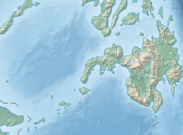
| Epicenter | 9°54′25″N 125°27′07″E / 9.907°N 125.452°E |
| Areas affected |
|
| Total damage | ₱665 million+ |
| Max. intensity | |
| Tsunami | No |
| Aftershocks | at least 140 |
| Casualties | 8 dead 200 injured[1] |
The 2017 Surigao earthquake occurred on February 10, 2017, at 10:03 PM (PST), with a surface wave magnitude of 6.7 off the coast of Surigao del Norte in the Philippines. According to the PHIVOLCS Earthquake Intensity Scale the earthquake was an Intensity VII (Destructive) earthquake at maximum.[2][3] In the past Surigao province has been hit by a magnitude 7.2 tremor in both 1879[4] and 1893.[citation needed]
YouTube Encyclopedic
-
1/1Views:8 501
-
EARTHQUAKE NEAR SURIGAO CITY
Transcription
Tectonic setting
The Philippine Islands is situated in a highly deformed zone between the convergent boundary of the Eurasian and Philippine Sea plates, known as the Philippine Mobile Belt. Along the east, the Philippine Sea Plate subducts beneath the islands at the Philippine and East Luzon trenches. Major subduction complexes are also active along the southwestern coast of Mindanao at the Cotabato Trench and along the Manila Trench of the west Luzon.
Running through the Philippine Mobile Belt is the Philippine Fault System; a large 1,200-kilometer-long, highly segmented strike-slip fault system. This left-lateral system of faults runs from southeastern Mindanao to northwestern Luzon. Strike-slip deformation within the Philippine Mobile Belt occurs as a result of oblique subduction of the Philippine Sea Plate, where the Philippine Fault System accommodates much of it.[5] The fault is seismically active and ruptures periodically in large earthquakes. Among the largest are the 1990 Luzon and 1973 Ragay Gulf earthquakes.
Earthquake
The earthquake was recorded by the Philippine Institute of Volcanology and Seismology (PHIVOLCS) on February 10, 2017, at 10:03:42 PM (UTC+8). According to PHIVOLCS, the epicenter of the 6.7 magnitude-earthquake was at 9°48′N 125°21′E / 9.80°N 125.35°E or 16 kilometers, north west of Surigao City. The earthquake was tectonic of origin. The most affected area in terms of the PHIVOLCS Earthquake Intensity Scale (PEIS) was Surigao City, which experienced an intensity of Intensity VII (Destructive).[6] The United States Geological Survey reported the earthquake as having a moment magnitude of 6.5.[2]
| Mainshock (Magnitude 6.7)[6] | |
|---|---|
| Intensity
Scale |
Location |
| VII | Surigao City; San Francisco, Surigao Del Norte |
| VI | Pintuyan, Southern Leyte. |
| V | Mandaue City, San Ricardo, Limasawa and San Francisco, Southern Leyte. |
| IV | Hinunangan, Southern Leyte and Butuan City. |
| III | Hibok-hibok, Camiguin, Tolosa and Tacloban, Leyte, Bislig City, Gingoog City, Misamis Oriental. |
| II | Cagayan de Oro City, Talocogon, Agusan del Sur, Dumaguete City, Cebu City |
| Aftershock (Magnitude 5.9)[7] | |
|---|---|
| Intensity
Scale |
Location |
| VI | Surigao City |
| IV | Limasawa and San Ricardo, Southern Leyte |
| III | San Juan and San Francisco, Southern Leyte |
| II | Gen. Luna, Surigao Del Norte; Ormoc City |
| Instrumental Intensities | |
| VII | Surigao City |
| I | Borongan, Eastern Samar; Palo, Leyte |
The Pacific Tsunami Warning Center issued no tsunami warning following the earthquake.[8]
Impact
According to the Department of Social Welfare and Development, at least 300 houses in Surigao del Norte were damaged following the earthquake.[9] Seven bridges collapsed, isolating San Francisco. At least eleven towns were affected, experiencing power outages.[4]
The Provincial Disaster Risk Reduction and Management Council of Surigao del Norte projected that the cost of damage to property and infrastructure was at least ₱665 million.[10]
Eight people died in the earthquake while 202 others were injured.[11]
Aftermath
On February 11, 2017, the government of Surigao City declared a state of calamity.[12]
The Civil Aviation Authority of the Philippines suspended all flights to and from Surigao City due to the damage sustained by the city's airport runway.[12]
The Philippine national government, through presidential spokesman Ernesto Abella, assured the public that the government would provide aid.[13]
By the afternoon of February 14, 2017, there were at least 140 reported aftershocks recorded by PHIVOLCS.[10]
On March 5, 2017, an aftershock of magnitude 5.9 occurred; one person died of a heart attack, and 29 others were injured, while some walls collapsed.[14]
See also
References
- ^ "Aftershocks rattle survivors after Philippine quake kills 8". Fox News. February 12, 2017. Retrieved February 12, 2017.
- ^ a b "M 6.5 - 11 km N of Mabua, Philippines". earthquake.usgs.gov. Archived from the original on January 23, 2022. Retrieved January 23, 2022.
- ^ "Magnitude 6.7 quake hits Surigao City". SunStar. February 12, 2017. Archived from the original on February 11, 2017. Retrieved February 11, 2017.
- ^ a b "6 dead, dozens hurt from magnitude-6.7 Surigao quake". CNN Philippines. February 11, 2017. Archived from the original on September 10, 2020. Retrieved February 11, 2017.
- ^ Mario A. Aurelio (2000). "Shear partitioning in the Philippines: Constraints from Philippine Fault and global positioning system data". Island Arc. Wiley Online Library. 9 (4): 584–597. Bibcode:2000IsArc...9..584A. doi:10.1111/j.1440-1738.2000.00304.x. S2CID 129633652.
- ^ a b "PHILVOLCS - Earthquake Information No.4 (10 Feb 2017 - 10:03:42 PM)". Philippine Institute of Volcanology and Seismology. February 11, 2017. Archived from the original on February 13, 2017. Retrieved February 12, 2017.
- ^ TV Patrol: Surigao City niyanig ng magnitude 5.9 na lindol; 1 patay, 35 sugatan. (In Tagalog) ABS CBN News March 6, 2017
- ^ "Magnitude 6.7 quake hits Surigao City". SunStar Cebu. February 10, 2017. Archived from the original on February 12, 2017. Retrieved February 12, 2017.
- ^ Gamil, Jaymee (February 11, 2017). "DSWD: More than 300 houses damaged due to Surigao earthquake". Philippine Daily Inquirer. Retrieved February 11, 2017.
- ^ a b "Surigao quake survivors refuse to go home". Philippine Daily Inquirer. February 15, 2017. Retrieved February 21, 2017.
- ^ "Surigao quake death toll climbs to 8". Philippine Star. February 14, 2017. Retrieved May 20, 2023.
- ^ a b "State of calamity declared in quake-hit Surigao". ABS-CBN News. February 11, 2017. Retrieved February 11, 2017.
- ^ "Gov't assures aid for victims of the Surigao earthquake". Philippine Daily Inquirer. Agence France-Presse. February 11, 2017. Retrieved February 11, 2017.
- ^ Samhati Bhattacharjya (March 5, 2017). "Philippine: Earthquake-stricken city Surigao experiences aftershock of 5.9-magnitude". International Business Times. Retrieved March 5, 2017.
External links
- The International Seismological Centre has a bibliography and/or authoritative data for this event.