
  | |
| UTC time | 2003-09-27 11:33:25 |
|---|---|
| ISC event | 7136530 |
| USGS-ANSS | ComCat |
| Local date | September 27, 2003 |
| Local time | 18:33 |
| Magnitude | 7.3 Mw[1] |
| Depth | 12.3 km (8 mi) [1] |
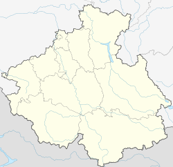
| Epicenter | 49°59′N 87°47′E / 49.99°N 87.79°E [1] |
| Type | Oblique-slip[2] |
| Total damage | $10.6–33 million [3][4] |
| Max. intensity | X (Extreme)[3] |
| Landslides | Yes [4] |
| Casualties | 3 dead, 5 injured [3] |
The 2003 Altai earthquake, or 2003 Chuya earthquake, occurred on September 27 at 18:33:26 local time with a moment magnitude of 7.3 and a maximum Mercalli intensity of X (Extreme). The epicenter of this oblique-slip shock was in Altai Republic, Russia near the borders of Mongolia, China, and Kazakhstan. Three deaths and five injuries were reported and the total damage was listed as $10.6–33 million.
YouTube Encyclopedic
-
1/3Views:1 05943853 478
-
ЧУЙСКОЕ ЗЕМЛЕТРЯСЕНИЕ 2003 ГОДА в Республике Алтай | Третье Самое Крупное Землетрясение в России
-
Бельтирский Оползень. Чуйское землетрясение с высоты птичьего полета. Алтай #Тыдтуярык
-
Алтайская принцесса - кем она была и как выглядела? Невероятные факты прошлой жизни алтайской мумии
Transcription
Earthquake
This earthquake had components of right-lateral strike-slip and reverse movement in a segmented fault zone which had not been previously recognized.[5]
Damage
Between 99 and 300 houses destroyed, along with 1,942 other buildings affected. It was the strongest earthquake in this region since an estimated magnitude 7.7 earthquake on December 20, 1761.[3][4]
Ground effects
Landslides affected the Kosh-Agachsky and Ust’-Ulagan Districts.[4]
See also
References
- ^ a b c ISC (2016), ISC-GEM Global Instrumental Earthquake Catalogue (1900–2012), Version 3.0, International Seismological Centre
- ^ USGS (September 4, 2009), PAGER-CAT Earthquake Catalog, Version 2008_06.1, United States Geological Survey, archived from the original on 2020-03-13
- ^ a b c d National Geophysical Data Center / World Data Service (NGDC/WDS) (1972), Significant Earthquake Database (Data Set), National Geophysical Data Center, NOAA, doi:10.7289/V5TD9V7K
- ^ a b c d USGS, M7.3 Respublika Altay, Russian Federation Earthquake of 27 September 2003 (PDF), United States Geological Survey
- ^ Nissen, E.; Emmerson, B.; Funning, G. J.; Mistrukov, A.; Parsons, B.; Robinson, D. P.; Rogozhin, E.; Wright, T. J. (2007), "Combining InSAR and seismology to study the 2003 Siberian Altai earthquakes—dextral strike-slip and anticlockwise rotations in the northern India–Eurasia collision zone" (PDF), Geophysical Journal International, Wiley, 169 (1): 216–232, Bibcode:2007GeoJI.169..216N, doi:10.1111/j.1365-246X.2006.03286.x
External links
- The International Seismological Centre has a bibliography and/or authoritative data for this event.