
  Kabul | |
| UTC time | 1956-06-09 23:13:55 |
|---|---|
| ISC event | 888345 |
| USGS-ANSS | ComCat |
| Local date | 10 June 1956 |
| Local time | 03:43 |
| Magnitude | 7.3 Mw[1] |
| Depth | 25 km (16 mi)[1] |
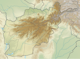
| Epicenter | 35°09′18″N 67°36′25″E / 35.155°N 67.607°E |
| Type | Oblique-slip[2] |
| Areas affected | Afghanistan |
| Max. intensity | VIII (Severe)–IX (Violent)[2] |
| Casualties | Deaths Reported: 570[3]–900[4] Afghan Embassy reported: 300[5] Injured Reported: 2000[6]–2500[3] Afghan Embassy reported: 200[5] |
The 1956 Afghanistan earthquake occurred in the early morning of 10 June 1956, causing considerable damage and casualties in the area of Kabul, Bamyan and the Hindu Kush mountain range.[7] It had a magnitude of 7.3 on the surface-wave magnitude scale. The total number of deaths were between 300[5] and as high as 900.[4] According to Radio Afghanistan it was the heaviest registered earthquake ever in Afghanistan.[7]
Earthquake
It had an magnitude of 7.3 on the surface-wave magnitude scale at a depth of 25 km (16 mi).[8] A foreshock was recorded one day prior to the mainshock. The foreshock occurred in Sayghan District, Kahmard District and Bamyan.[9] Five aftershocks followed the mainshock within the next two days. The location of these events delineated a 50 km (31 mi) rupture length trending northeast. The northeast trend was also consistent with the meizoseismal area where the Mercalli intensity was VIII–IX (Severe–Violent). Rupture occurred north of the Herat Fault; a 1,100 km (680 mi) long strike-slip fault trending east-west; no major earthquakes have been associated with the fault in the instrumental period.[2] Many aftershocks followed a week after the mainshock.[10][7][9]
Damage
The most affected areas were Kabul, Bamyan and the Hindu Kush mountain range.[11][7] In the affected areas all communication method and infrastructure was destroyed.[9] In the Kabul area, thousands of houses collapsed,[10] including some government buildings.[12] Villages were destroyed by landslides and rockslides;[9] hundreds of houses were washed away by floods in the Kunar Valley.[4][6] The earthquake caused the landscape to change.[10][7] The large rocks fell into the river valley, altering the course of the river.[9] Due to the damaged infrastructure, traffic was blocked in many affected areas.[13]
Casualties
In initial reports no number of victims could be given, as information was limited because all communication was destroyed in the affected area. Ten people were killed due to a bridge that collapsed.[14] As of 14 June, four days after the first earthquake, according to Radio Afghanistan at least hundred people were killed, 600 were missing and thousands were injured.[7] The next day the number of deaths were reported between 60 and 70.[12] 17 June, a week after the earthquake Radio Afghanistan reported around 270 deaths.[15][16] The next day 2500 new victims were announced, of whom 300 deaths.[13] In one of the affected areas 140 people were killed and 900 injured due to heavy floods. In another part of the valley there were 160 people killed and 1000 injured.[4][6] The total number of deaths reported by media was as high as 570[3] to 900.[4] The Afghan Embassy reported a total number of deaths of 300.[5] While the total number of injured people were reported to be 2000[6]–2500,[3] the Afghan embassy reported 200.[5]
Response
Relief work was carried out by Hilal Ahmar. Coordination was done by officials of the Ministries of health and public works.[9] Afghanistan received international aid. The Netherlands Red Cross sent, with transport help of KLM, aid to the victims.[12][17] Pakistan offered doctors and medication.[4]
See also
References
- ^ a b ISC (2022), ISC-GEM Global Instrumental Earthquake Catalogue (1904–2018), Version 9.1, International Seismological Centre, retrieved 7 October 2023
- ^ a b c Quittmeyer, R. C.; Jacob, K. H. (1979), "Historical and modern seismicity of Pakistan, Afghanistan, northwestern India, and southeastern Iran", Bulletin of the Seismological Society of America, 69 (3): 773–823, retrieved 7 October 2023
- ^ a b c d "Reddingsploeg vindt nog 2500 slachtoffers" [Rescue team finds 2500 more victims]. De Tijd (in Dutch). 19 June 1956. Retrieved 7 October 2023.
- ^ a b c d e f "In Afghanistan reeds 900 doden". Java-bode (in Dutch). 21 June 1956. Retrieved 7 October 2023.
- ^ a b c d e "Aardbeving eist 300 mensenlevens". Provinciale Drentsche en Asser Courant (in Dutch). 23 June 1956. Retrieved 7 October 2023.
- ^ a b c d "Aardbeving Afghanistan erger dan gedacht". De nieuwsgier (in Dutch). 21 June 1956. Retrieved 7 October 2023.
- ^ a b c d e f "Landschap in Afghanistan veranderd. Honderden doden bij aardbeving". De Volkskrant (in Dutch). 15 June 1956. Retrieved 7 October 2023.
- ^ "M 7.3 – central Afghanistan". United States Geological Survey. Retrieved 11 January 2017.
- ^ a b c d e f "Nog steeds aardschokken in Afghanistan". De Twentsche Courant Tubantia (in Dutch). 18 June 1956. Retrieved 7 October 2023.
- ^ a b c "Honderden doden door aardbeving in Afghanistan". Algemeen Handelsblad (in Dutch). 14 June 1956. Retrieved 7 October 2023.
- ^ "Zwarw aardbeving in Afghanistan" [Severe earthquake in Afghanistan]. Java-bode (in Dutch). Agence France-Presse. 12 June 1956. Retrieved 7 October 2023.
- ^ a b c "70 doden door aardbeving in Afghanistan". Provinciale Drentsche en Asser Courant (in Dutch). 16 June 1956. Retrieved 7 October 2023.
- ^ a b "Nieuwe slachtoffers van aardbevingen in Afghanistan". Leeuwarder Courant (in Dutch). 19 June 1956. Retrieved 7 October 2023.
- ^ "Afghaanse koning ziek". Algemeen Handelsblad (in Dutch). 14 June 1956. Retrieved 7 October 2023.
- ^ "Tot nu toe 270 doden bij aardbeving in Afghanistan". De Tijd (in Dutch). 18 June 1956. Retrieved 7 October 2023.
- ^ "De aardbeving in Afghanistan". Het Nieuwsblad van het Zuiden (in Dutch). 18 June 1956. Retrieved 7 October 2023.
- ^ "Nederlandsche Roode Kruis helpt Afghanistan". Nieuwsblad van het Noorden (in Dutch). 16 June 1956. Retrieved 7 October 2023.
Further reading
- Heuckroth, L. E., Karim, R. A., USAID/Afghanistan., & Kabul Research Foundation. (1970). Earthquake History, Seismicity, and Tectonics of the Regions of Afghanistan. Kabul: Kabul University, Faculty of Engineering, Seismological Center.