
Ōtoyo
大豊町 | |
|---|---|
 Otoyo town hall | |
 Flag  Seal | |
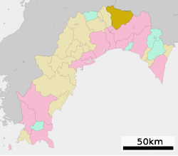
 Location of Ōtoyo in Kōchi Prefecture | |
 | |
 Ōtoyo Location in Japan | |
| Coordinates: 33°46′N 133°40′E / 33.767°N 133.667°E | |
| Country | Japan |
| Region | Shikoku |
| Prefecture | Kōchi |
| District | Nagaoka |
| Area | |
| • Total | 315.06 km2 (121.65 sq mi) |
| Population (August 1, 2022) | |
| • Total | 3,277 |
| • Density | 10/km2 (27/sq mi) |
| Time zone | UTC+09:00 (JST) |
| City hall address | 231 Takasu, Ōtoyo-chō, Nagaoka-gun, Kōchi-ken 789-0392 |
| Website | Official website |
| Symbols | |
| Bird | Varied tit |
| Flower | Adonis |
| Tree | Japanese cedar |


Ōtoyo (大豊町, Ōtoyo-chō) is a town located in Nagaoka District, Kōchi Prefecture, Japan. As of 1 August 2022[update], the town had an estimated population of 3277 in 1968 households and a population density of 10 persons per km².[1] The total area of the town is 315.06 square kilometres (121.65 sq mi).
Geography
Ōtoyo is located in northeastern Kōchi Prefecture on the island of Shikoku. The Yoshino River and the Ananai River flow through the town, which extends 32 kilometers from east to west and 28 kilometers from north to south. The elevation is between 200 and 1,400 meters.
Neighbouring municipalities
Kōchi Prefecture
Tokushima Prefecture
Ehime Prefecture
Climate
Ōtoyo has a humid subtropical climate (Köppen Cfa) characterized by warm summers and cool winters with light snowfall. There are significant differences in the weather depending on the topography. but since Ōtoyo is a heavy rainfall area in general, the annual rainfall reaches 3,000mm in some places, causing landslides and other disasters. The annual average temperature is 14 °C.
Demographics
Per Japanese census data,[2] the population of Ōtoyo has declined precipitously since the 1960s. It is the only municipality in Shikoku where over 50% of the population is aged over 65, therefore qualifying as a genkai shūraku.
| Year | Pop. | ±% |
|---|---|---|
| 1960 | 18,231 | — |
| 1970 | 12,440 | −31.8% |
| 1980 | 9,411 | −24.3% |
| 1990 | 7,760 | −17.5% |
| 2000 | 6,378 | −17.8% |
| 2010 | 4,719 | −26.0% |
| 2020 | 3,252 | −31.1% |
History
As with all of Kōchi Prefecture, the area of Ōtoyo was part of ancient Tosa Province. During the Edo period, the area was part of the holdings of Tosa Domain ruled by the Yamauchi clan from their seat at Kōchi Castle. The area was organized into villages within Nagaoka District with the creation of the modern municipalities system on April 1, 1889, including Higashitoyonaga, Nishitoyonaga, Ōsugi, and Tentsubo. These four villages merged on March 31, 1955 to form the village of Ōtoyo. The name Ōtoyo came from taking the Ō (大) in Ōsugi (大杉, Ōsugi) and the Toyo (豊, Toyo) in Toyonaga (豊永, Toyonaga). Following this, a section of Ōtoyo was absorbed into the town of Tosayamada (present day Kami, Kōchi). On the April 1, 1972, the village became a town.
Government
Ōtoyo has a mayor-council form of government with a directly elected mayor and a unicameral town council of ten members. Ōtoyo, together with the other municipalities of Nagaoka and Tosa Districts, contributes one member to the Kōchi Prefectural Assembly. In terms of national politics, the town is part of Kōchi 1st district of the lower house of the Diet of Japan.
Economy
The economy of Ōtoyo is centered on forestry.
Education
Ōtoyo has one public combined elementary/middle school operated by the town government. The town does not have a high school.
Transportation
Railway
- Tosa-Iwahara - Toyonaga - Ōtaguchi -Tosa-Ananai - Ōsugi - Tosa-Kitagawa - Kakumodani
Highways
Local attractions
Historic Sites
- Buraku-ji, Buddhist temple whose Yakushi-do is a National Important Cultural Property
- former Tajikawa Domain Bansho Shoin, National Important Cultural Property
Events
- Osugi Summer Festival
- Otaguchi Summer Festival
- Wild Game Festival
- Fukujuso Flower Festival
Tourist sites
- Sugi no Osugi (杉の大スギ, Sugi-no-Osugi), Special Natural Monument
- Yutoristo Park (ゆとりすとパークおおとよ, Yutorisuto Koen)
- Whitewater Rafting - Due to its prime location on the Yoshino River and its proximity to Oboke Gorge Otoyo is the location of a large number of rafting companies.
-
 Ryūjin shrine and Ryūō falls
 -
 Mount Kajigamori
Local products
Notable people from Ōtoyo
- Tomoyuki Yamashita, general in the Imperial Japanese Army
- Masaya Tokuhiro,manga artist
References
- ^ "Ōtoyo town official statistics" (in Japanese). Japan.
- ^ Ōtoyo population statistics
External links
![]() Media related to Ōtoyo, Kōchi at Wikimedia Commons
Media related to Ōtoyo, Kōchi at Wikimedia Commons
- Official website (in Japanese)
| International | |
|---|---|
| National | |
| Core city | ||
|---|---|---|
| Cities | ||
| Districts | ||
This Kōchi Prefecture location article is a stub. You can help Wikipedia by expanding it. |