Čekovnik | |
|---|---|
| Coordinates: 45°58′48.26″N 13°59′17.38″E / 45.9800722°N 13.9881611°E | |
| Country | |
| Traditional region | Inner Carniola |
| Statistical region | Gorizia |
| Municipality | Idrija |
| Area | |
| • Total | 17.5 km2 (6.8 sq mi) |
| Elevation | 647.4 m (2,124.0 ft) |
| Population (2002) | |
| • Total | 144 |
| [1] | |
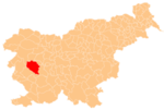
Čekovnik (pronounced [tʃɛˈkoːu̯nik]; German: Tschekaunik[2]) is a dispersed settlement in the hills west of Idrija in the traditional Inner Carniola region of Slovenia.[2]
Geography
In addition to Čekovnik itself, the settlement includes (or included) the hamlets of Dolenja Bela (German: Unterbela), Gantarica, Gorenja Bela (German: Oberbela), Hleviše, Kočevše, Krekovše, Lom, Nikova, Osojni Vrh, Pri Trevnu, Riže, Tupa, and Vrh Bele.[2][3][4]
History
Farming in Čekovnik is meager, and traditionally the economy of the village was based on forestry. Until 1926, timber was harvested and floated down Šihtenpoh Creek. A wooden dam was built on the creek in 1868 to aid log driving. During the Second World War, the local farmers were involved in support activities for the Partisans' Pavla field hospital. A memorial to this activity was unveiled in 1966.[3]
Notable people
Notable people that were born or lived in Čekovnik include:
- Janez Gruden (1887–1930), translator and journalist[3]
References
- ^ Statistical Office of the Republic of Slovenia
- ^ a b c Leksikon občin kraljestev in dežel zastopanih v državnem zboru, vol. 6: Kranjsko. Vienna: C. Kr. Dvorna in Državna Tiskarna. 1906. pp. 124–125.
- ^ a b c Savnik, Roman (1968). Krajevni leksikon Slovenije, vol. 1. Ljubljana: Državna založba Slovenije. p. 68.
- ^ Spezialkarte der Österreichisch-ungarischen Monarchie 1:75.000 Adelsberg (Map). Vienna: K. u. k. Militärgeographisches Institut. 1910. Retrieved January 7, 2019.


