
Ödemiş | |
|---|---|
District and municipality | |
 Lake Gölcük on Bozdağ Mountains | |
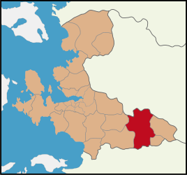 Map showing Ödemiş District in İzmir Province | |
 Ödemiş Location in Turkey  Ödemiş Ödemiş (İzmir) | |
| Coordinates: 38°13′52″N 27°58′19″E / 38.23111°N 27.97194°E | |
| Country | Turkey |
| Province | İzmir |
| Government | |
| • Mayor | Mehmet Eriş (CHP) |
| Area | 1,019 km2 (393 sq mi) |
| Elevation | 136 m (446 ft) |
| Population (2022)[1] | 132,740 |
| • Density | 130/km2 (340/sq mi) |
| Time zone | UTC+3 (TRT) |
| Postal code | 35750 |
| Area code | 0232 |
| Website | www |
Ödemiş (Turkish: [ˈœdemiʃ]) is a municipality and district of İzmir Province, Turkey.[2] Its area is 1,019 km2,[3] and its population is 132,740 (2022).[1] It is located 113 km southeast of the city of İzmir.
About 4 km north of Ödemiş town are the ruins of Hypaepa. The historical importance of the region is also reflected by the small town of Birgi, east of Ödemiş, which was the capital of the Aydınids, which has examples of Seljuq and Ottoman architecture. Birgi has been on the UNESCO World Cultural Heritage list since 1994, and points of interest here include Çakırağa Mansion, İmam-i Birgivi Medrese and Sultanşah Mausoleum. Ödemiş is famous for its potatoes, which has the best quality in Turkey, as well as its "Ödemiş Kebab". The city is the biggest potato grower of Turkey with its annual 350,000 tons of potato production.

YouTube Encyclopedic
-
1/3Views:3 0432 243547
-
Sultan Pazarı - Ödemiş / İzmir
-
Sultan Pazarı - Ödemiş / İzmir
-
Vlog - İzmir (Ödemiş)
Transcription
History
From 1867 until 1922, Ödemiş was part of the Aidin Vilayet of the Ottoman Empire.
Composition
There are 99 neighbourhoods in Ödemiş District:[4]
- 3 Eylül
- Akıncılar
- Alaşarlı
- Anafartalar
- Artıcak
- Atatürk
- Bademli
- Balabanlı
- Bayırlı
- Bengisu
- Beyezitlar
- Bıçakçı
- Birgi
- Bozcayaka
- Bozdağ
- Bucak
- Bülbüller
- Büyükavulcuk
- Çağlayan
- Çamlıca
- Çamyayla
- Çayır
- Çaylı
- Cevizalan
- Çobanlar
- Cumhuriyet
- Demircili
- Demirdere
- Derebebekler
- Dereuzunyer
- Dolaylar
- Emirli
- Emmioğlu
- Ertuğrul
- Gerçekli
- Gereli
- Gölcük
- Güney
- Günlüce
- Hacıhasan
- Hamam
- Horzum
- Hürriyet
- İlkkurşun
- İnönü
- Işık
- Karadoğan
- Karakova
- Kayaköy
- Kaymakçı
- Kazanlı
- Kemenler
- Kemer
- Kerpiçlik
- Kışla
- Kızılca
- Kızılcaavlu
- Köfündere
- Konaklı
- Köseler
- Küçükavulcuk
- Küçükören
- Küre
- Kurucuova
- Kutlubeyler
- Kuvvetli
- Mescitli
- Meşrutiyet
- Mimarsinan
- Mursallı
- Ocaklı
- Oğuzlar
- Orhangazi
- Ortaköy
- Ovacık
- Ovakent
- Pirinççi
- Sekiköy
- Seyrekli
- Şirinköy
- Suçıktı
- Süleyman Demirel
- Süleymanlar
- Tekke
- Tosunlar
- Türkmen
- Türkönü
- Üçkonak
- Umurbey
- Üzümlü
- Uzundere
- Veliler
- Yeniceköy
- Yeniköy
- Yeşilköy
- Yılanlı
- Yolüstü
- Yusufdere
- Zafer
Climate
| Climate data for Ödemiş (1991–2020) | |||||||||||||
|---|---|---|---|---|---|---|---|---|---|---|---|---|---|
| Month | Jan | Feb | Mar | Apr | May | Jun | Jul | Aug | Sep | Oct | Nov | Dec | Year |
| Mean daily maximum °C (°F) | 12.8 (55.0) |
14.2 (57.6) |
17.5 (63.5) |
22.0 (71.6) |
28.0 (82.4) |
33.2 (91.8) |
36.2 (97.2) |
36.3 (97.3) |
31.7 (89.1) |
25.9 (78.6) |
19.4 (66.9) |
14.1 (57.4) |
24.3 (75.7) |
| Daily mean °C (°F) | 7.1 (44.8) |
8.4 (47.1) |
11.0 (51.8) |
14.9 (58.8) |
20.1 (68.2) |
25.0 (77.0) |
27.6 (81.7) |
27.5 (81.5) |
22.9 (73.2) |
17.7 (63.9) |
12.1 (53.8) |
8.4 (47.1) |
16.9 (62.4) |
| Mean daily minimum °C (°F) | 2.5 (36.5) |
3.3 (37.9) |
4.9 (40.8) |
8.1 (46.6) |
12.3 (54.1) |
16.1 (61.0) |
18.3 (64.9) |
18.4 (65.1) |
14.4 (57.9) |
10.6 (51.1) |
6.1 (43.0) |
3.9 (39.0) |
9.9 (49.8) |
| Average precipitation mm (inches) | 88.49 (3.48) |
80.45 (3.17) |
64.7 (2.55) |
52.47 (2.07) |
36.71 (1.45) |
12.46 (0.49) |
4.08 (0.16) |
2.09 (0.08) |
17.69 (0.70) |
36.63 (1.44) |
75.36 (2.97) |
89.85 (3.54) |
560.98 (22.09) |
| Average precipitation days (≥ 1.0 mm) | 8.5 | 7.5 | 6.9 | 6.2 | 5 | 2.6 | 1.4 | 1.3 | 2.6 | 3.9 | 5.9 | 9 | 60.8 |
| Average relative humidity (%) | 77.4 | 74.5 | 70.5 | 67.9 | 61.7 | 52.9 | 50.9 | 52.4 | 58.7 | 68.1 | 74.1 | 78.8 | 65.4 |
| Source: NOAA[5] | |||||||||||||
Transport
See also:
- Ödemiş railway station
- Basmane-Ödemiş Regional – the railway service from Basmane Terminal in İzmir.
Notable people
- Muzafer Sherif (1906-1988), a Turkish-American social psychologist
- Çakırcalı Mehmet Efe (1872 kayaköy-Ödemiş – ö. 17 Kasım 1911 ) the legendary hero
- Gökçen Efe (1881-1919), folk hero of the Turkish War of Independence
- Şükrü Saracoğlu, 5th Prime Minister of Turkey
References
- ^ a b "Address-based population registration system (ADNKS) results dated 31 December 2022, Favorite Reports" (XLS). TÜİK. Retrieved 12 July 2023.
- ^ Büyükşehir İlçe Belediyesi, Turkey Civil Administration Departments Inventory. Retrieved 12 July 2023.
- ^ "İl ve İlçe Yüz ölçümleri". General Directorate of Mapping. Retrieved 12 July 2023.
- ^ Mahalle, Turkey Civil Administration Departments Inventory. Retrieved 12 July 2023.
- ^ "World Meteorological Organization Climate Normals for 1991-2020 — Ödemiş". National Oceanic and Atmospheric Administration. Retrieved January 15, 2024.
External links
Ödemiş in Izmir Province of Turkey | |||||||||||||||||||||||||||
|---|---|---|---|---|---|---|---|---|---|---|---|---|---|---|---|---|---|---|---|---|---|---|---|---|---|---|---|
| Districts |  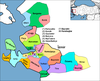 | ||||||||||||||||||||||||||
|
Metropolitan municipalities are bolded. | |||||||||||||||||||||||||||
| International | |
|---|---|
| National | |
This geographical article about a location in İzmir Province, Turkey is a stub. You can help Wikipedia by expanding it. |