
Ábrego | |
|---|---|
Municipality of Colombia | |
 | |
 Flag  Seal | |
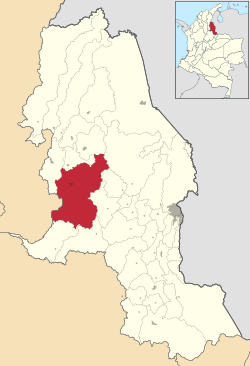 Location of Ábrego in Norte de Santander | |
 Ábrego Location of Ábrego in Colombia | |
| Coordinates: 8°00′N 73°12′W / 8.000°N 73.200°W | |
| Country | |
| Department | Norte de Santander |
| Subregion | Western |
| Founded | 12 March 1810 |
| Government | |
| • Mayor | Juan Carlos Jácome Ropero (2020-2023) |
| Area | |
| • Total | 1,582 km2 (611 sq mi) |
| Elevation | 1,398 m (4,587 ft) |
| Population (2015) | |
| • Total | 38,627 |
| • Density | 24/km2 (63/sq mi) |
| Time zone | UTC-5 (Colombia Standard Time) |
| Climate | Aw |
| Website | Official website |
Ábrego (Spanish pronunciation: [ˈaβɾeɣo]) is a Colombian municipality and town located in the department of Norte de Santander. The urban centre is situated at an altitude of 1,398 metres (4,587 ft) in the Eastern Ranges of the Colombian Andes.[1]
YouTube Encyclopedic
-
1/3Views:9 0341 2001 223
-
Ábrego. El bello valle.
-
Las Piedras Negras de Ábrego - Colombia
-
Activistas de Yanibel Ábrego del Cambio Democrático agreden a periodista de Claramente
Transcription
History
The territory was inhabited by various indigenous communities such as the Oroques, Turmeros, Seborucos and Carasicas. The first denomination of this place was Llano de los Orejones in 1530 by Ambrosio Alfínger's troops. On July 26, 1580, a wooden cross was erected in the middle of the valley of this municipality for the first Eucharist, from that moment, the place began to be called "Llanos de la Cruz". The settlement of the municipality began when the sisters Ana María and Josefa de la Encarnación Maldonado Quintero donated several lands to raise the population of the municipality, from that moment they began to build streets and squares. March 12, 1810, is the date of the founding of the municipality. On April 14, 1930, by ordinance number 32, the name of the municipality was changed to Abrego, in order to honor the nortesantadereana woman who is considered a heroine in the department, Mercedes Abrego de Reyes.[2]
Geography
About 3 hectares of the municipality are located in the Santurbán moor, which is a water source for the departments of Norte de Santander and Santander.[3] Part of the municipality is located in a valley between the Oroque and Frío rivers.[4]
Climate
| Climate data for Ábrego | |||||||||||||
|---|---|---|---|---|---|---|---|---|---|---|---|---|---|
| Month | Jan | Feb | Mar | Apr | May | Jun | Jul | Aug | Sep | Oct | Nov | Dec | Year |
| Mean daily maximum °C (°F) | 23.6 (74.5) |
24.3 (75.7) |
24.0 (75.2) |
23.2 (73.8) |
23.2 (73.8) |
23.6 (74.5) |
24.0 (75.2) |
24.2 (75.6) |
23.7 (74.7) |
22.9 (73.2) |
22.5 (72.5) |
23.0 (73.4) |
23.5 (74.3) |
| Daily mean °C (°F) | 18.5 (65.3) |
19.0 (66.2) |
19.2 (66.6) |
19.0 (66.2) |
19.0 (66.2) |
19.0 (66.2) |
19.0 (66.2) |
19.2 (66.6) |
19 (66) |
18.6 (65.5) |
18.5 (65.3) |
18.4 (65.1) |
18.9 (66.0) |
| Mean daily minimum °C (°F) | 14.6 (58.3) |
14.8 (58.6) |
15.5 (59.9) |
15.7 (60.3) |
15.7 (60.3) |
14.9 (58.8) |
14.7 (58.5) |
14.9 (58.8) |
15.2 (59.4) |
15.4 (59.7) |
15.7 (60.3) |
15 (59) |
15.2 (59.3) |
| Average rainfall mm (inches) | 77 (3.0) |
106 (4.2) |
210 (8.3) |
384 (15.1) |
507 (20.0) |
422 (16.6) |
363 (14.3) |
394 (15.5) |
402 (15.8) |
417 (16.4) |
301 (11.9) |
141 (5.6) |
3,724 (146.7) |
| Source: Climate-Data.org[5] | |||||||||||||
Economy
The municipality's economy is based on agriculture, the main crop produced in the municipality is onions.[6] Other products grown in Ábrego include tomatoes, cocoa, coffee, corn, beans, sugar cane and tobacco. In terms of commerce, in 2017, it was recorded that the municipality had 677 commercial establishments such as clothing stores, hairdressers, cafes or bakeries.[7]
Heritage Sites
Ábrego has several temples such as the Parish of Santa Bárbara, which is the first hermitage of the town completed in 1765,[8] which was founded by Juan Quintero Príncipe and Cristóbal Arévalo.[9] It became a parish on September 5, 1807, in which José María Fernández Carvajalino was the first parish priest.[9] On December 31, 2003, by decree 1144, the church is considered a property of cultural interest of departmental character.[10] Another temple in the municipality is the Divino Niño Church, which it was created by the parish priest Diógenes Sanabria, in 2009, the building was consecrated.[9]
Another tourist attraction is the Pozo del Burro (lit. 'The Donkey's Well'), in which according to a local legend, a traveler was traveling through this place with his donkey carrying gold, but he drowned in the river.[11] In addition to Piedras Negras (lit. 'Black Stones'), which are a pile of stones scattered over approximately 3 hectares. Some theories suggest that they are of volcanic origin or that they are fragments of an asteroid, there is also an oral tradition that says that they were used by the Orokes for rituals in the nular phase.[12]
Natural Reserves
One of the natural reserves of Ábrego is the Juridiscciones Moor has about 2800 hectares, specifically in the Pan de Azúcar Lagoon, where the Oroque and Frío rivers are born, which form the Algodonal river.[13] In December 2014, the Juridiscciones, Santurbán and Berlín Moors were delimited by resolution 2090, in this moor complex there are several lagoon, which are water sources for several municipalities of Norte de Santander, including Ábrego.[14]
Education
The first educational establishments in the municipality date back to 1844.[15] The municipality has a mega school called Carlo Julio Torrado Peñaranda School which was inaugurated in 2016, the mega school has three computer rooms, physics, chemistry and biology laboratories, also in 2016, the school had 1600 primary and high school students studying in it.[16] The municipality also has another school called Institución Educativa Colegio Santa Barbara, founded in 1966, in 2016, the 50th anniversary of the institution was celebrated in the main park of the municipality.[17]
References
- ^ (in Spanish) Official website Ábrego
- ^ "Archivo de la Alcaldía Municipal de Ábrego (Norte de Santander, Colombia)". Censo-Guía de Archivos de España e Iberoamérica (in Spanish). Archived from the original on 2021-11-01. Retrieved 2021-11-01.
- ^ "Informe económico de los municipios de la jurisdicción de la Cámara de Comercio de Ocaña" (PDF). Cámara de Comercio de Ocaña. 2018. Archived (PDF) from the original on 2021-11-01. Retrieved 2021-11-01.
- ^ "Cartilla Ábrego" (PDF). Corporación Nueva Sociedad de la Región Nororiental de Colombia. 2014. Archived (PDF) from the original on 2021-11-01. Retrieved 2021-11-01.
- ^ "Climate: Ábrego (Colombia)". Climate-Data.org. Retrieved 2021-11-01.
- ^ Carrascal, Blanca Liliana Velásquez; Álvarez, Melisa Daniela Verjel; Bayona-Vergel, Valentina; Hoyos-Patiño, Johann Fernando; Sayago-Velásquez, Jeimmy Estefany (2020-07-01). "Impacto económico en los agricultores por la falta de una plaza de mercado en el municipio de Abrego, Norte de Santander". Reflexiones contables (Cúcuta) (in Spanish). 3 (2): 40–50. doi:10.22463/26655543.2903. ISSN 2665-5543. S2CID 235856516.
- ^ Acevedo Martínez, Martha Janeth; Verjel Pérez, Lina Fernanda (2017). "Plan estratégico para el mejoramiento de la malla vial rural del municipio de Ábrego, Norte de Santander al año 2019" (in Spanish).
{{cite journal}}: Cite journal requires|journal=(help) - ^ Carrascal, Marilce Pacheco; Quintero, Damarys Vergel (2015-06-30). "Atractivos turísticos de Ocaña y su región". Revista Científica Profundidad Construyendo Futuro (in Spanish). 2 (2): 72–77. doi:10.22463/24221783.2254. ISSN 2422-2518. S2CID 257458200.
- ^ a b c "Iglesias y Templos en Municipio de Ábrego". Ocaña Turística. Archived from the original on 2016-06-12. Retrieved 2021-11-01.
- ^ Paéz, Luis (2007). "Guía Turística de la Región de Ocaña" (PDF). Biblioteca Mario Javier Pacheco García. Archived (PDF) from the original on 2021-11-01. Retrieved 2021-11-01.
- ^ Miustes, Alexandra (2021-03-12). "Ábrego: el bello valle de Norte de Santander". ATN TV (in Spanish). Archived from the original on 2021-03-12. Retrieved 2021-11-01.
- ^ "Las piedras negras más inexplicables del mundo están en Ábrego". La Opinión (in Spanish). Archived from the original on 2021-11-01. Retrieved 2021-11-01.
- ^ "Campesinos le dan vida al páramo Jurisdicciones". La Opinión (in Spanish). Retrieved 2022-08-27.
- ^ "Páramo Jurisdicciones – Santurbán - Berlín (PJSB) (Libro Orientador)" (PDF). Colombian Ministry of Environment and Sustainable Development (in Spanish). 2018-03-18. Retrieved 2022-08-27.
- ^ "Plan de Ordenación y Manejo de la Cuenca Hidrográfica del Río Algodonal" (PDF). Corporación Autónoma Regional de la Frontera Nororiental. 2010. Archived (PDF) from the original on 2020-07-26. Retrieved 2021-11-02.
- ^ "Ábrego: 1.600 estudiantes estrenan megacolegio". La Opinión (in Spanish). Archived from the original on 2021-11-01. Retrieved 2021-11-01.
- ^ "La i. e. colegio santa bárbara celebró, con alegría y jolgorio, sus bodas de oro". Colegio Santa Barbara (in Spanish). Archived from the original on 2021-11-02. Retrieved 2021-11-01.