
| Thunder River | |
|---|---|
 Thunder River in the Grand Canyon National Park | |
 | |
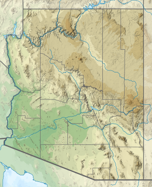 Location of the mouth of Thunder River in Arizona | |
| Location | |
| Country | United States |
| State | Arizona |
| County | Coconino |
| Physical characteristics | |
| Source | Thunder Springs[1] |
| • location | Grand Canyon (North Rim) |
| • coordinates | 36°23′45″N 112°27′28″W / 36.3958°N 112.4578°W |
| Mouth | Tapeats Creek[1] |
• location | Grand Canyon |
• coordinates | 36°23′31″N 112°27′05″W / 36.3919°N 112.4513°W |
• elevation | 2,549 feet (777 m) |
Thunder River is a river entirely within the Grand Canyon National Park. It flows southeast from its source near the North Rim of the canyon to Tapeats Creek. The 0.5-mile-long (0.80 km) river is one of the shortest in the United States,[a] and drops approximately 1,200 feet (370 m) over a series of waterfalls, making it the steepest river in the country.[3][4][b] It is also a rare instance where a river is a tributary of a creek.[3]
YouTube Encyclopedic
-
1/3Views:2 0005881 998
-
Fly Fishing Montana's Clark Fork River in October [Series Episode #20]
-
Havasu Falls Adventure
-
HD St Vrain Canyon and Creek Lyons to Allenspark Colorado in High Def
Transcription
History
While Tapeats Creek was named by the second Powell Expedition in the winter of 1871–1872, the expedition did not discover Thunder River; European-American discovery of the river did not occur until 1904.[6] The river can be reached by Thunder River Trail from the North Rim, which is only accessible from mid-May to late October. The upper portions of the trail were originally built in 1876 when rumors of placer gold led speculators to need a way into the area.[7] Further trail work was performed beginning in 1925 under the US Forest Service and continued under the National Park Service with the final sections to Tapeats Creek completed in 1939.[8]
Source
The creek is fed from Thunder Spring, the second-largest spring on the North Rim. Water emerges from the Muav Limestone in a deep cave system at approximately 54 °F (12 °C). Since the spring flows year round, the river is a perennial river.[3][9] In 1970, the spring was estimated to discharge twenty-one million US gal (79,000,000 L; 17,000,000 imp gal) of water per day into the river.[10]
Environment
Common trees near the spring include Fremont's cottonwoods and white sumac. Along the river are willows, seepwillows, other shrubs, crimson monkeyflower, maidenhair fern and other riparian fauna. Common aquatic invertebrate found in the creek include stoneflies and caddisflies.[3]
See also
- List of rivers of Arizona
- Wallkill River, in New Jersey and New York, also drains into a creek.
Notes
References
- ^ a b "Thunder River". Geographic Names Information System. United States Geological Survey, United States Department of the Interior. Retrieved April 30, 2017.
- ^ Grand Canyon National Park. Fodor's Travel. 2008. p. 79. ISBN 9781400007479. Retrieved 1 May 2017.
- ^ a b c d "Thunder Springs and Thunder River, Grand Canyon National Park, Arizona". azheritagewaters. Northern Arizona University. Retrieved 29 April 2017.
- ^ MacDonald, Douglas (Feb 2007). "Hike to the Grand Canyon's North Rim Waterfalls". Backpacker. 35 (246): 31. Retrieved 29 April 2017.
- ^ Granger, Byrd H. (1976). Grand Canyon Place Names. Tucson: The University of Arizona Press. p. 23. ISBN 9780816505388. Retrieved 30 April 2017.
- ^ Anderson, Michael F. (1998). Living at the Edge: Explorers, Exploiters, and Settlers of the Grand Canyon Region. Grand Canyon Association. ISBN 9780938216551. Retrieved 1 May 2017.
- ^ Roos, Constance (2012). The Grand Canyon: with Bryce and Zion Canyons in America's South West. Cicerone Press Limited. ISBN 9781849656580.
- ^ "Thunder River Trail". asu.edu. Archived from the original on 2017-04-04. Retrieved 30 April 2017.
- ^ Brown, Bryan T.; Carothers, Steven W.; Johnson, R. Roy (1987). Grand Canyon Birds, Historical Notes, Natural History, and Ecology. Tucson: The University of Arizona Press. ISBN 0816509301. Retrieved 30 April 2017.
- ^ Watkins, Conor; Rogers, J. David. "Landsliding And Channel Blockages In Tapeats Creek". mst.edu. Missouri University of Science and Technology. Retrieved 30 April 2017.
Colorado River system | |||||||||
|---|---|---|---|---|---|---|---|---|---|
| Jurisdictions |
|     | |||||||
| Canyons |
| ||||||||
| Natural features |
| ||||||||
| Tributaries | |||||||||
| Engineering |
| ||||||||
| Designated areas | |||||||||
| Related topics | |||||||||