| Narraguinnep Natural Area | |
|---|---|
| Location | Dolores County, Colorado |
| Nearest city | Cortez, Colorado |
| Coordinates | 37°41′24″N 108°39′49″W / 37.69000°N 108.66361°W |
| Area | 2,922 acres (11.82 km2) |
| Established | 1962 |
| Governing body | United States Forest Service |
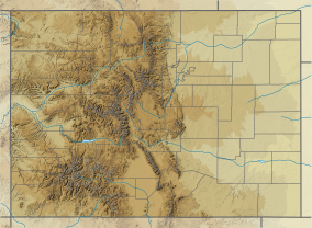
Narraguinnep Natural Area is a 2,922 acre natural area in Dolores County, Colorado that is owned by the United States Forest Service. It was designated a natural area in 1980. The Colorado Natural Area includes Narraguinnep Canyon,[2] which is located within Dolores Ranger District of the San Juan National Forest[3][4] and extends southwest into Montezuma County, Colorado.[5] It is near the Canyons of the Ancients National Monument.[6]
Oakbrush, juniper, and pinon and ponderosa pine trees grow in the natural area.[4] In 2009, a wildfire burned most of the natural area. Since then, Gambel oak thickets have returned in the main area. The old-growth pine, located in the northwest corner of the natural area, was not damaged during the fire.[2]
The Domínguez–Escalante expedition (1776) passed through the Dolores area and then east of present-day Cahone and Dove Creek during their expedition. While in the area, they took a siesta in an arroyo, which may have been in Narraguinnep Canyon.[7]
YouTube Encyclopedic
-
1/1Views:613
-
Visit Mesa Verde Country, Colorado, USA
Transcription
See also
- Fort Narraguinnep - a defensive site constructed after the Beaver Creek Massacre (June 19, 1885)
References
- ^ Protected Area Profile for Narraguinnep Research Natural Area from the World Database on Protected Areas. Retrieved May 10 2023.
- ^ a b "Colorado Natural Areas". cpw.maps.arcgis.com. p. III-54. Retrieved 2023-05-10.
- ^ "Narraguinnep Canyon, Dolores County - Feature ID 176636". Geographic Names Information System. Retrieved 2023-05-10.
- ^ a b Draft environmental impact statement for the San Juan National Forest land and resource management plan : Archuleta, San Juan, La Plata, Montezuma, Dolores, Mineral, Hinsdale, Conejos, San Miguel and Rio Grande Counties, Colorado. Durango, Colo. : The Service. 1982.
- ^ "Narraguinnep Canyon, Montezuma County - Feature ID 178781". Geographic Names Information System. Retrieved 2023-05-10.
- ^ Bitler, Teresa (2012). Backroads & byways of Indian country : drives, daytrips and weekend excursions. Woodstock, VT : Countryman Press ; New York, NY : Distributed by W. W. Norton. p. 22. ISBN 978-0-88150-957-1.
- ^ Domínguez, Francisco Atanasio (1977). The Domíniguez-Escalante journal : their expedition through Colorado, Utah, Arizona, and New Mexico in 1776. Provo, UT : Brigham Young University Press.


