
Kremmling, Colorado | |
|---|---|
 Tourist-oriented wooden structure in Kremmling | |
 Location of Kremmling in Grand County, Colorado. | |
| Coordinates: 40°03′23″N 106°22′41″W / 40.05639°N 106.37806°W | |
| Country | |
| State | |
| County[1] | Grand |
| Founded | 1881 |
| Incorporated (town) | May 14, 1904[2] |
| Government | |
| • Type | Statutory Town[1] |
| Area | |
| • Total | 1.31 sq mi (3.39 km2) |
| • Land | 1.31 sq mi (3.39 km2) |
| • Water | 0.00 sq mi (0.00 km2) |
| Elevation | 7,399 ft (2,255 m) |
| Population | |
| • Total | 1,509 |
| • Density | 1,200/sq mi (450/km2) |
| Time zone | UTC-7 (Mountain (MST)) |
| • Summer (DST) | UTC-6 (MDT) |
| ZIP code[6] | 80459 |
| Area code | 970 |
| FIPS code | 08-41560 |
| GNIS feature ID | 2412848[4] |
| Website | Town of Kremmling |
The Town of Kremmling is a Statutory Town in Grand County, Colorado, United States. The town population was 1,509 at the 2020 United States Census.[5] The town sits along the upper Colorado River in the lower arid section of Middle Park between Byers Canyon and Gore Canyon. The town was founded in 1881 during the Colorado Silver Boom days, but the lack of mineral resources in the nearby mountains made the town grow very slowly in the early days.
YouTube Encyclopedic
-
1/5Views:865924 2015514191 040
-
🇺🇸[4K60] Kremmling, Colorado! 🚘 Drive with me!
-
Private Sprawling Marvel in Kremmling, Colorado | Sotheby's International Realty
-
The beautiful fall drive from Steamboat Springs to Kremmling, Colorado on US 40, in 4K
-
True Hidden Gem Restaurant In Kremmling CO - The Kitchen Table | LifeProjX
-
Trough Road: The Whole Road, 24.7 Miles Kremmling to State Bridge: Colorado Overland
Transcription
History
The settlement started with only a general store, run by a man named Rudolph "Kare" Kremmling, built on the north side of Muddy Creek. In 1881, two brothers, Aaron and John Kinsey, made part of their ranch into a town and called it Kinsey City. Kare moved his store across the river to the new site and soon people were calling this place Kremmling. The original post office was called Kinsey City and ran from 1881 to 1885, with Kare Kremmling the first postmaster. The name Kremmling was not officially recognized until 1895. After the Moffat railroad—the Denver, Northwestern & Pacific Railway—arrived in July 1906, Kremmling became the county's central shipping point. It was incorporated May 14, 1904. In the 20th century, ranching became the main industry in the valley in the vicinity of the town. In 1906, Kasper Schuler built the first brick building in town. The Schuler bottling works occupied the first floor, while the Schuler House, a boarding house run by Miss Kienholz, occupied the second. In 1933, the building became the Hotel Eastin.
Kremmling was featured in W. Eugene Smith's photographic essay "Country Doctor" in the September 20, 1948, issue of LIFE.[7]
Geography
According to the United States Census Bureau, the town has a total area of 1.3 square miles (3.4 km2), all of it land.
The town is located approximately at the mouth of both the Blue River, which descends from the south, and Muddy Creek, which descends from the north. This location provides valley access to Dillon, Colorado, and the ski resorts of Summit County, and Rabbit Ears Pass (renowned for world-class snowmobiling) at the Continental Divide, which then descends into Steamboat Springs.
Demographics
| Census | Pop. | Note | %± |
|---|---|---|---|
| 1910 | 141 | — | |
| 1920 | 254 | 80.1% | |
| 1930 | 261 | 2.8% | |
| 1940 | 567 | 117.2% | |
| 1950 | 623 | 9.9% | |
| 1960 | 576 | −7.5% | |
| 1970 | 764 | 32.6% | |
| 1980 | 1,296 | 69.6% | |
| 1990 | 1,166 | −10.0% | |
| 2000 | 1,578 | 35.3% | |
| 2010 | 1,444 | −8.5% | |
| 2020 | 1,509 | 4.5% | |
| U.S. Decennial Census | |||
Climate
This climate type is dominated by the winter season, a long, bitterly cold period with short, clear days, relatively little precipitation mostly in the form of snow, and low humidity. According to the Köppen Climate Classification system, Kremmling has a continental climate, abbreviated "Dfb" on climate maps.[8]
| Climate data for Kremmling, Colorado, 1991–2020 normals, extremes 1908–present | |||||||||||||
|---|---|---|---|---|---|---|---|---|---|---|---|---|---|
| Month | Jan | Feb | Mar | Apr | May | Jun | Jul | Aug | Sep | Oct | Nov | Dec | Year |
| Record high °F (°C) | 55 (13) |
61 (16) |
69 (21) |
77 (25) |
85 (29) |
92 (33) |
94 (34) |
93 (34) |
89 (32) |
81 (27) |
69 (21) |
60 (16) |
94 (34) |
| Mean maximum °F (°C) | 44.3 (6.8) |
47.2 (8.4) |
59.3 (15.2) |
69.7 (20.9) |
78.1 (25.6) |
86.0 (30.0) |
89.3 (31.8) |
86.7 (30.4) |
82.7 (28.2) |
73.4 (23.0) |
58.3 (14.6) |
47.3 (8.5) |
89.7 (32.1) |
| Mean daily maximum °F (°C) | 26.4 (−3.1) |
31.3 (−0.4) |
43.3 (6.3) |
53.3 (11.8) |
63.7 (17.6) |
75.5 (24.2) |
81.3 (27.4) |
79.0 (26.1) |
71.7 (22.1) |
58.1 (14.5) |
42.4 (5.8) |
28.7 (−1.8) |
54.6 (12.5) |
| Daily mean °F (°C) | 12.4 (−10.9) |
17.2 (−8.2) |
29.7 (−1.3) |
38.7 (3.7) |
47.6 (8.7) |
56.9 (13.8) |
62.8 (17.1) |
60.7 (15.9) |
52.8 (11.6) |
40.7 (4.8) |
27.9 (−2.3) |
14.8 (−9.6) |
38.5 (3.6) |
| Mean daily minimum °F (°C) | −1.5 (−18.6) |
3.1 (−16.1) |
16.0 (−8.9) |
24.0 (−4.4) |
31.4 (−0.3) |
38.3 (3.5) |
44.2 (6.8) |
42.4 (5.8) |
33.8 (1.0) |
23.4 (−4.8) |
13.4 (−10.3) |
0.9 (−17.3) |
22.5 (−5.3) |
| Mean minimum °F (°C) | −22.9 (−30.5) |
−17.9 (−27.7) |
−3.9 (−19.9) |
11.6 (−11.3) |
20.8 (−6.2) |
29.9 (−1.2) |
36.5 (2.5) |
34.7 (1.5) |
22.6 (−5.2) |
9.2 (−12.7) |
−6.0 (−21.1) |
−19.4 (−28.6) |
−26.7 (−32.6) |
| Record low °F (°C) | −46 (−43) |
−49 (−45) |
−36 (−38) |
−13 (−25) |
9 (−13) |
20 (−7) |
26 (−3) |
22 (−6) |
11 (−12) |
−13 (−25) |
−31 (−35) |
−42 (−41) |
−49 (−45) |
| Average precipitation inches (mm) | 0.73 (19) |
0.72 (18) |
0.72 (18) |
1.15 (29) |
1.42 (36) |
0.88 (22) |
1.40 (36) |
1.31 (33) |
1.28 (33) |
0.91 (23) |
0.74 (19) |
0.74 (19) |
12.00 (305) |
| Average snowfall inches (cm) | 10.7 (27) |
9.1 (23) |
6.0 (15) |
5.8 (15) |
1.9 (4.8) |
0.0 (0.0) |
0.0 (0.0) |
0.0 (0.0) |
0.1 (0.25) |
3.1 (7.9) |
6.5 (17) |
9.2 (23) |
52.4 (132.95) |
| Average precipitation days (≥ 0.01 in) | 7.9 | 7.3 | 6.4 | 7.6 | 8.4 | 6.6 | 10.0 | 11.2 | 8.8 | 6.0 | 6.6 | 7.0 | 93.8 |
| Average snowy days (≥ 0.1 in) | 8.9 | 7.6 | 5.6 | 4.0 | 1.0 | 0.1 | 0.0 | 0.0 | 0.2 | 1.7 | 6.0 | 8.1 | 43.2 |
| Source 1: NOAA[9] | |||||||||||||
| Source 2: National Weather Service[10] | |||||||||||||
See also
References
- ^ a b "Active Colorado Municipalities". State of Colorado, Department of Local Affairs. Archived from the original on December 12, 2009. Retrieved September 1, 2007.
- ^ "Colorado Municipal Incorporations". State of Colorado, Department of Personnel & Administration, Colorado State Archives. December 1, 2004. Retrieved September 2, 2007.
- ^ "2019 U.S. Gazetteer Files". United States Census Bureau. Retrieved July 1, 2020.
- ^ a b U.S. Geological Survey Geographic Names Information System: Kremmling, Colorado
- ^ a b United States Census Bureau. "Kremmling town; Colorado". Retrieved April 23, 2023.
- ^ "ZIP Code Lookup". United States Postal Service. Archived from the original (JavaScript/HTML) on November 4, 2010. Retrieved October 21, 2007.
- ^ Smith, W. Eugene. "Country Doctor," LIFE (magazine), September 20, 1948. Retrieved April 17, 2018
- ^ Climate Summary for Kremmling, Colorado
- ^ "U.S. Climate Normals Quick Access". National Oceanic and Atmospheric Administration. Retrieved August 8, 2022.
- ^ "NOAA Online Weather Data". National Weather Service. Retrieved August 8, 2022.
External links
- Town of Kremmling website
- Kremmling Area Chamber of Commerce website
- CDOT map of the Town of Kremmling
Municipalities and communities of Grand County, Colorado, United States | ||
|---|---|---|
| Towns | 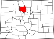 | |
| CDPs | ||
| Unincorporated communities | ||
| Ghost towns | ||
| International | |
|---|---|
| National | |