

Ziarat (Persian: زيارت)[a] is a city in the Central District of Shirvan County, North Khorasan province, Iran, serving as the administrative center for Ziarat Rural District.[4]
At the 2006 census, its population was 4,202 in 1,013 households, when it was a village in Ziarat Rural District.[5] The following census in 2011 counted 4,650 people in 1,262 households.[6] The latest census in 2016 showed a population of 4,179 people in 1,254 households,[2] by which time the village had been elevated to the status of a city.[7]
YouTube Encyclopedic
-
1/3Views:2 9321 168617
-
Kurdistan, Iran Part 5 (Travel Documentary in Urdu Hindi)
-
Iran Ark village, South Khorasan province روستاي آرك خراسان جنوبي ايران
-
iPhone 6s Plus 4K footage of Imam Reza Holy Shrine, Mashhad, Iran
Transcription
Notes
References
- ^ OpenStreetMap contributors (20 May 2023). "Ziarat, Shirvan County" (Map). OpenStreetMap. Retrieved 20 May 2023.
- ^ a b "Census of the Islamic Republic of Iran, 1395 (2016)". AMAR (in Persian). The Statistical Center of Iran. p. 28. Archived from the original (Excel) on 27 October 2020. Retrieved 19 December 2022.
- ^ Ziarat can be found at GEOnet Names Server, at this link, by opening the Advanced Search box, entering "-3089437" in the "Unique Feature Id" form, and clicking on "Search Database".
- ^ Mousavi, Mirhossein. "Creation and formation of eight rural districts including villages, farms and places in Shirvan County under Khorasan province". Islamic Parliament Research Center (in Persian). Ministry of Interior, Board of Ministers. Archived from the original on 9 September 2015. Retrieved 10 January 2024.
- ^ "Census of the Islamic Republic of Iran, 1385 (2006)". AMAR (in Persian). The Statistical Center of Iran. p. 28. Archived from the original (Excel) on 20 September 2011. Retrieved 25 September 2022.
- ^ "Census of the Islamic Republic of Iran, 1390 (2011)". Syracuse University (in Persian). The Statistical Center of Iran. p. 28. Archived from the original (Excel) on 19 January 2023. Retrieved 19 December 2022.
- ^ Rahimi, Mohammad Reza (7 May 2013). "Six new cities and towns were added to the map of country divisions". DOLAT (in Persian). Ministry of Interior, Board of Ministers. Archived from the original on 14 July 2014. Retrieved 17 March 2023.
North Khorasan Province, Iran | |||||||||||||||
|---|---|---|---|---|---|---|---|---|---|---|---|---|---|---|---|
| Capital | 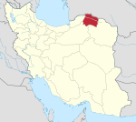 | ||||||||||||||
| Counties and cities |
| ||||||||||||||
| Sights |
| ||||||||||||||
| populated places | |||||||||||||||
| Capital | |||||||||||||||||||||||
|---|---|---|---|---|---|---|---|---|---|---|---|---|---|---|---|---|---|---|---|---|---|---|---|
| Districts |
| ||||||||||||||||||||||
This Shirvan County location article is a stub. You can help Wikipedia by expanding it. |