Bursa Yenişehir Airport Bursa Yenişehir Havalimanı | |||||||||||||||
|---|---|---|---|---|---|---|---|---|---|---|---|---|---|---|---|
 | |||||||||||||||
| Summary | |||||||||||||||
| Airport type | Public / military | ||||||||||||||
| Serves | Yenişehir, Bursa, Turkey | ||||||||||||||
| Opened | 2000 | ||||||||||||||
| Elevation AMSL | 764 ft / 233 m | ||||||||||||||
| Coordinates | 40°15′18″N 029°33′45″E / 40.25500°N 29.56250°E | ||||||||||||||
| Website | www.dhmi.gov.tr | ||||||||||||||
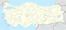
| Map | |||||||||||||||
| Runways | |||||||||||||||
| |||||||||||||||
Yenişehir Airport (IATA: YEI, ICAO: LTBR) is an international airport in the city of Yenişehir in the Bursa Province of Turkey.
The Yenişehir Airport YHT railway station of the Osmaneli-Bursa-Bandırma high-speed rail line will serve the airport.[3]
Airlines and destinations
The following airlines operate regular scheduled and charter flights at Burşa Yenişehir Airport:
| Airlines | Destinations |
|---|---|
| AJet[4] | Diyarbakır, Erzurum, Muş, Trabzon |
Statistics
References
- ^ "Airport information for LTBR". World Aero Data. Archived from the original on 2019-03-05.
{{cite web}}: CS1 maint: unfit URL (link) Data current as of October 2006. Source: DAFIF. - ^ Airport information for LTBR at Great Circle Mapper. Source: DAFIF (effective October 2006).
- ^ "Proje Tanıtımı - Bandırma-Bursa-Yenişehir-Osmaneli Yüksek Standartlı Demiryolu Projesi". www.bbyoyht.com. Retrieved 2024-03-31.
- ^ "Flight network". anadolujet.com.
External links
- Official website
- Current weather for LTBR at NOAA/NWS
- Accident history for YEI at Aviation Safety Network
- Bursa Travel Guide
- Bursa Landing and Taking Off Flights

