
Watersmeet, Michigan | |
|---|---|
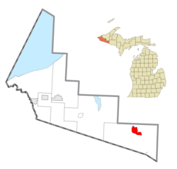 Location within Gogebic County | |
 Watersmeet Location within the state of Michigan  Watersmeet Watersmeet (the United States) | |
| Coordinates: 46°16′04″N 89°10′41″W / 46.26778°N 89.17806°W | |
| Country | United States |
| State | Michigan |
| County | Gogebic |
| Township | Watersmeet |
| Area | |
| • Total | 9.21 sq mi (23.84 km2) |
| • Land | 9.20 sq mi (23.83 km2) |
| • Water | 0.01 sq mi (0.01 km2) |
| Elevation | 1,598 ft (487 m) |
| Population (2020) | |
| • Total | 408 |
| • Density | 44.35/sq mi (17.12/km2) |
| Time zone | UTC-6 (Central (CST)) |
| • Summer (DST) | UTC-5 (CDT) |
| ZIP code(s) | 49969 |
| Area code | 906 |
| FIPS code | 26-84360[2] |
| GNIS feature ID | 1622065[3] |
Watersmeet is an unincorporated community and census-designated place (CDP) in Watersmeet Township, Michigan. As of the 2010 census, the CDP had a population of 428,[2] out of a total population in the township of 1,417. The community was platted in 1884, designated as a station of the Milwaukee Lake Shore and Western Railroad.[4]
YouTube Encyclopedic
-
1/2Views:14 53114 401
-
The mysterious Paulding Light in Watersmeet Michigan
-
Vacationland resort Thousand Island lake Watersmeet Michigan
Transcription
Geography
The community is located in the northern part of Watersmeet Township, in the western part of Michigan's Upper Peninsula, at the confluence of Duck Creek with the Middle Branch of the Ontonagon River. U.S. Routes 2 and 45 cross at the southern edge of town; US 2 leads southeast 30 miles (48 km) to Iron River and northwest 41 miles (66 km) to Wakefield, while US 45 leads north 46 miles (74 km) to Ontonagon on Lake Superior and south 26 miles (42 km) to Eagle River, Wisconsin. The community is also served by the State Line Trail.[5]
The community of Watersmeet was listed as a newly-organized census-designated place for the 2010 census, meaning it now has officially defined boundaries and population statistics for the first time.[6] According to the United States Census Bureau, the Watersmeet CDP has an area of 9.2 square miles (23.8 km2), of which 0.004 square miles (0.01 km2), or 0.06%, is water.[2]
Demographics
| Census | Pop. | Note | %± |
|---|---|---|---|
| 2020 | 408 | — | |
| U.S. Decennial Census[7] | |||
References
- ^ "2020 U.S. Gazetteer Files". United States Census Bureau. Retrieved May 21, 2022.
- ^ a b c "Geographic Identifiers: 2010 Demographic Profile Data (G001): Watersmeet CDP, Michigan". American Factfinder. U.S. Census Bureau. Retrieved December 19, 2016.[dead link]
- ^ U.S. Geological Survey Geographic Names Information System: Watersmeet, Michigan
- ^ Chicago and North Western Railway Company (1908). A History of the Origin of the Place Names Connected with the Chicago & North Western Railroad. p. 136.
- ^ "Amazing Michigan Trails for Hiking, Biking and More". michigan.org. Michigan Economic Development Corporation. 2020. Retrieved November 30, 2020.
Michigan's longest and reddest rail-trail.
- ^ "Michigan: 2010 Population and Housing Unit Counts 2010 Census of Population and Housing" (PDF). 2010 United States Census. United States Census Bureau. September 2012. p. III-5. Retrieved January 20, 2020.
- ^ "Census of Population and Housing". Census.gov. Retrieved June 4, 2016.
Municipalities and communities of Gogebic County, Michigan, United States | ||
|---|---|---|
| Cities |  | |
| Charter township | ||
| Civil townships | ||
| CDPs | ||
| Other communities | ||
| Indian reservation | ||
| International | |
|---|---|
| National | |