
Warwick, Oklahoma | |
|---|---|
 Location of Warwick, Oklahoma | |
| Coordinates: 35°41′17″N 97°0′06″W / 35.68806°N 97.00167°W | |
| Country | United States |
| State | Oklahoma |
| County | Lincoln |
| Area | |
| • Total | 2.78 sq mi (7.20 km2) |
| • Land | 2.75 sq mi (7.11 km2) |
| • Water | 0.03 sq mi (0.09 km2) |
| Elevation | 860 ft (260 m) |
| Population (2020) | |
| • Total | 184 |
| • Density | 59.74/sq mi (23.07/km2) |
| Time zone | UTC-6 (Central (CST)) |
| • Summer (DST) | UTC-5 (CDT) |
| FIPS code | 40-78650[3] |
| GNIS feature ID | 2413451[2] |
Warwick is a town in Lincoln County, Oklahoma, United States. The population was 184 at the 2020 census,[4] up from 148 in 2010.
Geography
Warwick is located in western Lincoln County. Interstate 44 runs through the north side of the town, with access from Exit 158, 2 miles (3 km) west of the town center. Oklahoma State Highway 66 runs through the center of the Warwick town limits, passing south of the residential portion of the town. Both highways lead west 37 miles (60 km) to Oklahoma City and northeast 68 miles (109 km) to Tulsa. U.S. Route 177 passes through the west side of Warwick, leading north 31 miles (50 km) to Stillwater and south 26 miles (42 km) to Shawnee.
According to the United States Census Bureau, the town of Warwick has a total area of 2.7 square miles (7.1 km2), of which 0.04 square miles (0.1 km2), or 1.26%, are water.[5]
The Deep Fork passes through the west side of the town, flowing east toward the North Canadian River at Eufaula.
Demographics
| Census | Pop. | Note | %± |
|---|---|---|---|
| 1970 | 146 | — | |
| 1980 | 167 | 14.4% | |
| 1990 | 160 | −4.2% | |
| 2000 | 235 | 46.9% | |
| 2010 | 148 | −37.0% | |
| 2020 | 184 | 24.3% | |
| U.S. Decennial Census[6] | |||
At the 2000 census there were 235 people, 85 households, and 66 families living in the town. The population density was 85.7 inhabitants per square mile (33.1/km2). There were 94 housing units at an average density of 34.3 per square mile (13.2/km2). The racial makeup of the town was 94.04% White, 1.70% African American, 1.28% Native American, and 2.98% from two or more races. Hispanic or Latino of any race were 0.85%.[3]
Of the 85 households 35.3% had children under the age of 18 living with them, 63.5% were married couples living together, 10.6% had a female householder with no husband present, and 21.2% were non-families. 18.8% of households were one person and 9.4% were one person aged 65 or older. The average household size was 2.76 and the average family size was 3.09.
The age distribution was 28.5% under the age of 18, 8.5% from 18 to 24, 25.5% from 25 to 44, 23.4% from 45 to 64, and 14.0% 65 or older. The median age was 38 years. For every 100 females, there were 97.5 males. For every 100 females age 18 and over, there were 95.3 males.
The median household income was $28,438 and the median family income was $36,250. Males had a median income of $26,250 versus $27,946 for females. The per capita income for the town was $15,344. About 4.6% of families and 8.8% of the population were below the poverty line, including 18.9% of those under the age of eighteen and 6.5% of those sixty five or over.
References
- ^ "ArcGIS REST Services Directory". United States Census Bureau. Retrieved September 20, 2022.
- ^ a b U.S. Geological Survey Geographic Names Information System: Warwick, Oklahoma
- ^ a b "U.S. Census website". United States Census Bureau. Retrieved January 31, 2008.
- ^ "Total Population: 2020 Census DEC Summary File 1 (P1), Warwick town, Oklahoma". data.census.gov. U.S. Census Bureau. Retrieved December 2, 2022.
- ^ "2019 U.S. Gazetteer Files". United States Census Bureau. Retrieved July 28, 2020.
- ^ "Census of Population and Housing". Census.gov. Retrieved June 4, 2015.
Municipalities and communities of Lincoln County, Oklahoma, United States | ||
|---|---|---|
| Cities | 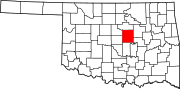 | |
| Towns | ||
| Unincorporated communities | ||
| Ghost towns | ||
| Footnotes | ‡This populated place also has portions in an adjacent county or counties | |