
Vyšné Nemecké | |
|---|---|
 Border Post entering Slovakia at Vyšné Nemecké | |
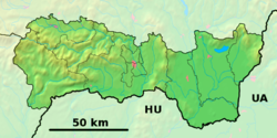 Vyšné Nemecké Location in Slovakia  Vyšné Nemecké Location in Košice Region | |
| Coordinates: 48°39′40″N 22°15′49″E / 48.66111°N 22.26361°E | |
| Country | Slovakia |
| Region | Košice |
| District | Sobrance |
| First mentioned | 1372 |
| Government | |
| • Mayor (Starosta) | Peter Zuza |
| Area | |
| • Total | 4.63[2] km2 (1.79[2] sq mi) |
| Elevation | 132[3] m (433[3] ft) |
| Population (2021) | |
| • Total | 232[1] |
| • Density | 50.74/km2 (19.59/sq mi) |
| Postal code | 072 51[3] |
| Area code | +421 56[3] |
| Car plate | SO |
Vyšné Nemecké (Hungarian: Felsőnémeti, Ukrainian: Ви́шнє Німе́цьке) is a small village in the Sobrance District, Košice Region, right on the Slovak side of the main international road border with Ukraine, opposite the city of Uzhhorod. As of 2011 it had 245 inhabitants.
YouTube Encyclopedic
-
1/3Views:5 76410 821667
-
Skorumpovaný Ukrajinskí policajti ( skúška alkoholu )
-
moje cesta na na hraniční přechod " Slovensko-Ukrajina " Vyšné Nemecké-Užhorod 21.5.2011
-
Vysne Nemecke April 11-15 2016
Transcription
References
- ^ "Počet obyvateľov podľa pohlavia - obce (ročne)". www.statistics.sk (in Slovak). Statistical Office of the Slovak Republic. 2022-03-31. Retrieved 2022-03-31.
- ^ a b "Hustota obyvateľstva - obce [om7014rr_ukaz: Rozloha (Štvorcový meter)]". www.statistics.sk (in Slovak). Statistical Office of the Slovak Republic. 2022-03-31. Retrieved 2022-03-31.
- ^ a b c d "Základná charakteristika". www.statistics.sk (in Slovak). Statistical Office of the Slovak Republic. 2015-04-17. Retrieved 2022-03-31.
External links
Wikimedia Commons has media related to Vyšné Nemecké.
This Košice Region geography article is a stub. You can help Wikipedia by expanding it. |
| Authority control databases: National |
|---|