
| Unai Pass | |
|---|---|
| Elevation | 3,252 m (10,669 ft)[1] |
| Location | Maidan Wardak, Afghanistan |
| Coordinates | 34°28′01″N 68°19′44″E / 34.467°N 68.329°E |

The Unai Pass or Onai Pass is a mountain pass on the western side of the Paghman Mountains[2] in Jalrez District, Maidan Wardak Province, Afghanistan. It is of strategical importance due to its geographical location to the southwest of Kabul. The Sarchashma River flows through the pass, which is the upstream part of the Kabul River.[3] The Maidan River, a tributary of the Kabul/Sarchashma rises at the pass at an altitude of about 3,300 metres (10,800 ft).[4]
Due to its importance, the pass has had a long history of being the focus of conflict in Afghanistan. In 1929, Muhammad Mir Fath (1901-1964) was one of three Hazara commanders who defeated the forces of Habibullah Kalakani at the pass between March and September of that year.[5] The mujahedin took the Unai Pass in the spring of 1979 during the war against the Soviet-backed Afghan communist regime, and Jalrez district was one of the earliest districts to be taken.[3] In 1983, the Hazara Al-Nasr group attacked the Harakat Islami in Siasang and the area near the pass.[6]
In 2008, the Ministry of Public Works began the rehabilitation of 136 kilometres of the Kabul highway,[7] aided by 36 million euros funding from the Italian government. The first phase of the project, Lot No 1, began in 2008 with the rehabilitation of a 54 kilometre stretch of earth road starting in Maidan Shar and working towards the Unai Pass.[8]
YouTube Encyclopedic
-
1/3Views:1 6971 339581
-
Geography of Afghanistan
-
DAILY CURRENT AFFAIRS | 4th APRIL 2019 | UPSC CSE PRELIMS 2019 | EKAM IAS
-
UPSC & State PCS Exam | 10 Most Important Questions | Geography | CivilsTap
Transcription
References
- ^ "Unai Pass, Afghanistan - Geographical Names, map, geographic coordinates". geographic.org. 26 September 2005. Retrieved 1 July 2021.
- ^ Ḥamīd Allāh Amīn; Gordon B. Schilz (1976). "A Geography of Afghanistan". Omaha, Nebraska: Center for Afghanistan Studies, University of Nebraska. p. 37.
- ^ a b "One Land, Two Rules (9): Delivering public services in insurgency-affected Jalrez district of Wardak province". Afghan Analysts Network. 16 December 2019. Retrieved 30 April 2020.
- ^ "The Kabul Times Annual". Kabul Times Publishing Agency. 1970. p. 270.
- ^ Adamec, Ludwig W. (2012). Historical Dictionary of Afghanistan. Scarecrow Press, Inc. p. 289. ISBN 978-0-8108-7815-0.
- ^ Tanwir, Dr. M. Halim (2013). Afghanistan: History, Diplomacy and Journalism, Volume 2. p. 540. ISBN 978-1-4797-9739-4.
- ^ "More than 600 vulnerable families in Maidan Wardak district receive food aid". United Nations Assistance Mission in Afghanistan. 8 February 2010. Retrieved 30 April 2020.
- ^ "Job description". Devex.com. Retrieved 30 April 2020.
Capital: Jalrez | |
| Towns and villages |
|
| Geography and transport |
|
| Notable people |
|
| Districts | 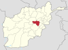 | |
|---|---|---|
| Populated places | ||
| Landforms | ||
| Other | ||