
| Ukelayat Укэлаят / Вуквылгаят | |
|---|---|
 Course of the Ukelayat map section | |
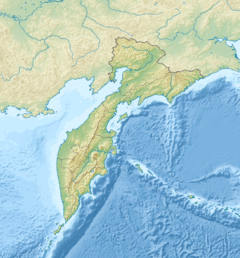 Mouth location in Kamchatka Krai | |
| Location | |
| Country | Russia |
| Federal subject | Kamchatka Krai |
| District | Olyutorsky District |
| Physical characteristics | |
| Source | |
| • location | Koryak Highlands |
| • coordinates | 61°59′28″N 170°53′0″E / 61.99111°N 170.88333°E |
| • elevation | ca 1,000 metres (3,300 ft) |
| Mouth | Bering Sea |
• coordinates | 61°43′15″N 173°31′12″E / 61.72083°N 173.52000°E |
• elevation | 0 metres (0 ft) |
| Length | 118 km (73 mi) |
| Basin size | 6,820 km2 (2,630 sq mi) |
The Ukelayat (Russian: Укэлаят; Koryak: Вуквылгаят) is a river in Kamchatka Krai, Russia. The length of the river is 118 kilometres (73 mi) and the area of is drainage basin 6,820 square kilometres (2,630 sq mi).[1]
The name of the river comes from the Koryak "vukvylgayat" (Вуквылгаят), meaning "rock/fall".[2]
Course
The Ukelayat has its source in the Koryak Highlands. It is fed by glaciers of the northern slopes of the adjoining ranges. It flows roughly eastwards within a valley bound by the Pikas Range to the north and the Ukelayat Range to the south. The river divides into channels along its middle and lower course. Its mouth is in the small Dezhnyov Bay of the Bering Sea.[3][4]
Its main tributary is the 148 km (92 mi) long Pikasvayam, joining it from the left about halfway through its course.[1]
Flora and fauna
The river basin is characterized by tundra vegetation, including mosses, lichens, dwarf shrubs, and sedges.[5]
See also
References
- ^ a b "Река Укэлаят in the State Water Register of Russia". textual.ru (in Russian).
- ^ Leontiev V.V. , Novikova K.A. Toponymic dictionary of the North-East of the USSR / scientific. ed. G. A. Menovshchikov ; FEB AS USSR . North-East complex. Research Institute. Lab. archeology, history and ethnography. - Magadan: Magadan . book. publishing house , 1989. - S. 290. - 456 p. — ISBN 5-7581-0044-7 .
- ^ Google Earth
- ^ Water of Russia - Корякское нагорье (ледниковая система)
- ^ V. Yu. Neshataeva, Vegetation cover of the North of the Kamchatka Okrug (Kamchatsky Krai) and its geobotanical zoning // Ecology and geography of plants and plant communities: Proceedings of the IV International Scientific Conference. - Yekaterinburg, 2018. - April 16. — ISBN 978-5-7741-0341-6
External links
- The Penzhina-West Kamchatka folded zone and the Ukelayat-Sredinnyi block in the structure of the Koryak Highland and Kamchatka
- Kamchatka Krai travel guide
This Kamchatka Krai location article is a stub. You can help Wikipedia by expanding it. |
This article related to a river in Russia is a stub. You can help Wikipedia by expanding it. |