
Truxton, Arizona | |
|---|---|
 Bell Gas sign, Truxton, Arizona | |
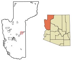 Location in Mohave County, Arizona | |
 Truxton  Truxton | |
| Coordinates: 35°29′26″N 113°33′44″W / 35.49056°N 113.56222°W | |
| Country | United States |
| State | Arizona |
| County | Mohave |
| Area | |
| • Total | 3.83 sq mi (9.90 km2) |
| • Land | 3.77 sq mi (9.77 km2) |
| • Water | 0.05 sq mi (0.13 km2) |
| Population | |
| • Total | 104 |
| • Density | 27.56/sq mi (10.64/km2) |
| Time zone | UTC-7 (MST (no DST)) |
| FIPS code | 04-75590 |
Truxton is an unincorporated community and census-designated place (CDP) in Mohave County, in the U.S. state of Arizona.[3] The population was 104 at the 2020 census,[2] down from 134 in 2010.[4]
YouTube Encyclopedic
-
1/3Views:305664766
-
TRUXTON FLYOVER, 07 07 20
-
Historic US 66, AZ 66 East - The Mother Road, National Trails Highway - Kingman to Truxton
-
BNSF Truxton Flyover, August 16, 2020
Transcription
History and location
Truxton is in eastern Mohave County, along Arizona State Route 66, former U.S. Route 66. It is 41 miles (66 km) northeast of Kingman, the county seat, and 45 miles (72 km) west of Seligman.
The Atlantic and Pacific Railroad section across northern Arizona was built in the early 1880s, and later acquired by the Santa Fe (now BNSF Railway), and included a stop at Truxton. The name comes from Truxton Springs, found by Edward Fitzgerald Beale when surveying and a laying wagon road through Arizona in 1857-58, see Beale's Wagon Road. "Truxtun" (slightly different spelling) was a family name; his son was Truxtun Beale, and his mother's maiden name was Emily Truxtun, a daughter of Thomas Truxtun.
Modern Truxton began to grow in 1951 when a few people moved in on Route 66, just northeast of the railstop, in anticipation of the building of the proposed Bridge Canyon Dam which would be nearby and would generate commerce. Though the dam was never built, business grew from Route 66 traffic coming through the very sparsely populated area.[5] When Interstate 40 opened in 1978 and bypassed this stretch of U.S. 66, it greatly reduced traffic and commerce in Truxton.[6][7]
Education
The Valentine Elementary School District, which contains Truxton,[8] has its single K-8 school in Truxton. The school has been there since 1969, and was previously in Valentine.[9]
Demographics
| Census | Pop. | Note | %± |
|---|---|---|---|
| 2010 | 134 | — | |
| 2020 | 104 | −22.4% | |
| U.S. Decennial Census[10] | |||
References
- ^ "2021 U.S. Gazetteer Files: Arizona". United States Census Bureau. Retrieved May 26, 2022.
- ^ a b "P1. Race – Truxton CDP, Arizona: 2020 DEC Redistricting Data (PL 94-171)". U.S. Census Bureau. Retrieved May 26, 2022.
- ^ U.S. Geological Survey Geographic Names Information System: Truxton, Arizona
- ^ "2010 Census Gazetteer Files - Places: New Mexico". U.S. Census Bureau. Retrieved February 26, 2017.
- ^ Branning, Debe. Arizona's Haunted Route 66, p. 131 (2021)
- ^ (March 11, 1979). Nobody bets on Truxton, Arizona Republic
- ^ Daniels, Steve (March 23, 1987). Route 66 revival, Arizona Republic
- ^ "2020 CENSUS - SCHOOL DISTRICT REFERENCE MAP: Mohave County, AZ" (PDF). U.S. Census Bureau. Retrieved January 24, 2022.
- ^ "About Valentine Elementary". Valentine Elementary School District. Retrieved January 24, 2022. - The address states "Peach Springs, AZ" but the school, as per the page, is in Truxton.
- ^ "Census of Population and Housing". Census.gov. Retrieved June 4, 2016.
