
Tiszakürt | |
|---|---|
Village | |
 Coat of arms | |
 Tiszakürt | |
| Coordinates: 46°53′05″N 20°07′34″E / 46.88472°N 20.12611°E | |
| Country | |
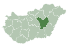
| County | Jász-Nagykun-Szolnok |
| District | Kunszentmárton |
| Area | |
| • Total | 28.37 km2 (10.95 sq mi) |
| Population (2015) | |
| • Total | 1,416[1] |
| • Density | 49.9/km2 (129/sq mi) |
| Time zone | UTC+1 (CET) |
| • Summer (DST) | UTC+2 (CEST) |
| Postal code | 5471 |
| Area code(s) | (+36) 56 |
Tiszakürt is a village in Jász-Nagykun-Szolnok county, in the Northern Great Plain region of central Hungary.
YouTube Encyclopedic
-
1/2Views:1 2631 277
-
Tiszakürt Arborétum
-
Arborétum Tiszakürt
Transcription
Geography
It covers an area of 28.37 km2 (11 sq mi) and has a population of 1416 people (2015).[1]
Ethnic affiliation of the population of the locality in 2001: Hungarian: 95,1%; Gipsy, Romany: 0,4%; unknown, did not wish to answer: 4,7%
Religious denomination of the population of the locality in 2001: Roman Catholic: 41,0%; Greek Catholic: 0,4%; Calvinist: 29,9%; Lutheran: 0,3%; belonging to other church/denomination: 0,3%; does not belong to any church/denomination: 18,5%; unknown, did not wish to answer: 9,6%
Attractions
- Bolza Mansion
- The Reformed Church was built in 1887, an eclectic style.
- Roman Catholic Church.
- Local History Museum of Tiszakürt
- Granary Building.
- World War I Memorial.
- World War II Memorial.
Census data
| Date | Number of | Area (in km2) | |
|---|---|---|---|
| Resident population | dwellings | ||
| 1990.01.01 (census) | 1687 | 752 | 28.48 |
| 1991.01.01 | 1653 | 750 | 28.48 |
| 1992.01.01 | 1631 | 751 | 28.48 |
| 1993.01.01 | 1615 | 751 | 28.48 |
| 1994.01.01 | 1595 | 753 | 28.48 |
| 1995.01.01 | 1631 | 754 | 28.48 |
| 1996.01.01 | 1628 | 757 | 28.48 |
| 1997.01.01 | 1594 | 759 | 28.48 |
| 1998.01.01 | 1596 | 760 | 28.48 |
| 1999.01.01 | 1620 | 760 | 28.48 |
| 2000.01.01 | 1618 | 760 | 28.48 |
| 2001.02.01 (census) | 1606 | 790 | 28.48 |
| 2002.01.01 | 1594 | 788 | 28.48 |
| 2003.01.01 | 1605 | 788 | 28.37 |
| 2004.01.01 | 1581 | 787 | 28.37 |
| 2005.01.01 | 1580 | 785 | 28.37 |
| 2006.01.01 | 1571 | 784 | 28.37 |
| 2007.01.01 | 1544 | 784 | 28.37 |
| 2008.01.01 | 1511 | 784 | 28.37 |
| 2009.01.01 | 1463 | 783 | 28.37 |
| 2010.01.01 | 1414 | 781 | 28.37 |
| 2011.01.01 | 1372 | 779 | 28.37 |
References
- ^ a b Gazetteer of Hungary, 1st January 2015. Hungarian Central Statistical Office. 3 September 2015
External links
- Official site in Hungarian
| Towns (2) |
| |
|---|---|---|
| Large villages (2) | ||
| Villages (7) | ||
| City with county rights |
|   |
|---|---|---|
| Towns | ||
| Large villages | ||
| Villages |
| |
| Other topics |
| |