
Tibacuy | |
|---|---|
Municipality and town | |
 View from Cumaca, rural part of Tibacuy | |
 Flag  Seal | |
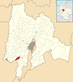 Location of the municipality and town inside Cundinamarca Department of Colombia | |
 Tibacuy Location in Colombia | |
| Coordinates: 4°20′50″N 74°27′9″W / 4.34722°N 74.45250°W | |
| Country | |
| Department | |
| Province | Sumapaz Province |
| Founded | 17 February 1592 |
| Founded by | Bernardino de Albornoz |
| Government | |
| • Mayor | Eduar Javier Serrano Orjuela (2016–2019) |
| Area | |
| • Municipality and town | 84.4 km2 (32.6 sq mi) |
| • Urban | 0.25 km2 (0.10 sq mi) |
| Elevation | 1,647 m (5,404 ft) |
| Population (2015) | |
| • Municipality and town | 4,828 |
| • Density | 57/km2 (150/sq mi) |
| • Urban | 523 |
| Time zone | UTC-5 (Colombia Standard Time) |
| Website | Official website |
Tibacuy is a municipality and town of Colombia in the department of Cundinamarca, in Sumapaz Province. Tibacuy is situated south of the Altiplano Cundiboyacense in the Eastern Ranges of the Colombian Andes at 87 kilometres (54 mi) southeast of the capital Bogotá.[1]
YouTube Encyclopedic
-
1/5Views:5 9792 0814594 1761 298
-
TIBACUY
-
en tibacuy - cundinamarca. tour en moto por pueblos y ciudades de colombia.
-
VIDEO FINAL ALGO MÁS QUE TIBACUY
-
bosque de robles, cerro Quininí, Tibacuy Cundinamarca, Colombia
-
de nilo a tibacuy - cundinamarca, por la via batavia.tour en moto por pueblos
Transcription
Climate
| Tibacuy - 1647 m
| ||||||||||||||||||||||||||||||||||||||||||||||||||||||||||||
|---|---|---|---|---|---|---|---|---|---|---|---|---|---|---|---|---|---|---|---|---|---|---|---|---|---|---|---|---|---|---|---|---|---|---|---|---|---|---|---|---|---|---|---|---|---|---|---|---|---|---|---|---|---|---|---|---|---|---|---|---|
| Climate chart (explanation) | ||||||||||||||||||||||||||||||||||||||||||||||||||||||||||||
| ||||||||||||||||||||||||||||||||||||||||||||||||||||||||||||
| ||||||||||||||||||||||||||||||||||||||||||||||||||||||||||||
Etymology
In the Chibcha language of the Muisca and Panche, Tibacuy means "official chief".[1]
History
The area of Tibacuy was inhabited by the Muisca and the Panche with the Sutagao living to the southeast. The present town centre is situated at a lower altitude than the original indigenous village. Modern Tibacuy was founded between 13th and 17th of February 1592 by Bernardino de Albornoz.[1]
Economy
Main economical activity of Tibacuy is agriculture, predominantly coffee, bananas, tomatoes and blackberries.
Archaeology
In Cumaca, rural part of Tibacuy, petroglyphs have been found.[1]
Gallery
-
 Location of petroglyphs in Cumaca, Tibacuy
 -
 Petroglyphs
 -
 Petroglyphs
See also
References
- ^ a b c d (in Spanish) Official website Tibacuy