
 Map of South Tarawa and North Tarawa within Tarawa Atoll | |
 Map of the Gilbert Islands | |
 Tarawa Tarawa 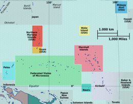 Tarawa Tarawa (Micronesia)  Tarawa Tarawa (Oceania)  Tarawa Tarawa (Pacific Ocean) | |
| Geography | |
|---|---|
| Location | Pacific Ocean |
| Coordinates | 1°20′N 173°00′E / 1.333°N 173.000°E |
| Archipelago | Gilbert Islands |
| Area | 31.02 km2 (11.98 sq mi) |
| Highest elevation | 3 m (10 ft) |
| Administration | |
Kiribati | |
| Island councils | Betio, North Tarawa, South Tarawa |
| Largest settlement | Betio |
| Demographics | |
| Population | 70,480 (2020) |
| Pop. density | 2,031.5/km2 (5261.6/sq mi) |
| Languages | Gilbertese |
| Ethnic groups | I-Kiribati (95.5%) |
| Additional information | |
| Time zone | |
Tarawa is an atoll and the capital of the Republic of Kiribati,[1][2][3] in the Micronesia region of the central Pacific Ocean. It comprises North Tarawa, which has 6,629 inhabitants and much in common with other more remote islands of the Gilbert group, and South Tarawa, which has 56,388 inhabitants as of 2015[update], half of the country's total population.[4][5] The atoll was the site of the Battle of Tarawa during World War II.
YouTube Encyclopedic
-
1/5Views:458 240593 998625 001128 19183 106
-
With the Marines at Tarawa
-
Hellfire in Paradise: Tarawa, Makin and the Gilbert Islands Campaign
-
Marine Films Enemy In the Open on Tarawa's Front Lines & Wins Oscar | Norman Hatch
-
Battle of Tarawa 1943 – The Start of the Island Hopping.
-
Utmost Savagery-Tarawa Day 1 -Episode 227
Transcription
[naval music playing] These are the men of the second marine division. We are now embarking on a full-scale amphibious operation after many months of intensive training. [naval music still playing] The transports are combat loaded. The ships of the Navy and Coast Guard form our convoy. Squadrons of carrier planes cover us in the sky. Several days from our destination, a destroyer brings us sealed orders. [dramatic music playing] It won't be long now before we know where we're bound. The relief map of our objective is broken out. Fortified out on the Betio in the Tarawa Atoll. A very important Jap air base on the outer fringe of their Pacific defenses. Our platoon leader started explaining the terrain to us. By the time they were finished, we knew that island and its reefs as well as we knew our own back yards. We built more machine gun ammunition. [dreary, dramatic music playing] Check and test-fire all weapons. [very loud gun shot booms, listeners should brace or lower their volumes] Exercise helped to relieve the tension. Navy and Coast Guard coxswains receive last minute instructions on formations, rendezvous areas, and departure times. Services are held on the last evening before D-Day. [organ music playing] We liked listening to Father Kelly. He'd been with us at Guadalcanal. He had a way of saying what we wanted to hear. Many of these men were killed the following morning. [organ music continues, turns into dramatic music at 2:47] We are ready. D-Day. It's the day we attack. Long before daylight, we're over the side into our amphibian tractors and landing boats. [dramatic music continues] At daylight our naval vessels open fire, for four solid hours they bombed Tarawa with high explosives. [bomb blasts] Everything went like clockwork. When the ships stopped firing, the Navy planes would take over...bombing. [machine gun sounds] Strafing. We were a team working together. [Machine guns blasting] Then again according to plan, the planes withdraw, the ships' batteries open up again. [Machine guns sounds] H-hour, the hour we attack is getting close. For three days before we moved in, over four million pounds of explosives have been dropped on the island. It didn't seem possible that anyone could live through that bombardment. [bomb blasts] [airplane engines] From this Jap hulk, machine guns constantly strafed our assault waves. [airplane soaring sounds] We bomb them out twice, but each time a new crew took over. One of our planes scores a direct hit. [airplane gliding and soaring, loud] As we approach the island, we have the feeling that the show is just about over. There doesn't seem to be any organized resistance. However, we're taking no chances. Suddenly we're met by heavy machine gun and mortar fire. Takes a heavy toll of our boats and men. It doesn't stop us. [heavy machine guns and bombs] We fight our way onto the beach. [machine guns and bombs blasting] Our men wade ashore from wrecked amphibians. [gun shots continue] A long pier extending across the fringing reef gives protection to a lot of our boys on the way in. We have a pretty good toehold on the beach but Jap fire pins us down for hours. [gun shots, bombs and airplanes' engines sounding] Casualties are pretty high, but as we found out later, blood plasma saves a lot of lives. [gun shots] When reinforcements arrive, we start moving up. [gun shots] It isn't easy knocking those Japs out of their positions. They're hidden in trees, behind revetments, buried pillboxes, bomb proofs, bunkers. [guns, machine guns, bombs] [repeated gun fire] We use hand grenades. We use all the fire power we have to blast them out. Our rifle fire is deadly, so are the flame throwers, and the mortars. [gun shots] The enemy breaks from cover. [bomb blasts] [machine gun fire] It's tough getting them out of places like this, we can never be sure where their snipers are placed. We take it slow...easy. [bomb blast from a hand grenade thrown] This bunker is giving us plenty of trouble, we have orders to clean it out. [gun shots] [bomb blasts] This is what we found on the other side. [gun shots] They're savage fighters; their lives mean nothing to them. One of our boys is hit. [machine gun fire] At night, the Japs would swim out to our wrecked amphibians and set up machine guns. They got a few of us, before we got them. [bomb blasts] Commanding officer of the assault troops confers with his staff. One of our medium tanks remains in operation. [machine gun fire] Although, at the end of the second day, D+1, we breathe a little easier; mortar squads continue to hammer enemy points of resistance. [hammer hitting metal] [gun fire] [bomb blasts] By this time we know the Japs are licked. They must know it, too. There's still strong resistance and if suicide snipers tie themselves up in the trees and take pot shots at us, we hit them but they don't fall, just die and hang there. [gun shots] [machine gun fire] [gun shots] [ricochet sounds] [machine gun fire] [tank rumbling] A light tank moves up the airstrip. One of our boys is wounded during the attack on the airfield. Another Marine goes out after him in a Jeep under heavy machine gun fire. [Tank engine noise] [machine gun fire] Back at the beach, there's constant activity. Amphibians tow in fresh supplies, food, ammunition, guns. [gun shots] As the battle moves across the island, the chaplain's assistants tend the dead. Removing the lower identification ticket and leaving the duplicate on each Marine so there'll be no mistake later on. [low music playing] Generals Holland Smith and Julian Smith commanding the force and division. Admiral Harry Hill commanding the task force. Sometimes we actually have to dig the Japs out of their holes. The island is infested with buried pillboxes, many of them still crawling with Japs. These bunkers were so constructed that heavy shelling and demolition charges failed to crumble them. Many of them were over 20 feet deep. Our first prisoners. The wounded are given first aid in the field, and then carried by stretcher to the boats. With them always are the Navy hospital corpsman and Navy doctors and surgeons. At the transport, the steel litters are lifted from the barges and lowered into the hold. They are taken to the ships hospital, not a second is lost. [dramatic music] These are marine dead. This is the price we have to pay for a war we didn't want and before it's over, there'll be more dead on other battlefields. [water splashing] Burial aboard ship for Marines killed in action. [water splashing] [gunfire salute] Just to make sure they're not concealing weapons, the prisoners are lined up and their clothes cut away. We gave them new ones later from their own dumps. [sounds of clothes being ripped] The rest of the island's defending force is dead, none escaped. Tokyo once boasted that it would cost a hundred thousand of our men to take Tarawa. We lost less than a thousand; the Japs, over four thousand. A wounded Japs soldier, we took very little of these. Most of our prisoners were Korean laborers. One of our officers captured these Japs from a disabled landing boat. Prisoners carry their own wounded to the pier for evacuation. Captured Jap water, this is the first chance the boys have had to wash since they got on the island. Gun fire from our warships knocked these big guns out early in the bombardment. These were English Vickers guns captured by the Japs in Singapore. One of their many light tanks. This was the Jap command post, built of reinforced concrete, several feet thick. That building was built to withstand plenty, and did. We finally took it with TNT and flamethrowers. The fighting was still going on at one end of the island when the Seabees landed with their heavy equipment. They set to work clearing the airstrip even while we were fighting for it. [tank engine sounds] The first plane landed just 24 hours after the Seabees had started the work. The second one lands one minute later. Welcome the pilot to our new home. It was our first chance to thank those guys for the swell job they did for us before and during the attack. On D plus four our relief came in. Maybe you think we weren't glad to see them. [patriotic music, "Marines' Hymn", plays] I guess all of us knew from the first, no matter how tough the going was, that we'd take the island. Just the same, the day the colors were run up on this palm tree and flew for the first time over Tarawa, we got a lump in our throats. We were mighty proud. [trumpet plays] [snare drum rolls] [band plays] These are the Marines who took Tarawa.
Etymology
Tarawa is an old Gilbertese form for Te Rawa, meaning "The Passage" (of the Lagoon), named for the unusual large ship channel to the lagoon.[6] In the popular etymology based on Kiribati mythology, Nareau, the God-spider, distinguished Karawa, the sky, from Marawa, the Sea, from Tarawa, the land.
Geography
Tarawa has a large lagoon, 500 square kilometres (193 square miles) in total area, and a wide reef. The lagoon is widely open to the ocean, with a large ship pass. Although naturally abundant in fish and shellfish of all kinds, marine resources are being strained by the large and growing population. Drought is frequent, but in normal years rainfall is sufficient to maintain breadfruit, papaya and banana trees as well as coconut and pandanus.
North Tarawa consists of a string of islets from Buariki in the north to Buota in the south. The islets are separated in places by wide channels that are best crossed at low tide, and there is a ferry service between Buota and Abatao.[7] Only Buota is connected by road to South Tarawa, via a bridge.
On South Tarawa, the construction of causeways has now created a single strip of land from Betio in the west to Tanaea in the northeast.[8]
Climate

Tarawa features a tropical rainforest climate under the Köppen climate classification. The climate is pleasant from April to October, with predominant northeastern winds and stable temperatures close to 30 °C (86 °F). From November to March, western gales bring rain and occasional cyclones.[2][9][10]
Precipitation varies significantly between islands. For example, the annual average is 3,000 mm (120 in) in the north and 500 mm (20 in) in the south of the Gilbert Islands.[9] Most of these islands are in the dry belt of the equatorial oceanic climatic zone and experience prolonged droughts.[10]
| Climate data for Tarawa Airport (South Tarawa) | |||||||||||||
|---|---|---|---|---|---|---|---|---|---|---|---|---|---|
| Month | Jan | Feb | Mar | Apr | May | Jun | Jul | Aug | Sep | Oct | Nov | Dec | Year |
| Record high °C (°F) | 35.0 (95.0) |
33.0 (91.4) |
35.0 (95.0) |
34.5 (94.1) |
34.5 (94.1) |
33.5 (92.3) |
34.5 (94.1) |
34.5 (94.1) |
34.5 (94.1) |
35.0 (95.0) |
35.0 (95.0) |
35.0 (95.0) |
35.0 (95.0) |
| Mean daily maximum °C (°F) | 30.7 (87.3) |
30.6 (87.1) |
30.7 (87.3) |
30.7 (87.3) |
30.8 (87.4) |
30.8 (87.4) |
30.9 (87.6) |
31.0 (87.8) |
31.1 (88.0) |
31.2 (88.2) |
31.3 (88.3) |
30.9 (87.6) |
30.9 (87.6) |
| Daily mean °C (°F) | 28.2 (82.8) |
28.1 (82.6) |
28.1 (82.6) |
28.2 (82.8) |
28.4 (83.1) |
28.3 (82.9) |
28.2 (82.8) |
28.3 (82.9) |
28.4 (83.1) |
28.6 (83.5) |
28.5 (83.3) |
28.2 (82.8) |
28.3 (82.9) |
| Mean daily minimum °C (°F) | 25.3 (77.5) |
25.3 (77.5) |
25.2 (77.4) |
25.3 (77.5) |
25.5 (77.9) |
25.3 (77.5) |
25.1 (77.2) |
25.2 (77.4) |
25.3 (77.5) |
25.4 (77.7) |
25.4 (77.7) |
25.3 (77.5) |
25.3 (77.5) |
| Record low °C (°F) | 21.5 (70.7) |
22.5 (72.5) |
22.5 (72.5) |
22.5 (72.5) |
21.0 (69.8) |
21.0 (69.8) |
21.0 (69.8) |
21.5 (70.7) |
22.5 (72.5) |
22.0 (71.6) |
22.5 (72.5) |
22.0 (71.6) |
21.0 (69.8) |
| Average precipitation mm (inches) | 271 (10.7) |
218 (8.6) |
204 (8.0) |
184 (7.2) |
158 (6.2) |
155 (6.1) |
168 (6.6) |
138 (5.4) |
120 (4.7) |
110 (4.3) |
115 (4.5) |
212 (8.3) |
2,052 (80.8) |
| Average precipitation days (≥ 0.3 mm) | 15 | 12 | 14 | 15 | 15 | 14 | 16 | 18 | 15 | 11 | 10 | 17 | 172 |
| Average relative humidity (%) | 81 | 80 | 81 | 82 | 81 | 81 | 80 | 79 | 77 | 77 | 79 | 81 | 80 |
| Mean monthly sunshine hours | 220.1 | 192.1 | 207.7 | 201.0 | 229.4 | 219.0 | 229.4 | 257.3 | 243.0 | 260.4 | 240.0 | 189.1 | 2,688.5 |
| Mean daily sunshine hours | 7.1 | 6.8 | 6.7 | 6.7 | 7.4 | 7.3 | 7.4 | 8.3 | 8.1 | 8.4 | 8.0 | 6.1 | 7.4 |
| Source: Deutscher Wetterdienst[11] | |||||||||||||
Administration
Tarawa atoll has three administrative subdivisions: Betio Town Council (or BTC), on Betio Islet; Teinainano Urban Council (or TUC), from Bairiki to Tanaea; and Eutan Tarawa Council (or ETC), for North Tarawa or Tarawa Ieta, consisting of all the islets on the east side from Buota northwards.[12] The meaning of Te inainano in Gilbertese language is "down of the mast", alluding to the sail-shape of the atoll [13]
South Tarawa hosts the capital of the Republic of Kiribati and was also the central headquarters of the Gilbert and Ellice Islands since 1895. The House of Assembly is in Ambo, and the State House is in Bairiki. The offices of the various ministries of the government range from Betio at the south-west extreme to Nawerewere (on an easterly island in its chain), close to Bonriki (International Airport) and Temwaiku. Settlements on North Tarawa include Buariki, Abaokoro, Marenanuka and Taborio.
Diplomatic missions
Four resident diplomatic missions exist: the embassies of China (closed in 2003, re-opened in 2020) and Japan (opened in 2023), and the high commissions of Australia and New Zealand. The United Nations are also present in Kiribati, including UNICEF, UNDP, UNFPA, UNOPS, UN Women, WHO and FAO.
History

In Kiribati mythology, Tarawa was the earth when the land, ocean and sky had not been cleaved yet by Nareau the spider. Thus, after calling the sky karawa and the ocean marawa, he called the piece of rock that Riiki (another god that Nareau found) had stood upon when he lifted up the sky as, Tarawa. Nareau then created the rest of the islands in Kiribati and also Samoa.
Gilbertese arrived at these islands thousands of years ago, and there have been migrations to and from Gilbert Islands since antiquity.[14]
Evidence from a range of sources, including carbon dating and DNA analyses, confirms that the exploration of the Pacific included settlement of the Gilbert Islands by around 200 BC. The people of Tungaru (native name of the Gilbertese) are still excellent seafarers, capable of making ocean crossings in locally made vessels using traditional navigation techniques.[15]
Thomas Gilbert, captain of the East India Company vessel Charlotte, was the first European to describe Tarawa, arriving on 20 June 1788. He did not land. He named it Matthew Island, after the owner of his ship Charlotte. He named the lagoon Charlotte Bay.[16] Gilbert's 1788 sketches survive.

The island was surveyed in 1841 by the US Exploring Expedition.[17]
For nine generations, the island was divided between two warring factions, the House of Auatubu and the House of Teabike, until in 1892 HMS Royalist (1883) arrived, with Captain Edward Davis proclaiming that the island was now a British Protectorate. This saved Auatubu from massacre; the day before, they had been badly defeated by Teabike. A very old lady, plaiting a sleeping mat twenty-five years later, described the situation:
"In those days death was on the right hand and on the left. If we wandered north, we were killed or raped. If we wandered south, we were killed or raped. If we returned alive from walking abroad, our husbands themselves killed us, for they said that we had gone forth seeking to be raped. That was indeed just, for a woman who disobeys her husband is a woman of no account, and it matters not how she dies. Yet how beautiful is life in our villages, now that there is no killing and war is no more... Behold my son and my grandson! These would have died with me that day at Nea if the warship had not arrived. And these"-she pointed out her great and great-great-grandchildren-"would never have been born. We live because the Government of Kuini Kabitoria brought peace to us, and here I sit plaiting this mat to be buried in because of the kindness of that woman, with all my generations around me to wrap me in it when I die."[18]
The aftermath of land claims and counter-claims between Auatubu and Teabike nevertheless caused high tension for years afterwards.[19]
Charles Richard Swayne, the first Resident Commissioner, decided to install the central headquarters of the Gilbert and Ellice Islands protectorate in Tarawa in 1895.[20] Tarawa Post Office opened on 1 January 1911.[21]
Sir Arthur Grimble was a cadet administrative officer based at Tarawa (1913–1919).[22] He became Resident Commissioner of the Gilbert and Ellice Islands colony in 1926.[23]
During World War II, Tarawa was occupied by the Japanese, and beginning on 20 November 1943 it was the scene of the bloody Battle of Tarawa. On that day U.S. Marines landed on Tarawa and fought Japanese Marines of the Special Naval Landing Forces occupying entrenched positions on the atoll. The Marines captured the island after 76 hours of intense fighting that killed 6,000 people in total.
The fierce fighting was the subject of a documentary film produced by the Combat Photographers of the Second Marine Division entitled With the Marines at Tarawa. It was released in March 1944 at the insistence of President Roosevelt. It became the first time many Americans viewed American servicemen dead on film.[citation needed]. The US built bases on the Island.
The Kiribati Government began a road restoration project funded in part by the World Bank in 2014 to re-surface the main road from Betio in the west to Bonriki in the east,[24] upgrading the main road that transits Tarawa from a dirt road. As of 2018, all that remained to be completed of this project was the sealing of the Japanese Causeway, connecting Bairiki and Betio, done in 2019.
Literature and journal
- A Pattern of Islands by Sir Arthur Grimble, John Murray & Co, London, 1952; republished 2011 by Eland, London, ISBN 978-1-906011-45-1
- Return to the Islands by Sir Arthur Grimble, John Murray & Co, London, 1957
- The 2004 book The Sex Lives of Cannibals by J. Maarten Troost is a lighthearted account of the author's two years living on Tarawa.
- The Precedence of Tarawa Atoll, by H.E. Maude and Edwin Doran Jr, Annals of the Association of American Geographers, Vol. 56, No. 2 (Jun. 1966), pp. 269–289.
- Kiribati. Cronache illustrate da una terra (s)perduta is an illustrated book of Alice Piciocchi (illustrator: Andrea Angeli). March 2016. 24 Ore Cultura, Milan, also in French translation Chronique illustrée d’un archipel perdu, éditions du Rouergue, 2018.
- "Tarawa" by war correspondent Robert Sherrod was published in 1944 and chronicles the WWII battle
In popular culture
- Tarawa is the site of the 1944 Pulitzer Prize-winning photograph by Frank Filan, depicting a destroyed bunker.
- Leon Cooper, a US Navy Landing Craft Operator who took part in the WWII battle, returned to the island in 2008 to investigate reports the beach he landed on was littered with garbage. His journey was chronicled in the documentary "Return to Tarawa: The Leon Cooper Story", narrated by Ed Harris.
- "Tarawa Atoll Sanglant" is a Belgian comic written by Jean-Michel Charlier and Victor Hubinon in 1950. (ISBN 2-8001-2063-0)
- Leon Uris' 1953 fictional Battle Cry extensively depicts the 1943 battle. (Uris was a Marine on Guadalcanal.)
- Tarawa Atoll is featured as the penultimate battle of EA Games Medal of Honor, Pacific Assault (2004).
- A 1956 British drama film Pacific Destiny based on the book A Pattern of Islands was made in 1956.
- The Far Reaches, a 2007 historical novel by Homer Hickam, describes the Battle of Tarawa. (ISBN 0-312-334753)
- In the novel Snow Falling on Cedars, Ishmael Chambers is a World War II US Marine Corps veteran who lost an arm fighting the Japanese at the Battle of Tarawa while watching his friends die. He revisits his part in the battle in a flashback.
- The Sex Lives of Cannibals: Adrift in the Equatorial Pacific is a 2004 travelogue by author J. Maarten Troost describing the two years he and his girlfriend spent living on the Tarawa atoll in the Pacific island nation of Kiribati.
Memorial
- USS Tarawa was the name of the first LHA-class amphibious assault ship.
See also
References
- ^ "Kiribati government website". Government of Kiribati. Archived from the original on 26 June 2010. Retrieved 29 May 2014.
- ^ a b Kiribati. The World Factbook. Central Intelligence Agency.
- ^ "European Union – list of countries in the world".
- ^ Country files at earth-info.nga.mil Archived 12 August 2005 at the Wayback Machine
- ^ "Kiribati Census Report 2015 Volume 1" (PDF). National Statistics Office, Ministry of Finance and Economic Development, Government of Kiribati. Archived from the original (PDF) on 30 September 2013. Retrieved 17 March 2013.
- ^ Rawa. n. a passage, canal, passage through reef, a strait. Ernest Sabatier, Dictionnaire gilbertin-français, 1952.
- ^ "North Tarawa Island Report 2012". Government of Kiribati.
- ^ "South Tarawa Island Report 2012". Government of Kiribati.
- ^ a b Kiribati. Encyclopædia Britannica
- ^ a b Thomas, 3
- ^ "Klimatafel von Tarawa, Int. Flugh. Bonriki / Kiribati (Gilbert-Inseln)" (PDF). Baseline climate means (1961–1990) from stations all over the world (in German). Deutscher Wetterdienst. Retrieved 30 November 2020.
- ^ Dr Temakei Tebano & others (March 2008). "Island/atoll climate change profiles – Tarawaieta (North Tawara)". Office of Te Beretitent – Republic of Kiribati Island Report Series (for KAP II (Phase 2). Archived from the original on 6 November 2011. Retrieved 28 April 2015.
- ^ "inainano: *B ináinano. n. lower sprit or brace of a canoe sail; *O inainano. n. the lower yard arm.", from Trussel Gilbertese dictionary).
- ^ North Tarawa Socioeconomic Report 2008. Secretariat of the Pacific Community and Government of Kiribati
- ^ Howe, K. R. (2006). Vaka Moana – voyages of the ancestors. David Bateman. ISBN 1869536258.
- ^ Samuel Eliot Morison (22 May 1944). "The Gilberts & Marshalls: A distinguished historian recalls the past of two recently captured pacific groups". Life. Retrieved 14 October 2009.
Being now abreast of this island, the extremity ending in a beautiful clump of trees, I hauled up to look at the bay. It appeared to be safe and commodious, sheltered by a long reef running parallel with the island, with two large inlets into the bay. The reef is about ¾ of a mile from the beach, and has several small islands which appear like flower pots.
- ^ Stanton, William (1975). The Great United States Exploring Expedition. Berkeley: University of California Press. pp. 245. ISBN 0520025571.
- ^ A Pattern of Islands. Arthur Grimble. The Reprint Society, by arrangement with John Murray (publishers) Ltd., 1954. First published 1952. Pages 178-180.
- ^ A Pattern of Islands. Arthur Grimble. The Reprint Society, by arrangement with John Murray (publishers) Ltd., 1954. First published 1952. Pages 247-258.
- ^ Maude, H.E.; Doran, Edwin Jr. (June 1966). "The Precedence of Tarawa Atoll". Annals of the Association of American Geographers. 56 (2): 269–289.
- ^ Premier Postal History. "Post Office List". Premier Postal Auctions. Retrieved 5 July 2013.
- ^ Grimble, Sir Arthur (1952). "A Pattern of Islands". Early New Zealand Books (NZETC). Retrieved 16 October 2011.
- ^ Grimble, Sir Arthur (2011). A Pattern of Islands. John Murray & Co, London, 1952; republished 2011 by Eland, London. ISBN 978-1-906011-45-1.
- ^ "Projects : Kiribati Road Rehabilitation Project | The World Bank". Archived from the original on 12 November 2012.
External links
- Tarawa on The Web – A History of the Bloodiest Battle
- The Marine Assault of Tarawa
- Tarawa the Aftermath
- "Tarawa" the USCG cat
- Exhibit: The Alfred Agate Collection: The United States Exploring Expedition, 1838–1842 from the Navy Art Gallery
- Return to Tawara
| Gilbert Islands |  | |
|---|---|---|
| Phoenix Islands | ||
| Line Islands | ||
| West of Gilberts | ||
| Reefs | ||
| ||
| International | |
|---|---|
| National | |
| Other | |