
Tapah | |
|---|---|
Town and district capital | |
| Other transcription(s) | |
| • Jawi | تاڤه |
| • Tamil | தாப்பா |
| • Chinese | 打巴 |
 | |
 Seal | |
 Tapah Location of Tapah | |
| Coordinates: 4°11′53″N 101°15′41″E / 4.19806°N 101.26139°E | |
| Country | Malaysia |
| State | Perak |
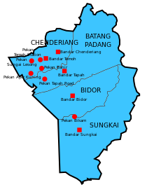
| District | Batang Padang |
| Government | |
| • Type | Local government |
| • Body | Tapah District Council |
| • President | Ahmad Roslan Mohamed Nazir |
| Time zone | UTC+8 (Malaysian Standard Time) |
| Website | http://mdtapah.gov.my |
Tapah District Council Majlis Daerah Tapah مجليس دايره تاڤه | |
|---|---|
| Local Government Act 1976 | |
 | |
| Type | |
| Type | |
| History | |
| Founded | 1 September 1979 |
| Leadership | |
President | Ahmad Roslan Mohamed Nazir |
| Motto | |
| Menuju Kejayaan Towards Success | |
| Meeting place | |
| Jalan Stesyen, 35000 Tapah, Perak Darul Ridzuan. | |
| Website | |
| www | |
Tapah is a town and the capital of Batang Padang District, Perak, Malaysia.[1]
YouTube Encyclopedic
-
1/4Views:6 93311 7262 262159 294
-
Tapah, Perak
-
Sadhana of Tapah Kindling the fire within
-
#KitaMakan Mi Rebus Tapah
-
Sumpah Tapah
Transcription
Name
The name "Tapah" is said to be originated from the name of a freshwater fish, "Ikan Tapah". The scientific name of the fish is Wallago leeri. The locals said that the name has been taken from the Perak Malay word which means "no worry".[2]
Geography
The Batang Padang River flows through this town.[3] Major neighbouring towns are Kampar and Bidor. The Lata Kinjang waterfall is about 18 km from Tapah on the road to Chenderiang. It is an impressive series of cascades down a 100 m drop. The falls can be seen from the North–South Expressway (PLUS).
Transport

Tapah is located on the trunk road between Kuala Lumpur and Ipoh. There is an entrance to the North–South Expressway (E1) at Tapah via exit 132. This town is also widely considered as the main entry point into the old Cameron Highlands route, which is a winding and narrow road uphill. The nearest train station is Tapah Road.[4]
References
- ^ The Directory & Chronicle for China, Japan, Corea, Indo-China, Straits Settlements, Malay States, Sian, Netherlands India, Borneo, the Philippines. Hongkong Daily Press Office. 1910. p. 1394.
- ^ http://www.suaraperak.com/tidak-boleh-makan-ikan-tapah-bukan-sekadar-mitos/ (in malay)
- ^ Nathan, R S (1970). "Batang Padang". Malaysia in History. Malaysian Historical Society. 13 (1–2): 20.
- ^ Richmond, Simon (2010). Malaysia, Singapore & Brunei. Lonely Planet. p. 147. ISBN 9781741048872.
| International | |
|---|---|
| National | |
4°12′N 101°16′E / 4.20°N 101.26°E
This Perak location article is a stub. You can help Wikipedia by expanding it. |