
Svínoy | |
|---|---|
 Stamp FR 350 of Postverk Føroya (issued: 25 May 1999; photo: Per á Hædd) | |
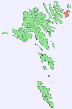 Location within the Faroe Islands | |
| Coordinates: 62°16′N 6°22′W / 62.267°N 6.367°W | |
| State | Kingdom of Denmark |
| Constituent country | Faroe Islands |
| Area | |
| • Total | 27.1 km2 (10.5 sq mi) |
| • Rank | 10 |
| Highest elevation | 586 m (1,923 ft) |
| Population (Nov 2020) | |
| • Total | 31 |
| • Density | 1.1/km2 (3.0/sq mi) |
| Time zone | UTC+0 (GMT) |
| • Summer (DST) | UTC+1 (EST) |
| Calling code | 298 |
Svínoy (Faroese pronunciation: [ˈsvʊinɪ], Danish: Svinø) is an island in the north-east of the Faroe Islands, to the east of Borðoy and Viðoy. It takes its name from Old Norse, Svíney, meaning "Swine Isle". Svinoy also refers to a section of the ocean where North Atlantic water flows into the Norwegian Sea.[1] There is a similarly named island, Swona, in the Orkney Islands.
Svínoy like Kalsoy is a comparatively isolated island, in that there are no bridge, tunnel or causeway links to it. There are boat and helicopter connections.
YouTube Encyclopedic
-
1/3Views:36 9611 7473 552
-
Faroe Islands - A Trip to Fugloy and Svínoy Islands
-
Ritan leggur at í Svínoy
-
Landing attempt at Svínoy
Transcription
Geography
Svínoy is divided into two unequally sized peninsulas. The coast is mostly steep slopes and cliffs, including the 345-metre (1,132 ft) precipice of Eysturhøvdi on the north coast. It has only one settlement, also named Svínoy, where all the inhabitants live.
Important Bird Area
The coastline of the island has been identified as an Important Bird Area by BirdLife International because of its significance as a breeding site for seabirds, especially European storm petrels (25,000 pairs), Atlantic puffins (10,000 pairs) and black guillemots (100 pairs).[2]
Mountains

There are seven mountains on Svínoy:
| # | Name | Height |
|---|---|---|
| 1. | Havnartindur | 586 m |
| 2. | Keldufjall | 463 m |
| 2. | Knúkur, vestari | 463 m |
| 4. | Knúkur | 460 m |
| 5. | Múlin | 443 m |
| 6. | Middagur | 422 m |
| 7. | Eysturhøvdi | 344 m |
History
- 975 Viking Chief Svínoyar-Bjarni is mentioned in the Færeyinga saga. A headstone in the church is assumed to be Bjarni's memorial stone.
- 1583 Jacob Eudensen from Svinoy was the last person in the Faroe Islands to be condemned to death for heresy; he had refused to renounce his Catholic faith and convert to Lutheranism.
Gallery
-
 Svínoy village
 -
 Svínoy
 -
 The coast of Svínoy
 -
 Svínoy in 1899
References
- ^ C.Michael Hogan. 2011. Norwegian Sea. Eds.Peter Saundry & C.J.Cleveland. Encyclopedia of Earth. National Council for science and the Environment. Washington DC
- ^ BirdLife International. (2012). Important Bird Areas factsheet: Svínoy. Downloaded from http://www.birdlife.org on 2012-02-24.
External links
- personal website with 9 aerial photos of Svínoy
Islands of the Faroe Islands | ||
|---|---|---|