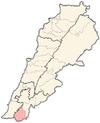
As-Sultaniyah
السلطانية | |
|---|---|
Village | |
 As-Sultaniyah | |
| Coordinates: 33°12′18″N 35°24′19″E / 33.20500°N 35.40528°E | |
| Grid position | 188/290 PAL |
| Country | |
| Governorate | Nabatieh Governorate |
| District | Bint Jbeil District |
| Elevation | 600 m (2,000 ft) |
| Time zone | UTC+2 (EET) |
| • Summer (DST) | UTC+3 (EEST) |
As-Sultaniyah (Arabic: السلطانية) is a village in the Bint Jbeil District, in southern Lebanon, located just north of Tebnine. It was earlier called el Yehudiyeh.
YouTube Encyclopedic
-
1/3Views:32 2292 05960 692
-
SELAWAT SULTAN - USTAZ AZAHAR HASHIM ALHADRAMI (Selawat- A-long)
-
BEDAH KITAB AL AHKAM AS SULTHANIYAH, KARYA IMAM AL MAWARDI | KH. ROKHMAT S. LABIB
-
IF YOU FAIL THIS ALLAH GIVES PAINFUL LIFE
Transcription
Name
According to E. H. Palmer in 1881, El Yehûdîyeh meant "the Jews" or "Jewish woman."[1]
History
In 1881, the PEF's Survey of Western Palestine (SWP) described it as: "A small village, containing about 100 Metawileh, situated in a valley, with olives, figs, and arable land. There is a spring and cisterns at the village."[2] They further noted that south of the village was a perennial spring, built up with masonry.[3]
References
Bibliography
- Conder, C.R; Kitchener, H.H. (1881). The Survey of Western Palestine: Memoirs of the Topography, Orography, Hydrography, and Archaeology. Vol. 1. London: Committee of the Palestine Exploration Fund.
- Palmer, E.H. (1881). The Survey of Western Palestine: Arabic and English Name Lists Collected During the Survey by Lieutenants Conder and Kitchener, R. E. Transliterated and Explained by E.H. Palmer. Committee of the Palestine Exploration Fund.
External links
- Soultaniyeh, Localiban
- Survey of Western Palestine, Map 2: IAA, Wikimedia commons


