
Sudong County | |
|---|---|
| Korean transcription(s) | |
| • Hangul | 수동군 |
| • Hanja | 水洞郡 |
| • Revised Romanization | Sudong-gun |
| • McCune–Reischauer | Sudong kun |
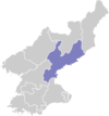
 Map of South Hamgyong showing the location of Sudong | |
| Country | North Korea |
| Province | South Hamgyong |
| Administrative divisions | 6 dong, 14 ri |
| Area | |
| • Total | 783.4 km2 (302.5 sq mi) |
| Population (2008)[1] | |
| • Total | 95,716 |
| • Density | 120/km2 (320/sq mi) |
Sudong County is a county in South Hamgyŏng province, North Korea. It was formed from part of Kowŏn County in December 1990.[2]
Sudong is the site of a major coal seam first discovered in 1918.[3] The P'yŏngra Line of the Korean State Railway passes through the district.
Administrative divisions
Sudong is divided into 6 dong (neighbourhoods) and 14 ri (villages):
|
|
Transportation
Sudong-gu has a trolleybus line opened in 1979 running within this district,[4] linking residential areas to Kowon mine.[5] The line opened in 1979, with a number of second hand Chollima 9.11 trolleybuses used to serve the line initially.[6] The line appears to no longer have any trolleybuses.
Kowon Tangwang Line runs to this district from Tunjon station, serving the colliery.[7]
See also
Notes
- ^ North Korea: Administrative Division
- ^ "행정구역 개편 일지". NKChosun.com. 2006-04-05. Archived from the original on 2006-11-02. Retrieved 2006-11-08. See also 고원군의 연혁[permanent dead link]
- ^ 고원-문천탄전 (in Korean). Doosan Encyclopedia/Naver. Retrieved 2006-11-08.[permanent dead link]
- ^ "민추본". www.unikorea.or.kr. Retrieved 2021-02-22.
- ^ "북한지역정보넷". www.cybernk.net. Retrieved 2021-02-22.
- ^ "Обзор транспорта Северной Кореи". www.gruzovikpress.ru. Retrieved 2021-04-20.
- ^ Kokubu, Hayato; 国分隼人 (2007). Shōgun sama no tetsudō : Kitachōsen tetsudō jijō. Tōkyō: Shinchōsha. ISBN 978-4-10-303731-6. OCLC 140100407.
This North Korea location article is a stub. You can help Wikipedia by expanding it. |