
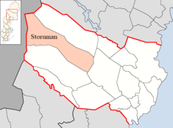
Storuman Municipality
Storumans kommun | |
|---|---|
 The lake at Storuman seen from the hills above the town | |
 Coat of arms | |
 | |
| Coordinates: 65°06′N 17°06′E / 65.100°N 17.100°E | |
| Country | Sweden |
| County | Westrobothnia County |
| Seat | Storuman |
| Area | |
| • Total | 8,234.1 km2 (3,179.2 sq mi) |
| • Land | 7,303.53 km2 (2,819.91 sq mi) |
| • Water | 930.57 km2 (359.30 sq mi) |
| Area as of 1 January 2014. | |
| Population (31 December 2021)[2] | |
| • Total | 5,808 |
| • Density | 0.71/km2 (1.8/sq mi) |
| Time zone | UTC+1 (CET) |
| • Summer (DST) | UTC+2 (CEST) |
| ISO 3166 code | SE |
| Province | Lapland |
| Municipal code | 2421 |
| Website | www.storuman.se |
Storuman Municipality (Swedish: Storumans kommun; Southern Sami: Luspie tjïelte; Ume Sami: Lusspie kommuvnna) is a municipality in Westrobothnia County in northern Sweden. Its seat is located in Storuman.
The parish Stensele was created as late as 1822. It was, together with the parish Tärna, made into a municipality in 1863. In 1903 Tärna was detached to form a municipality of its own. The local government reform of 1971 saw the reunification of Stensele and Tärnaby municipalities, thus forming Storuman Municipality with the name taken from its largest town.
Tärnaby, a small village in the municipality, has fostered the internationally famous alpine skiers Ingemar Stenmark, Stig Strand and Anja Pärson.
YouTube Encyclopedic
-
1/2Views:6 0437 198
-
A Drive Through Storuman
-
Accident on E45 near Storuman, Sweden
Transcription
Geography
With an area of 8,286 square kilometres (3,199 sq mi), the municipality has Sweden's ninth largest area, but is sparsely populated with a population density of less than 1 inhabitant per km2.
Localities
There are four localities (or urban areas) in Storuman Municipality:[3]
| # | Locality | Population |
|---|---|---|
| 1 | Storuman | 2,255 |
| 2 | Stensele | 578 |
| 3 | Tärnaby | 533 |
| 4 | Hemavan/Bierke | 216 |
The municipal seat in bold
Demographics
This is a demographic table based on Storuman Municipality's electoral districts in the 2022 Swedish general election sourced from SVT's election platform, in turn taken from SCB official statistics.[4]
In total there were 5,801 residents, including 4,515 Swedish citizens of voting age.[4] 51.2% voted for the left coalition and 48.0% for the right coalition. Indicators are in percentage points except population totals and income.
| Location | Residents | Citizen adults |
Left vote | Right vote | Employed | Swedish parents |
Foreign heritage |
Income SEK |
Degree |
|---|---|---|---|---|---|---|---|---|---|
| % | % | ||||||||
| Gunnarn | 560 | 434 | 46.6 | 52.6 | 82 | 93 | 7 | 21,919 | 26 |
| Luspen | 1,941 | 1,427 | 53.3 | 45.8 | 81 | 85 | 15 | 22,257 | 30 |
| Slussfors | 460 | 394 | 55.1 | 44.9 | 85 | 91 | 9 | 19,591 | 31 |
| Tärnaby-Hemavan | 1,519 | 1,238 | 52.1 | 47.2 | 82 | 91 | 9 | 23,698 | 34 |
| Vallnäs | 1,321 | 1,022 | 48.8 | 50.2 | 84 | 92 | 8 | 24,379 | 31 |
| Source: SVT[4] | |||||||||
Transportation
Storuman Municipality has two major roads, E12 and E45, crossing in Storuman. An international tourist route Blue Highway (Norway - Sweden - Finland - Russia) goes through Storuman.
There are two railways, Inlandsbanan and the Storuman-Hällnäs Line in Storuman. The former is used for tourist trains in the summer, and both for freight trains.
The nearest airport for the eastern part of Storuman Municipality is Vilhelmina Airport. For the western part, Hemavan Airport is situated near the village centre of Hemavan.
Sister cities
The following cities are twinned with Storuman:[5]
References
- ^ "Statistiska centralbyrån, Kommunarealer den 1 januari 2014" (in Swedish). Statistics Sweden. 2014-01-01. Archived from the original (Microsoft Excel) on 2016-09-27. Retrieved 2014-04-18.
- ^ "Folkmängd i riket, län och kommuner 31 december 2021" (in Swedish). Statistics Sweden. February 22, 2022. Retrieved February 22, 2022.
- ^ Statistics Sweden as of December 31, 2005
- ^ a b c "Valresultat 2022 för Storuman i riksdagsvalet" (in Swedish). SVT. 11 September 2022. Retrieved 24 January 2024.
- ^ "Ystävyyskunnat" (in Norwegian). City of Viitasaari. Archived from the original on 2012-06-04. Retrieved 2012-06-01.
External links
- Storuman Municipality - Official site (in Swedish)
Places adjacent to Storuman Municipality | ||||||||||||||||
|---|---|---|---|---|---|---|---|---|---|---|---|---|---|---|---|---|
| ||||||||||||||||
Municipalities and seats of Västerbotten County | ||
|---|---|---|
| Municipalities | ||
| Municipal seats | ||
| International | |
|---|---|
| Geographic | |